Coast to Coast Day 5 Patterdale to Brampton

That’s Day 5, Patterdale up and over the highest point on the Coast to Coast to Brampton (via Burnbanks) done. What a day!

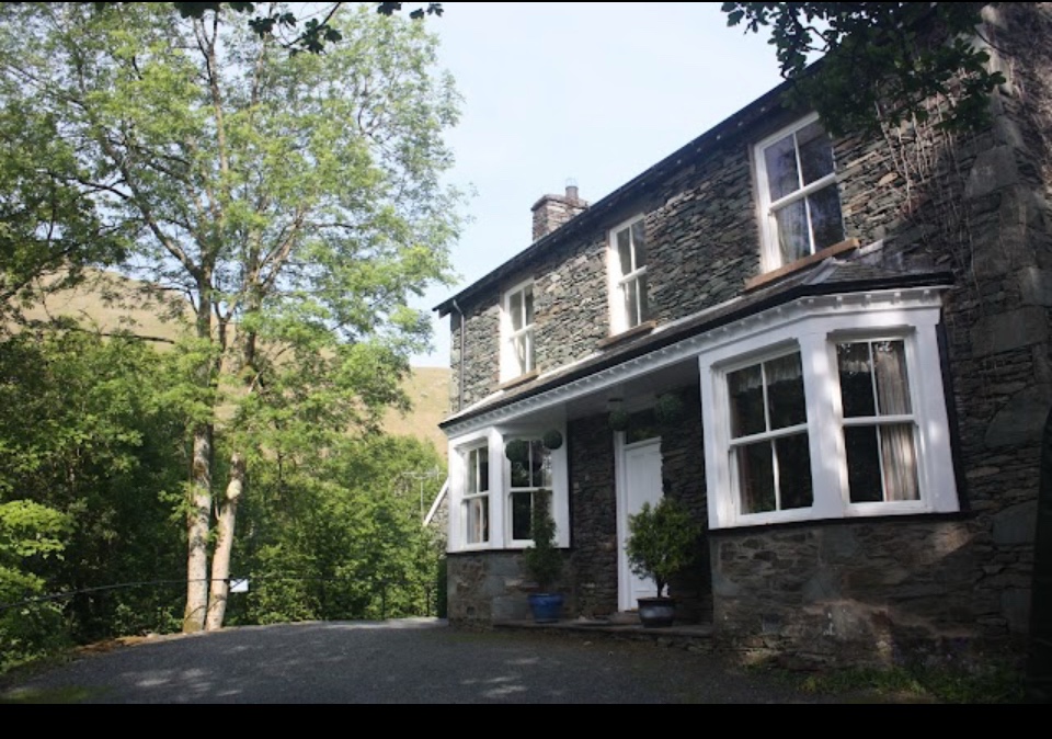
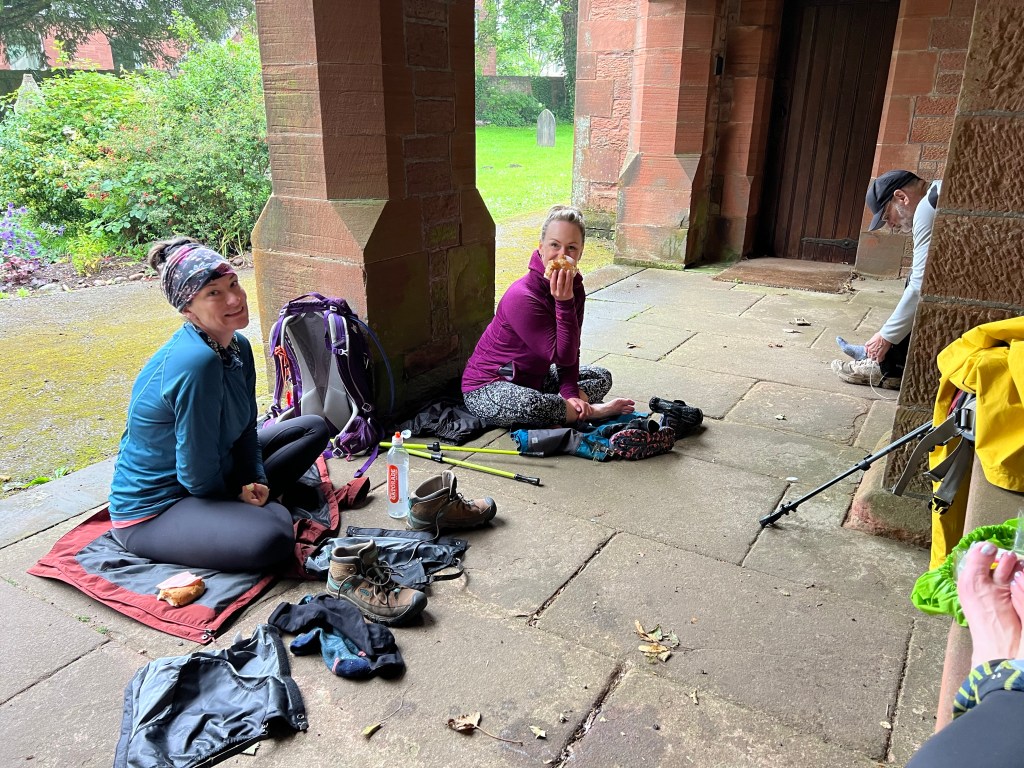
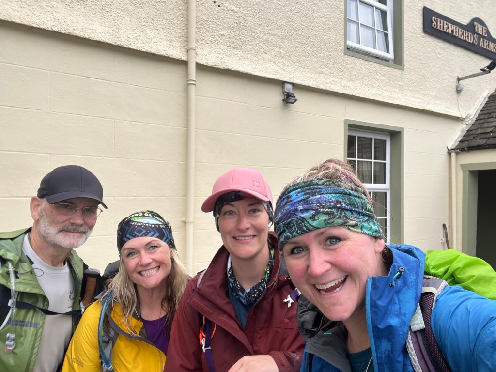
We left our BnB (the Old View Inn ) at about 9am after an amazing breakfast with all the fancy things like tea cups and proper spoons and plates and such – in stark contrast to the stinky hikers we are by Day 6 with no laundry other than in a sink to this point!

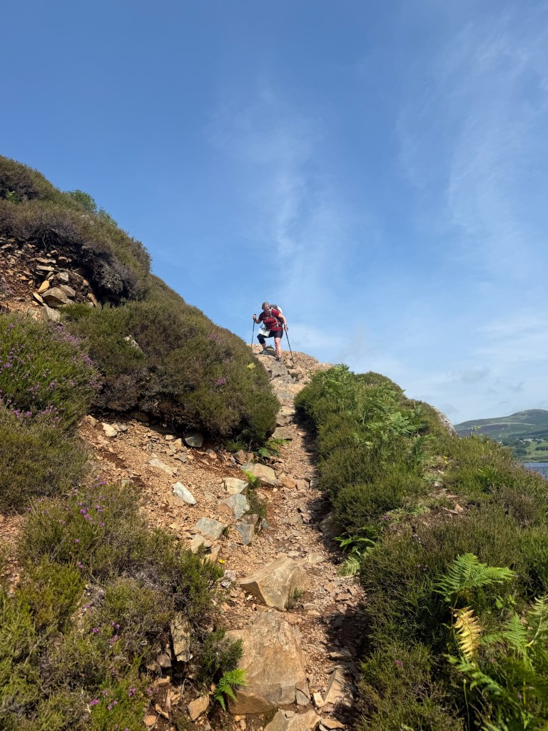
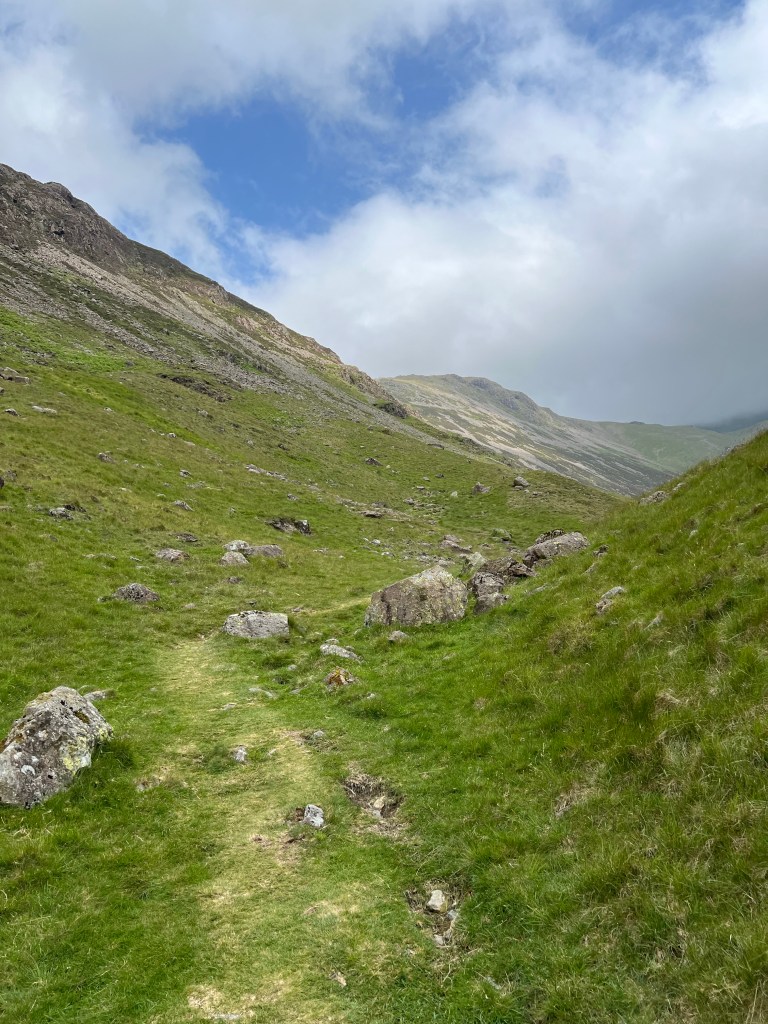
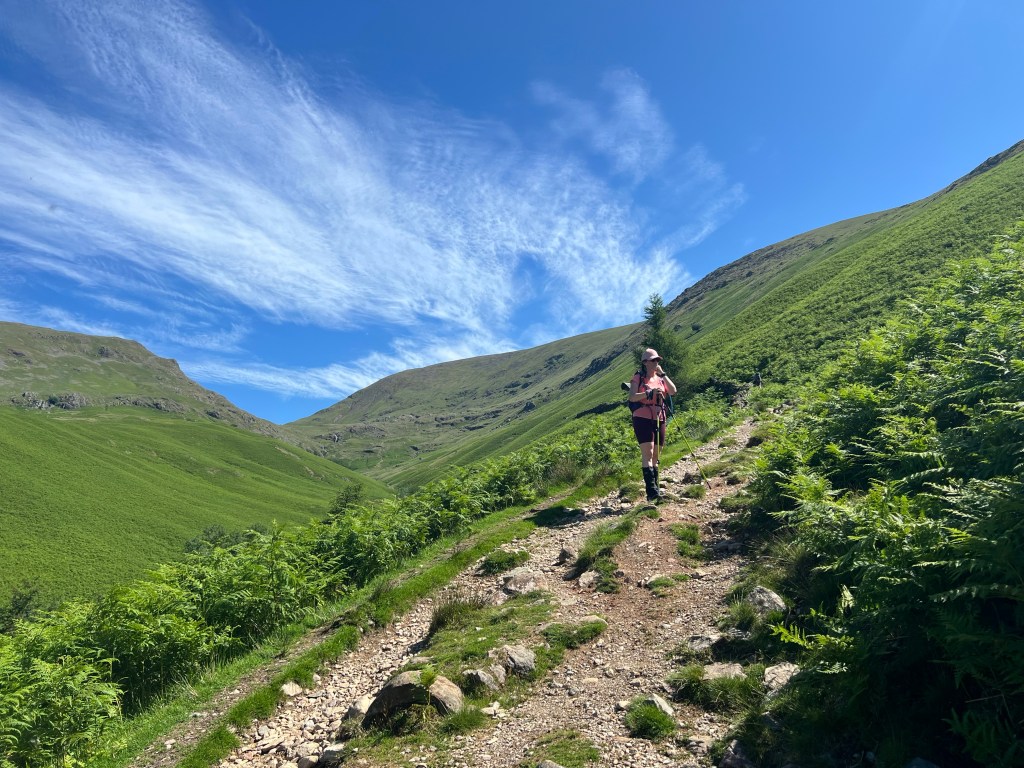
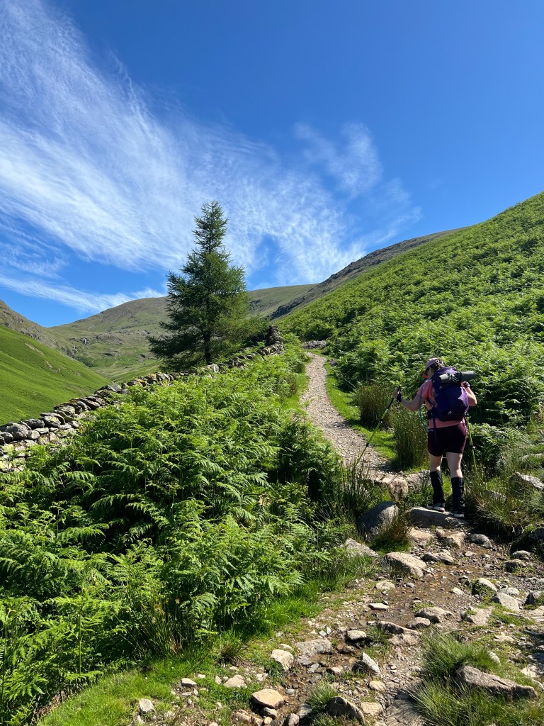
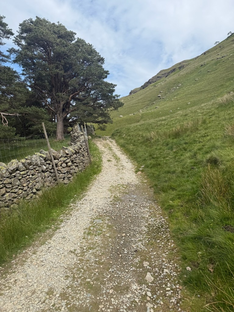
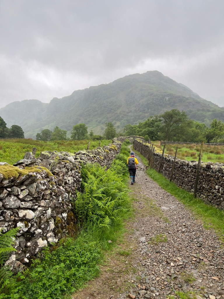
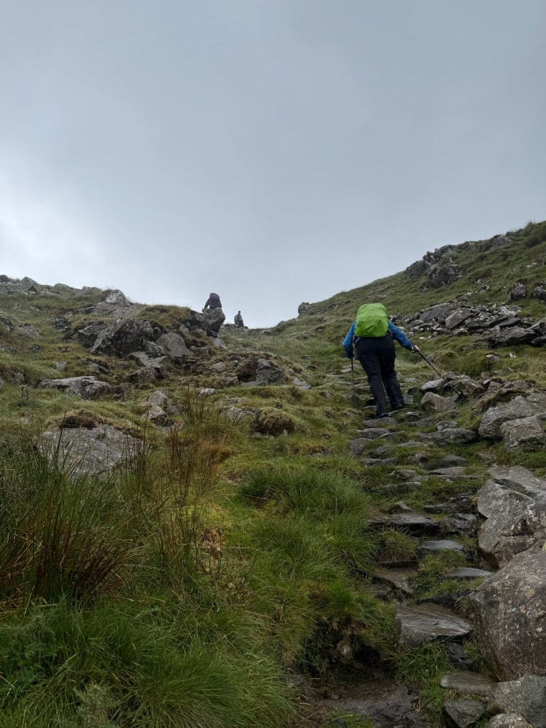
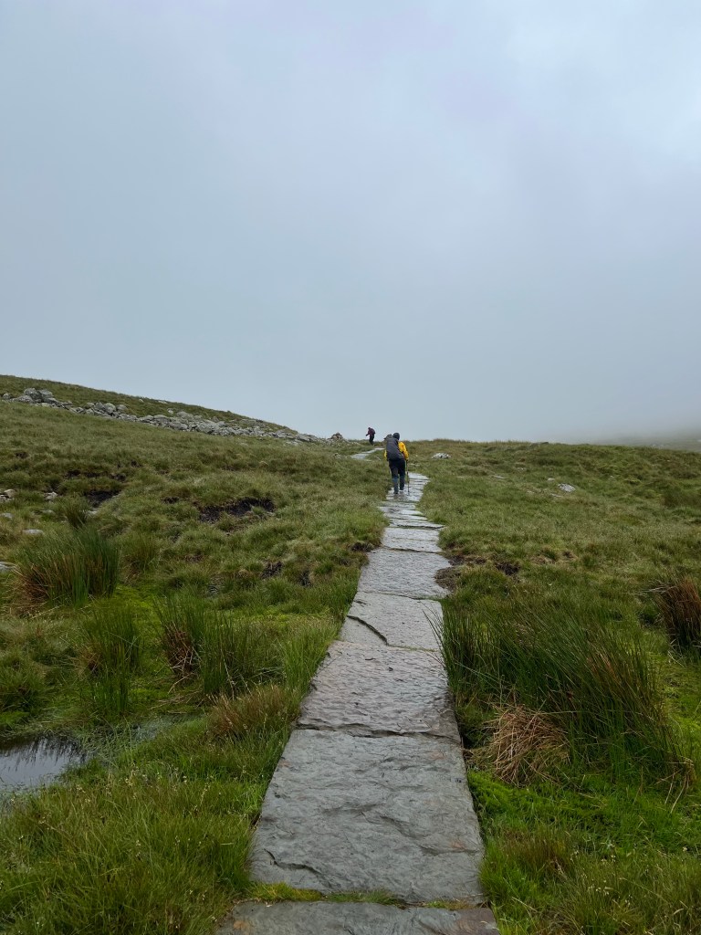
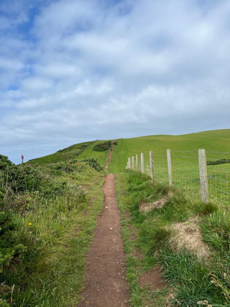
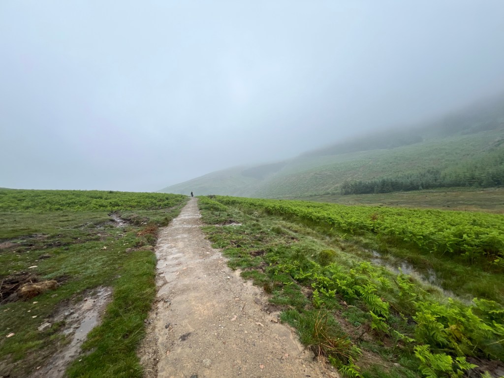
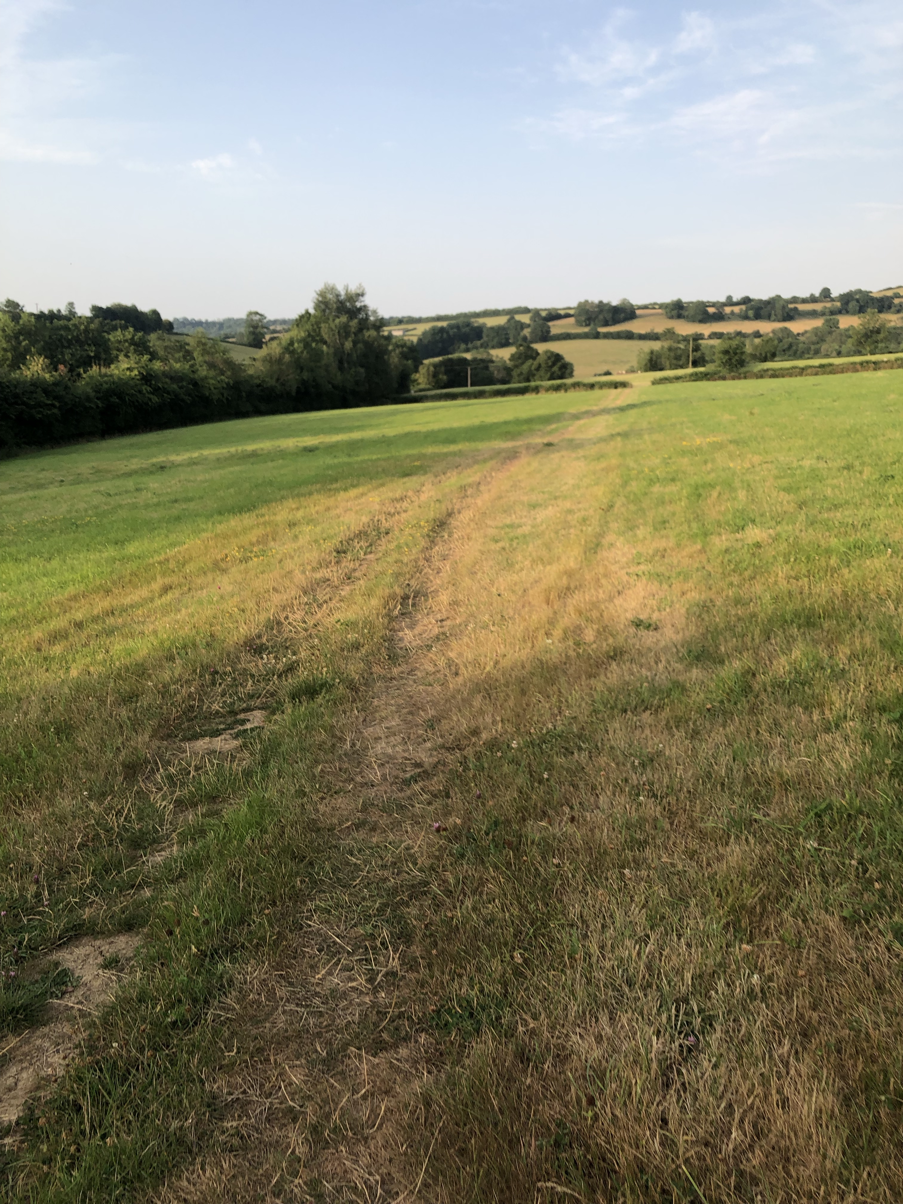
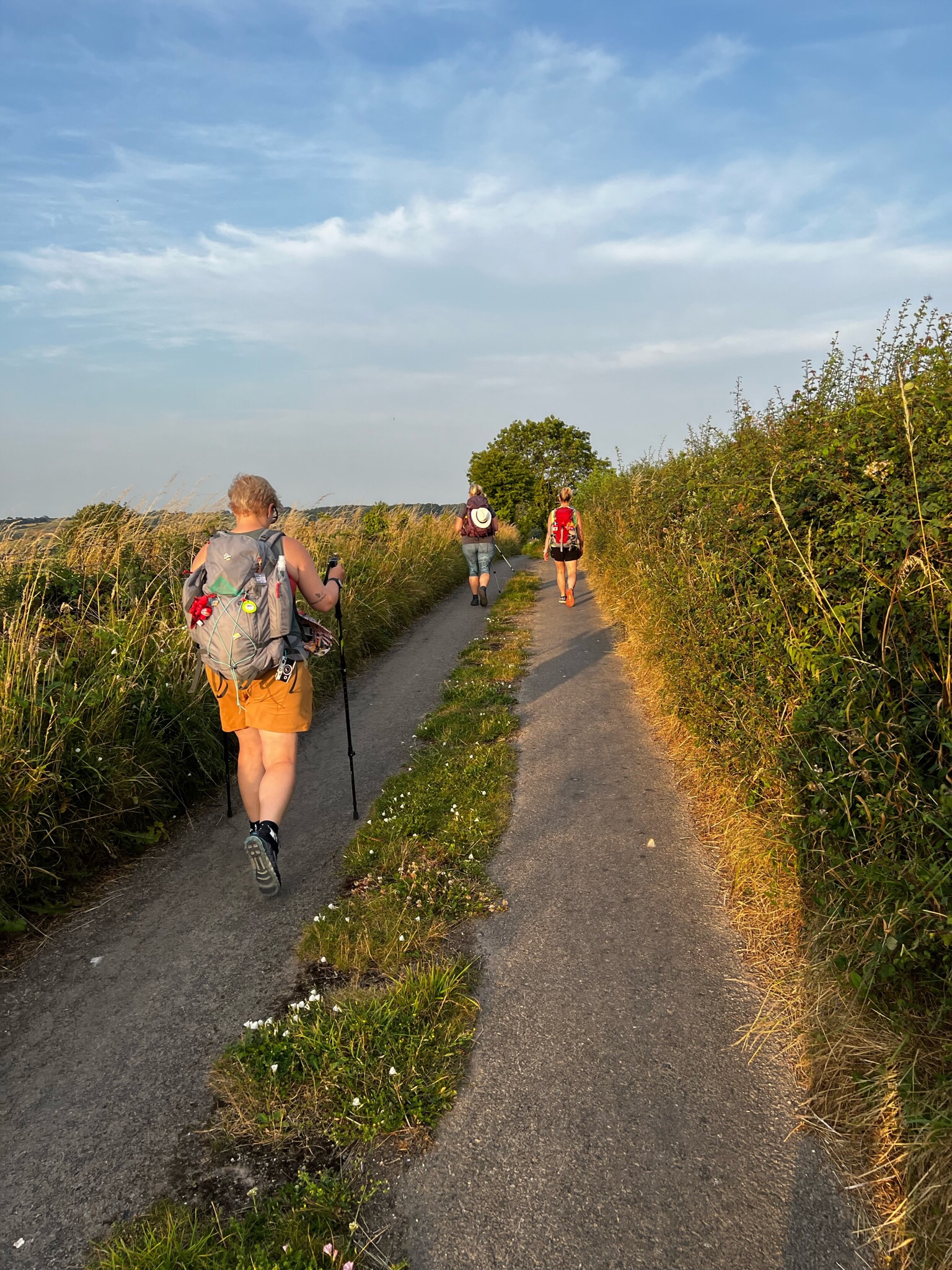
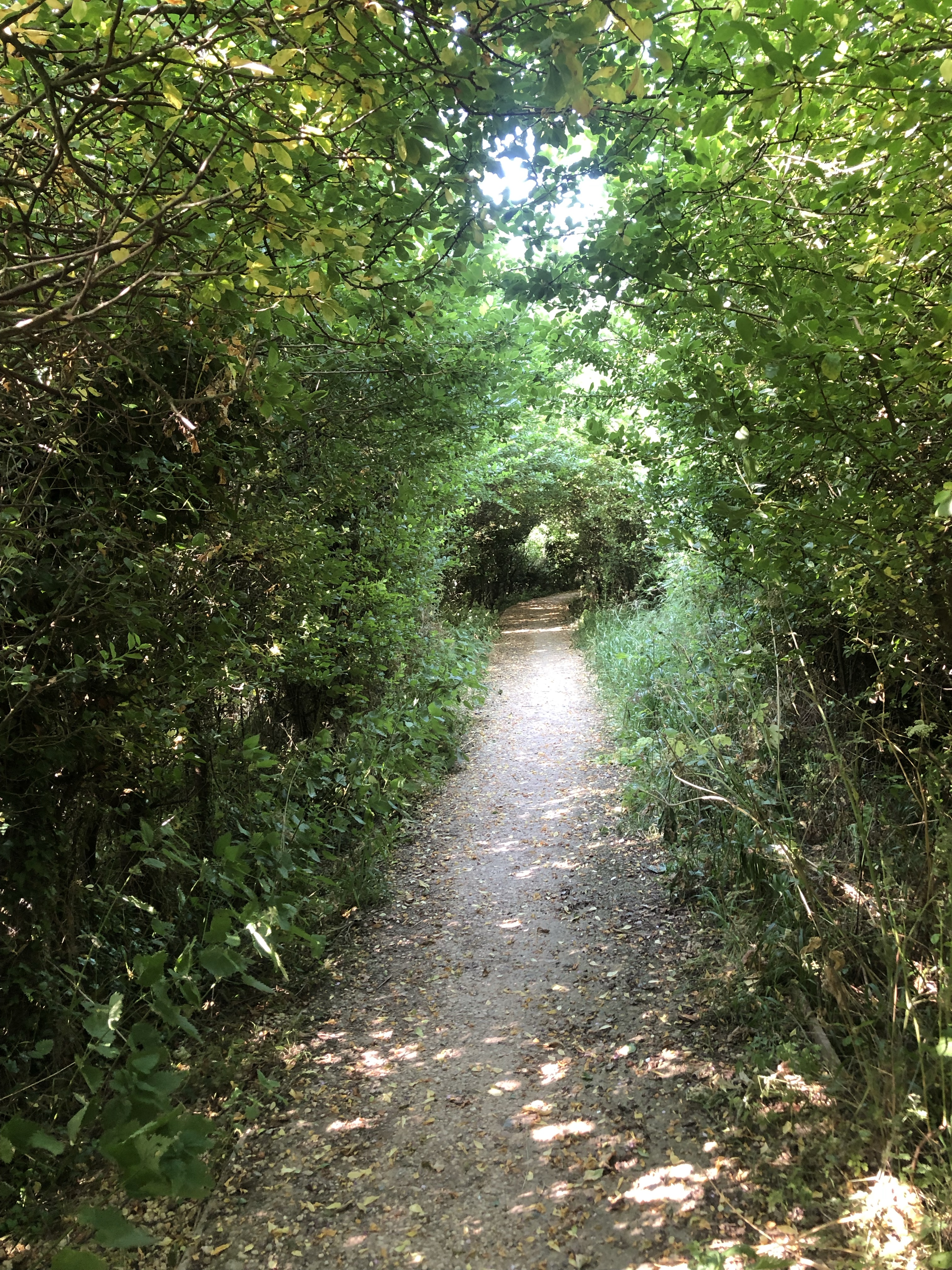
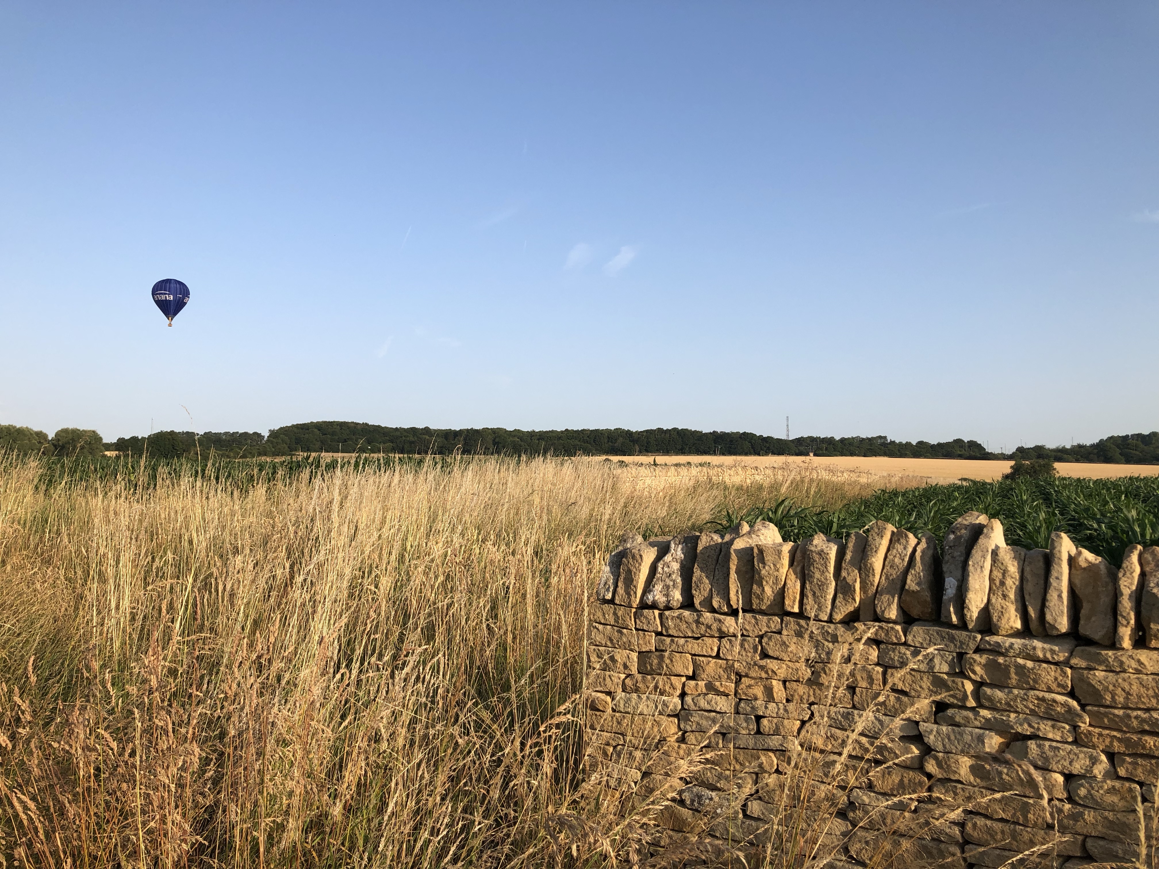
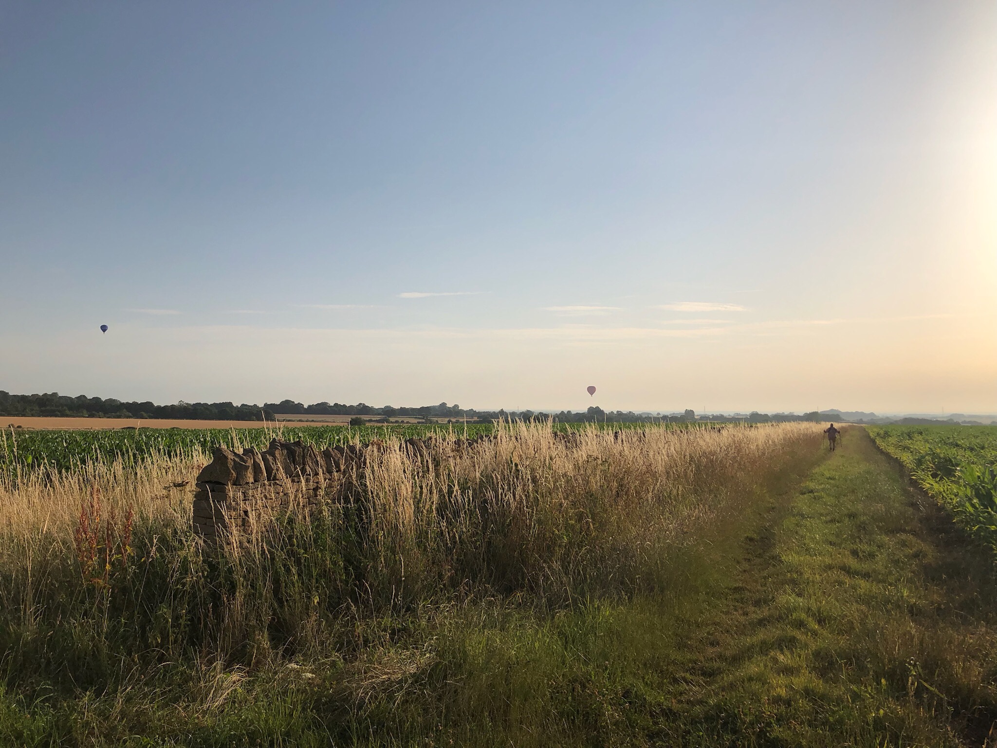
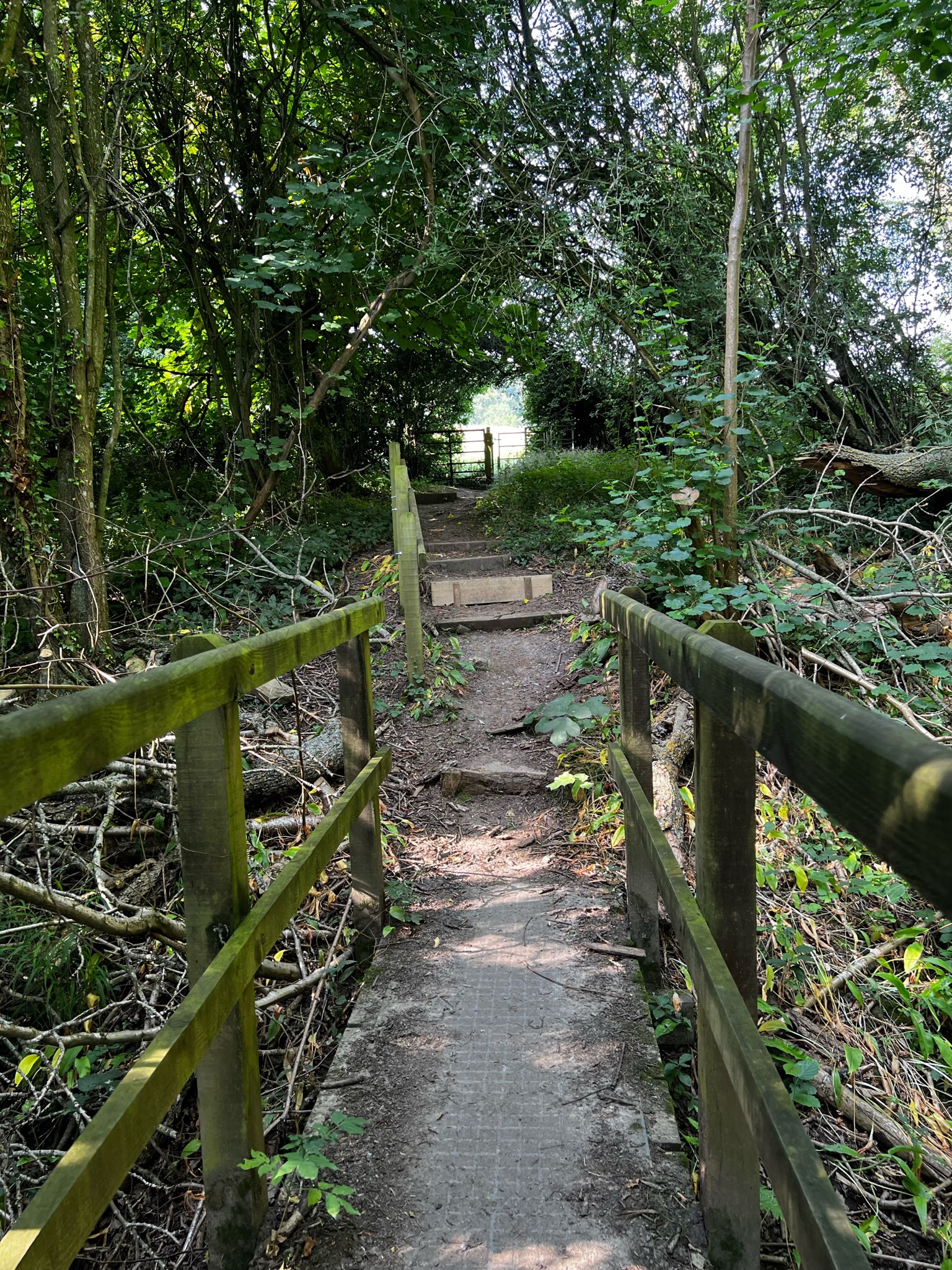
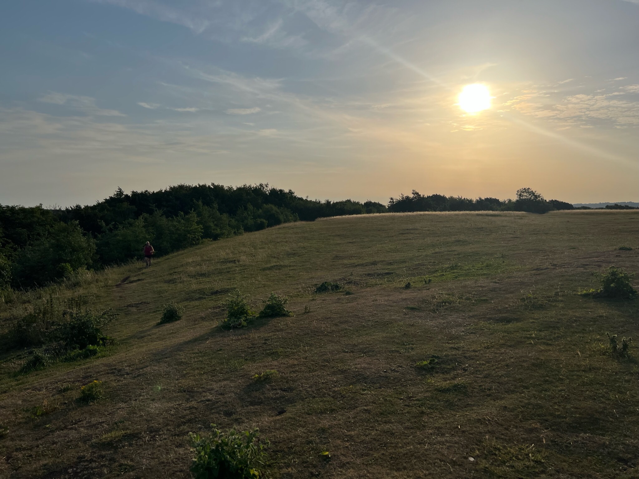
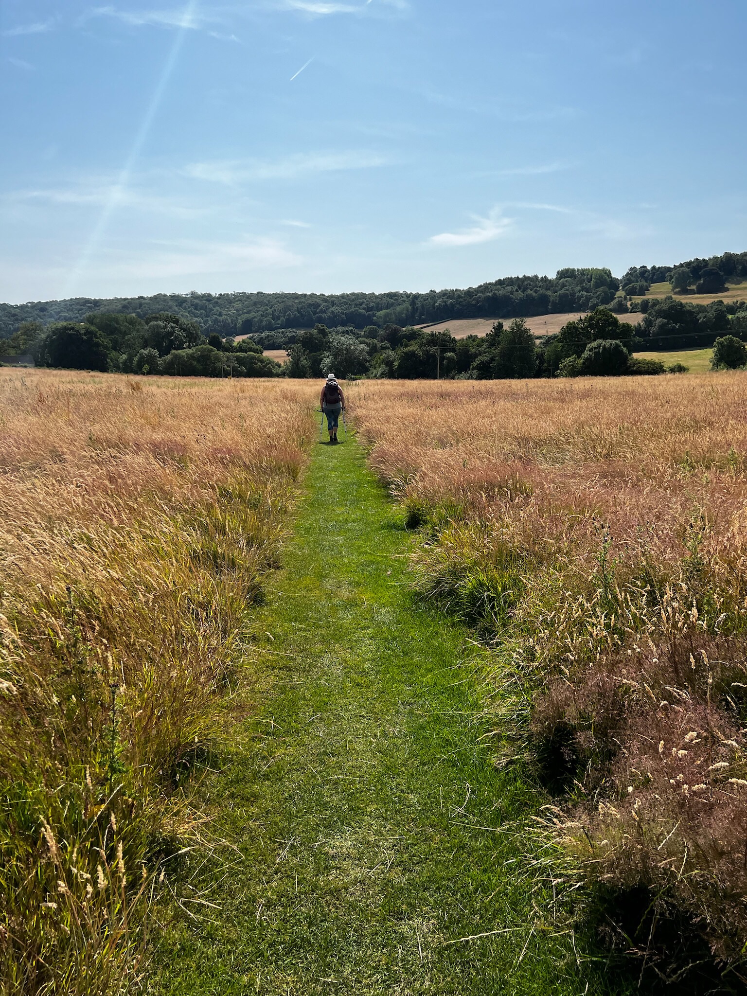
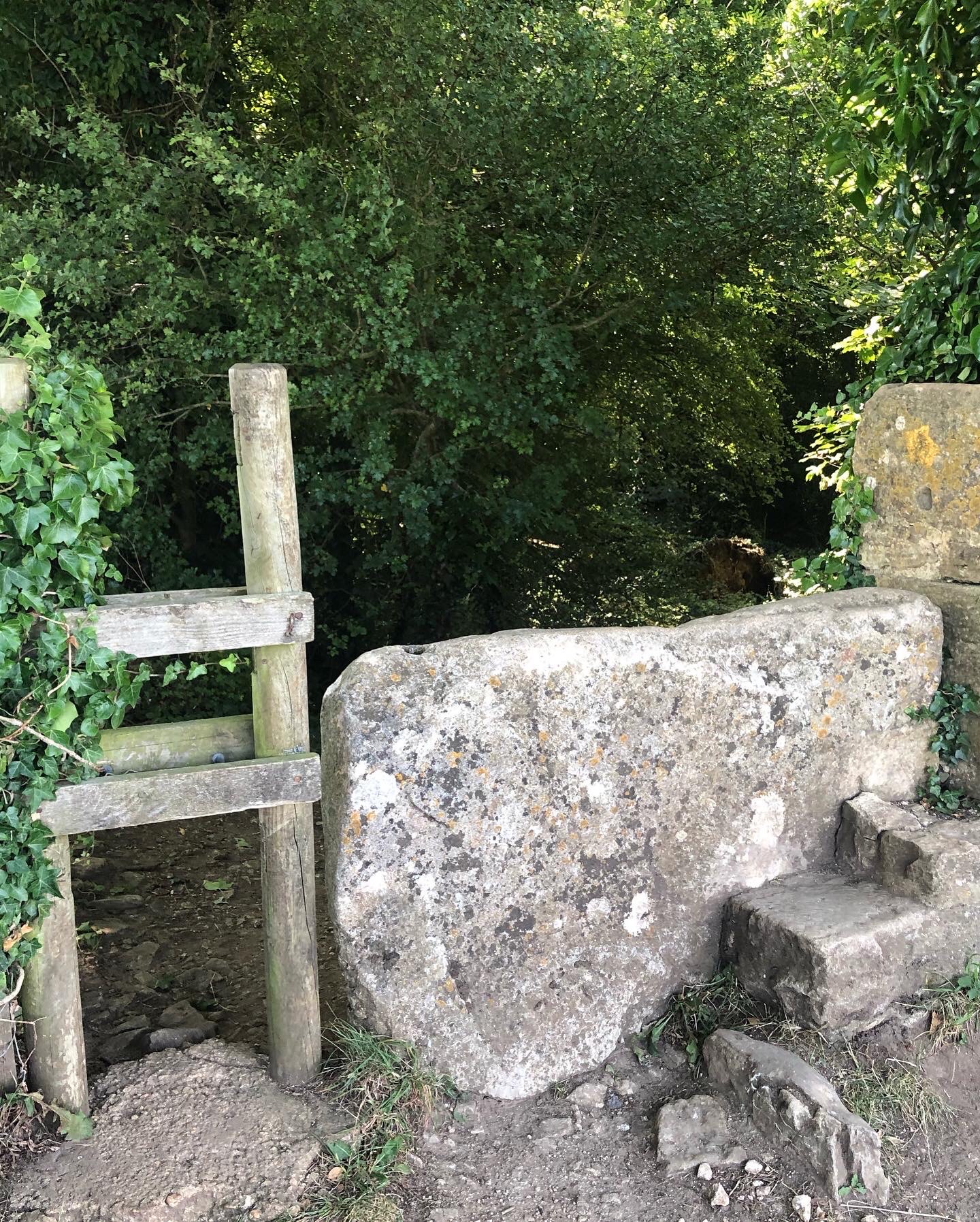
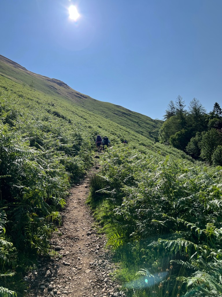
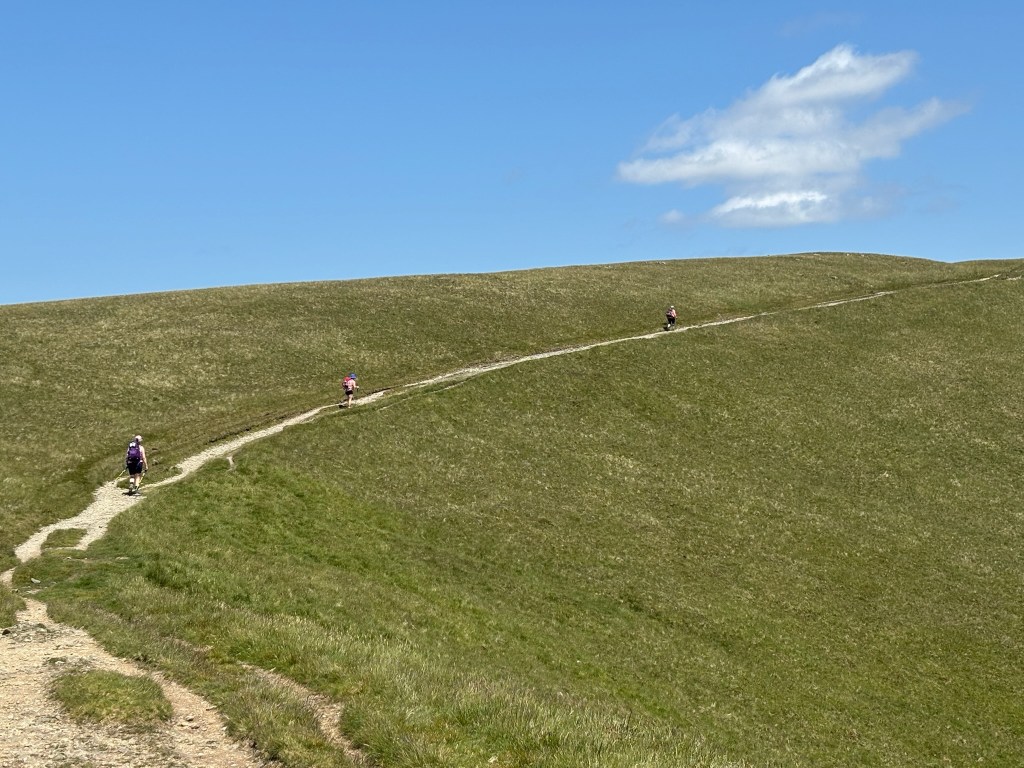
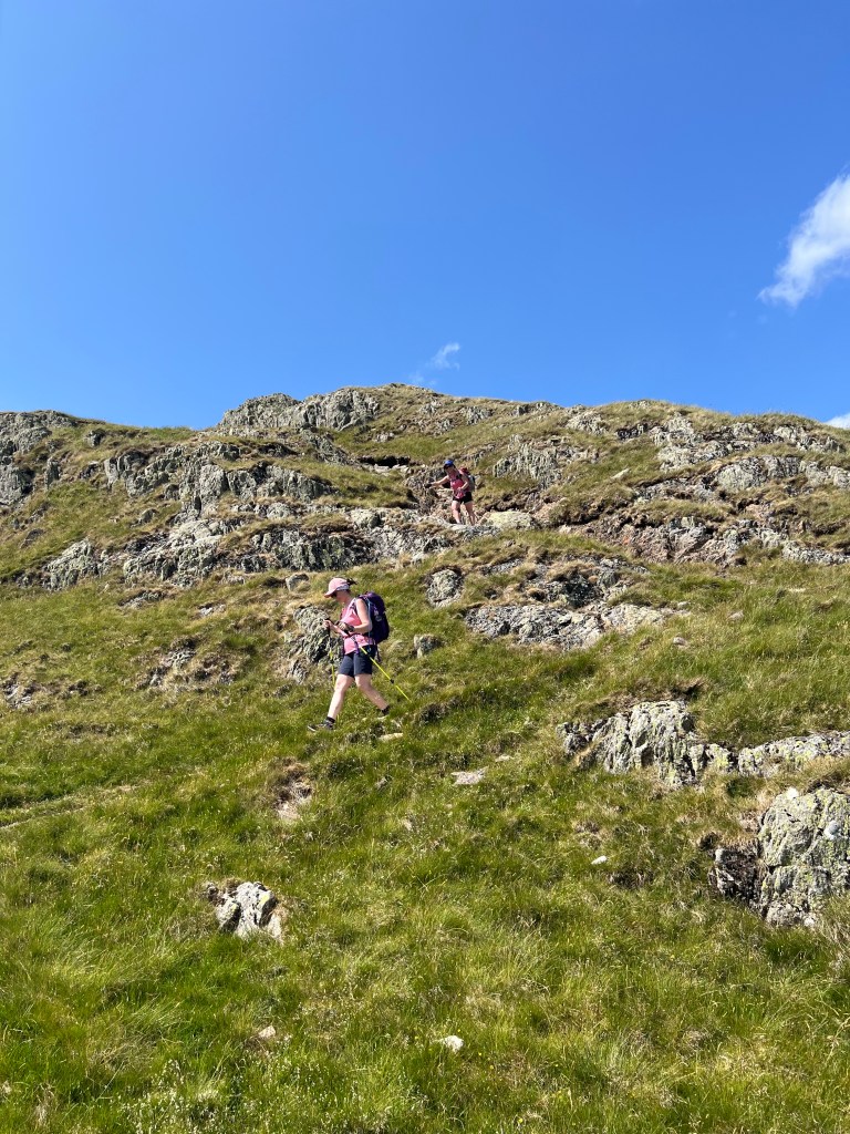
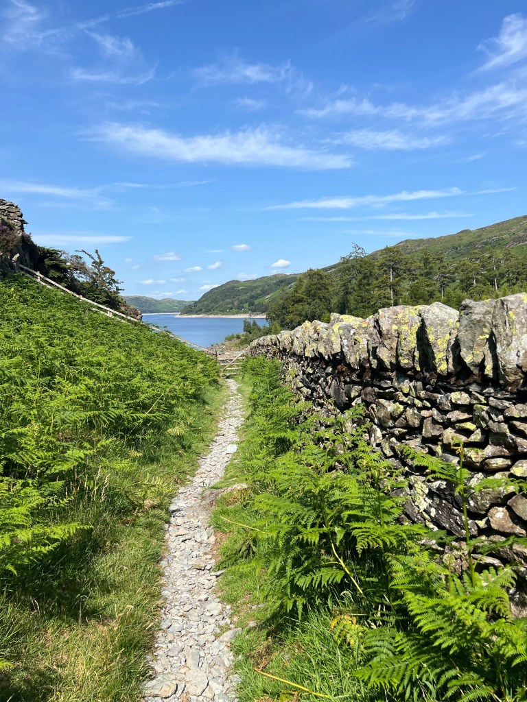
A tiny bit of road walking to the trail head, and then we were in it right from the jump! Up and up and up on rocky obvious path with bracken (large ferns) to the left and right of us as we climbed. No crazy cliffs and no scrambling, just hard work up with great views back into Patterdale.

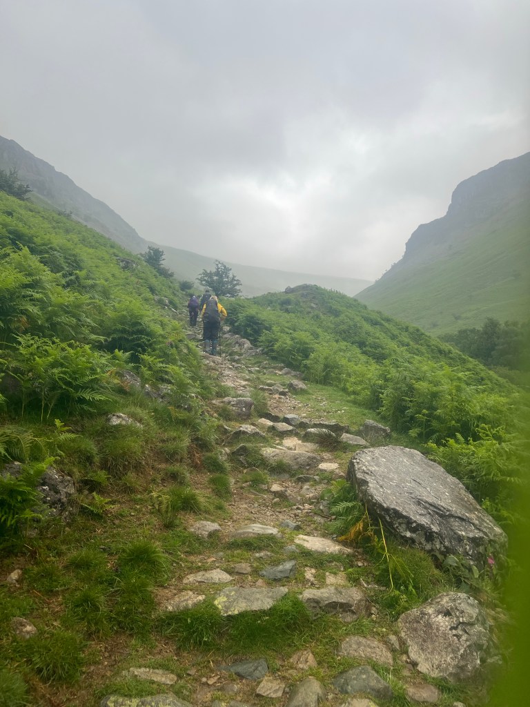
We had four milestones to hit today, the first being an include up to Angle Tarn – just keep walking, just keep walking. With my tummy still sore from yesterday for some reason I was not so much Scaredy Bear today but rather Slothy Bear. One step at a time made sure I kept up with my crew. We made it to the 1,500 feet were rewarded with the views of the Tarn!

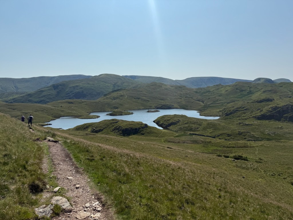
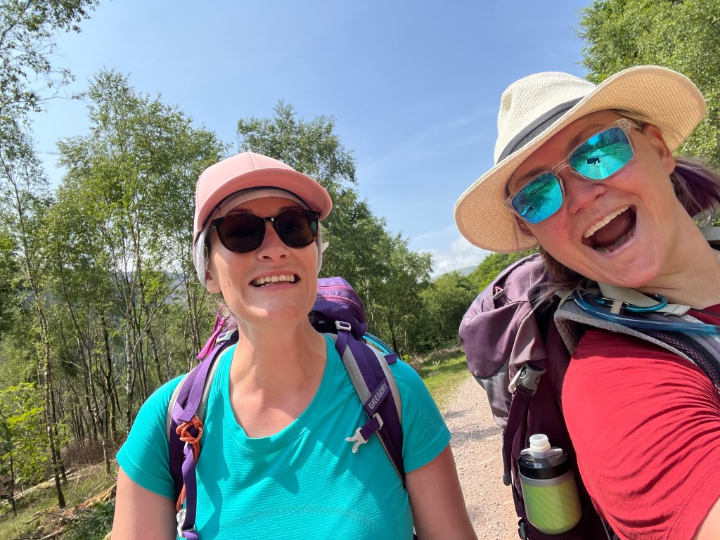
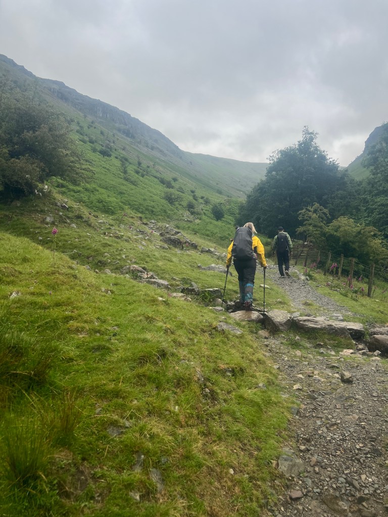
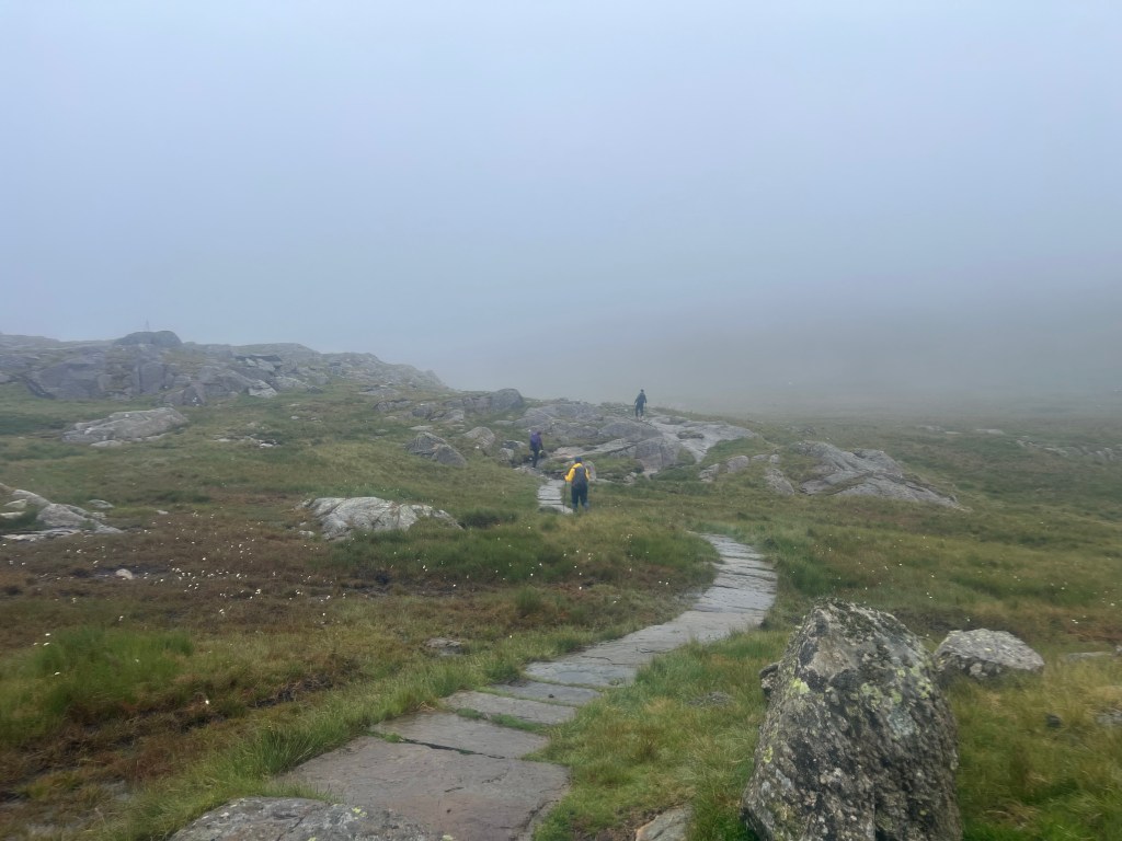
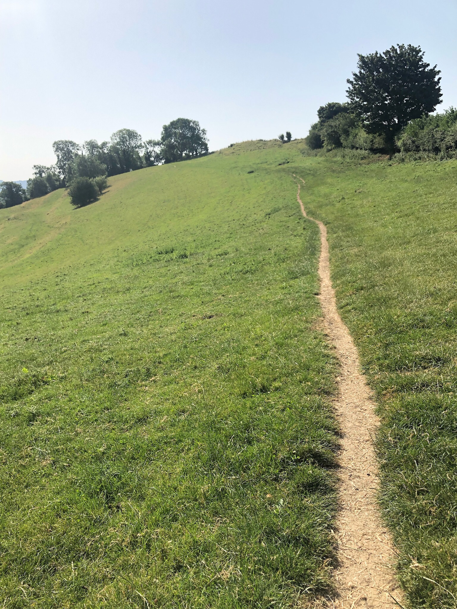
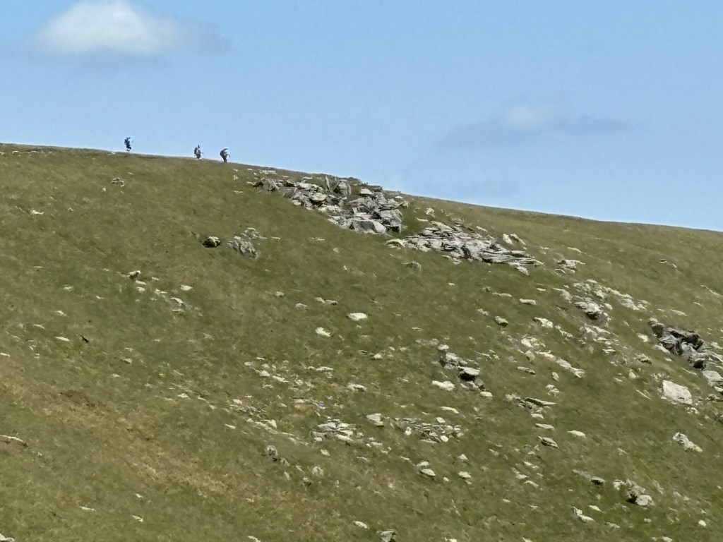
We hit Angle Tarn, had a micro break – aka sunscreen and some candy – and then made our way to the next milestone, the peak of The Knott at 2,425 feet / 739 m. While still up and up this was a LOT less steep than our first push out of town but no less rewarding. Mostly obvious rocky path with a few soft (thank you!) grass sections.

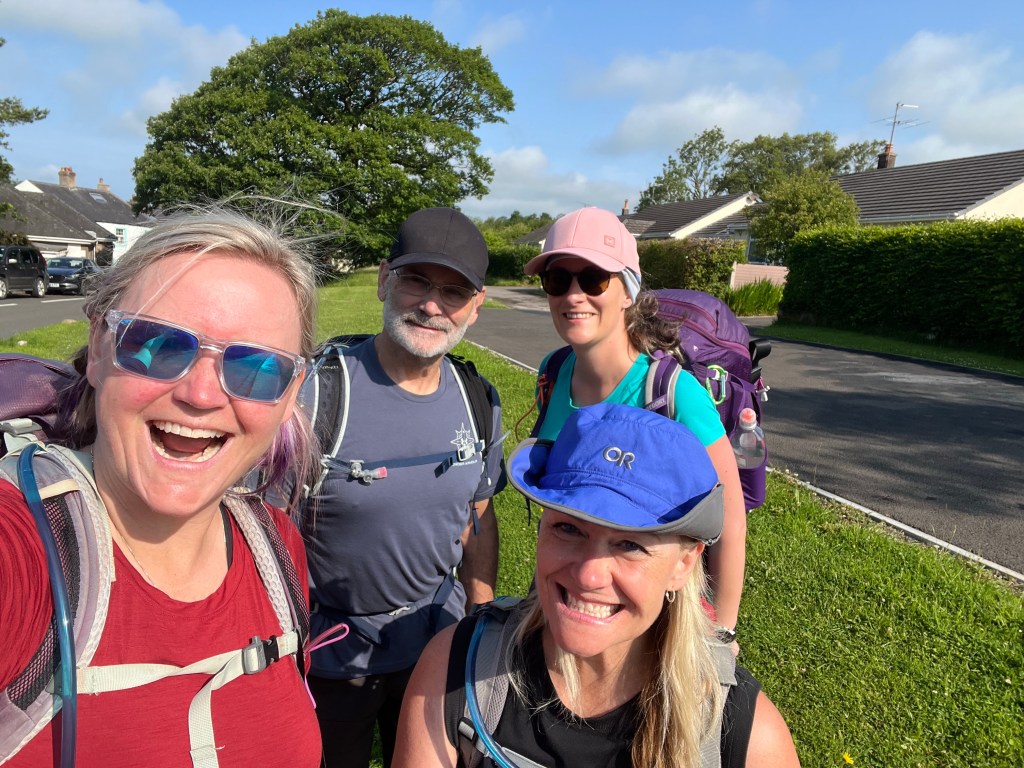
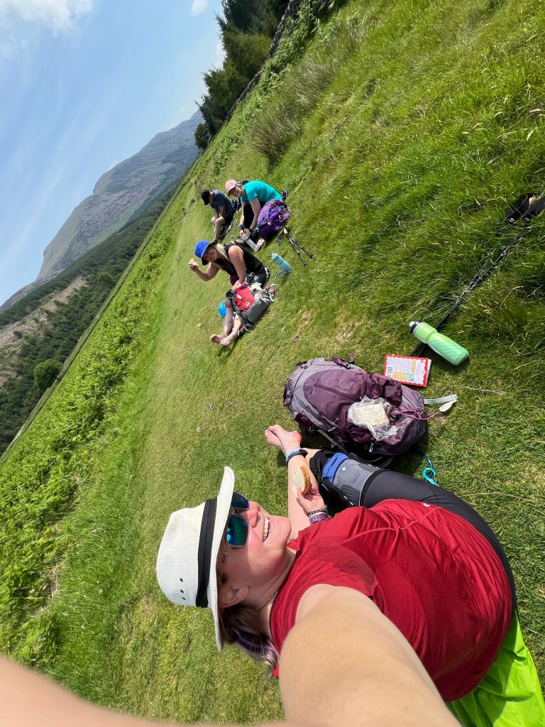
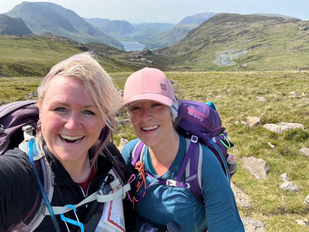
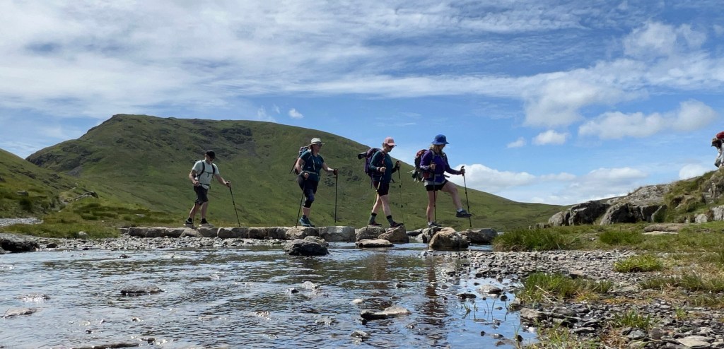
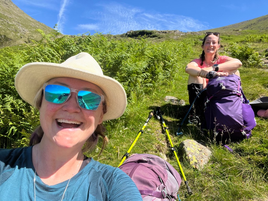
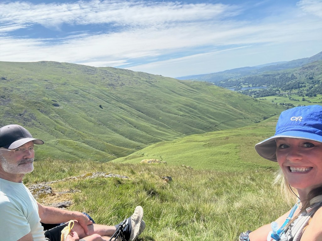
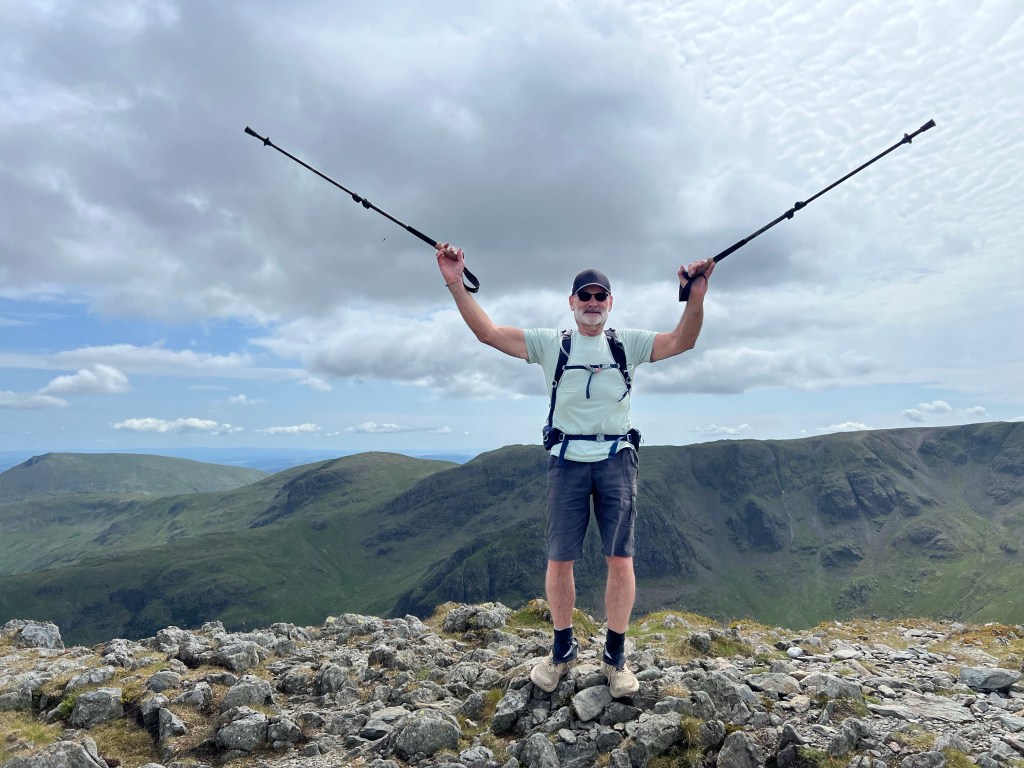
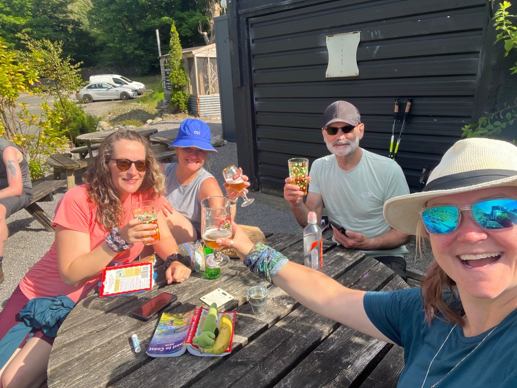
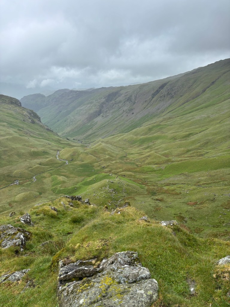
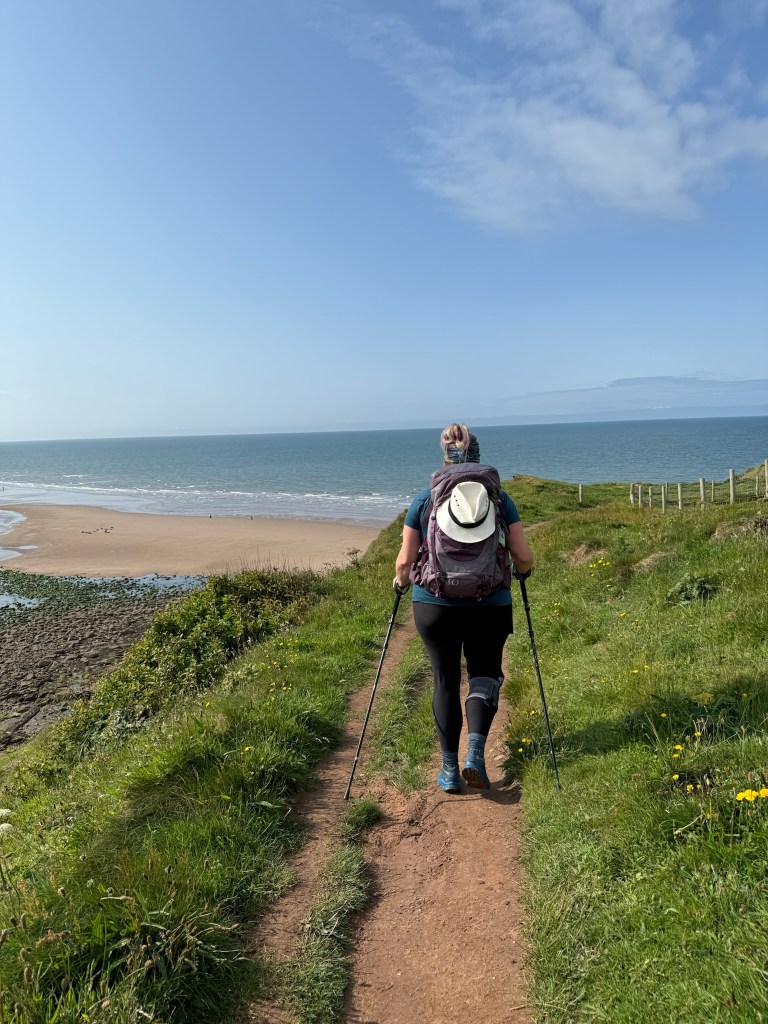
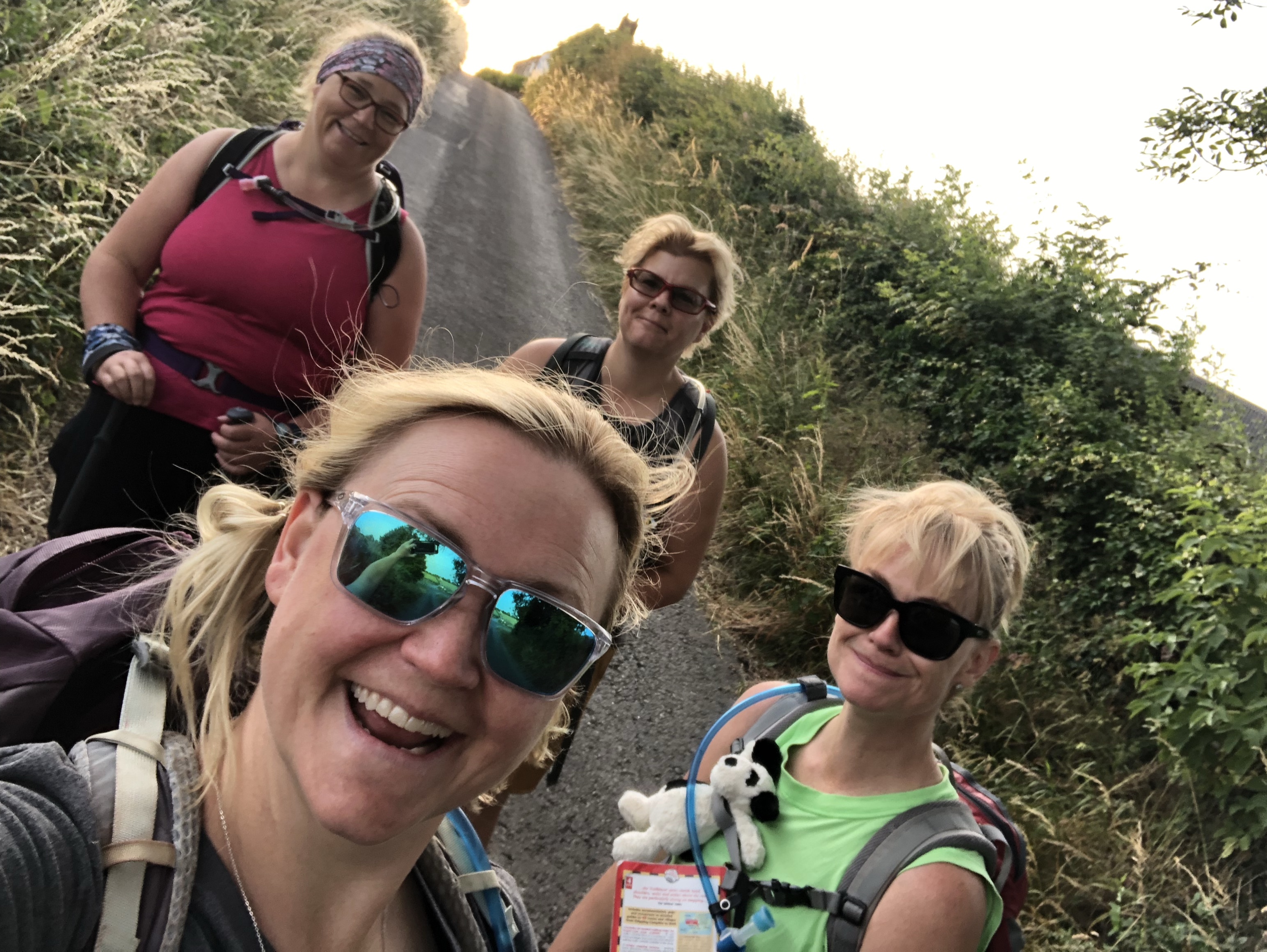
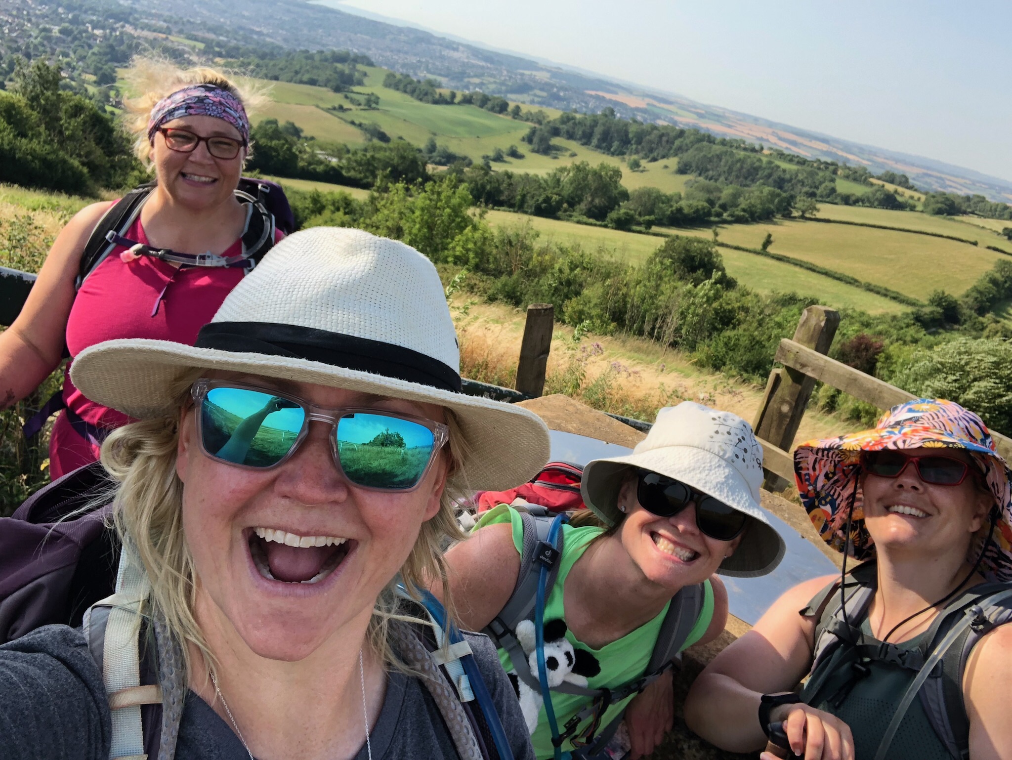
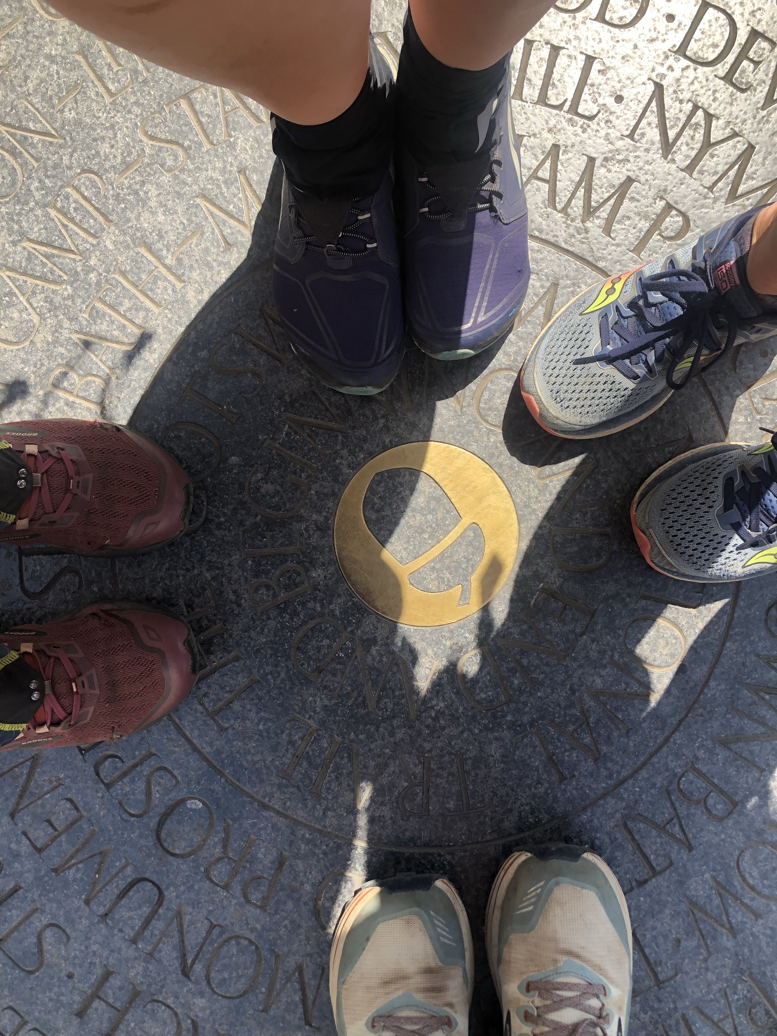
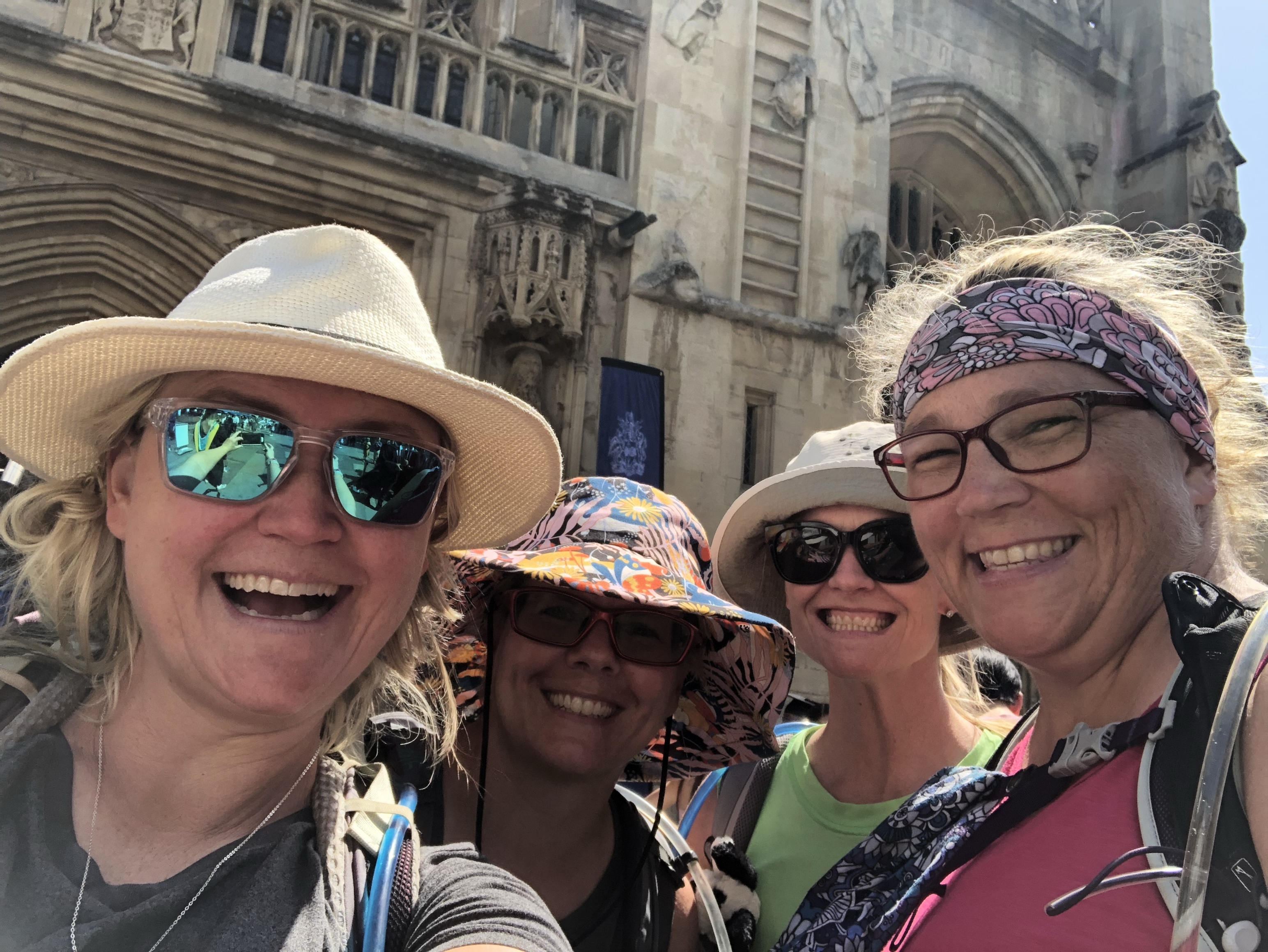
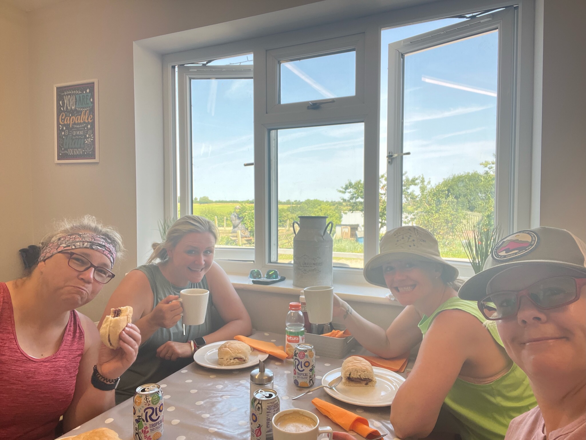
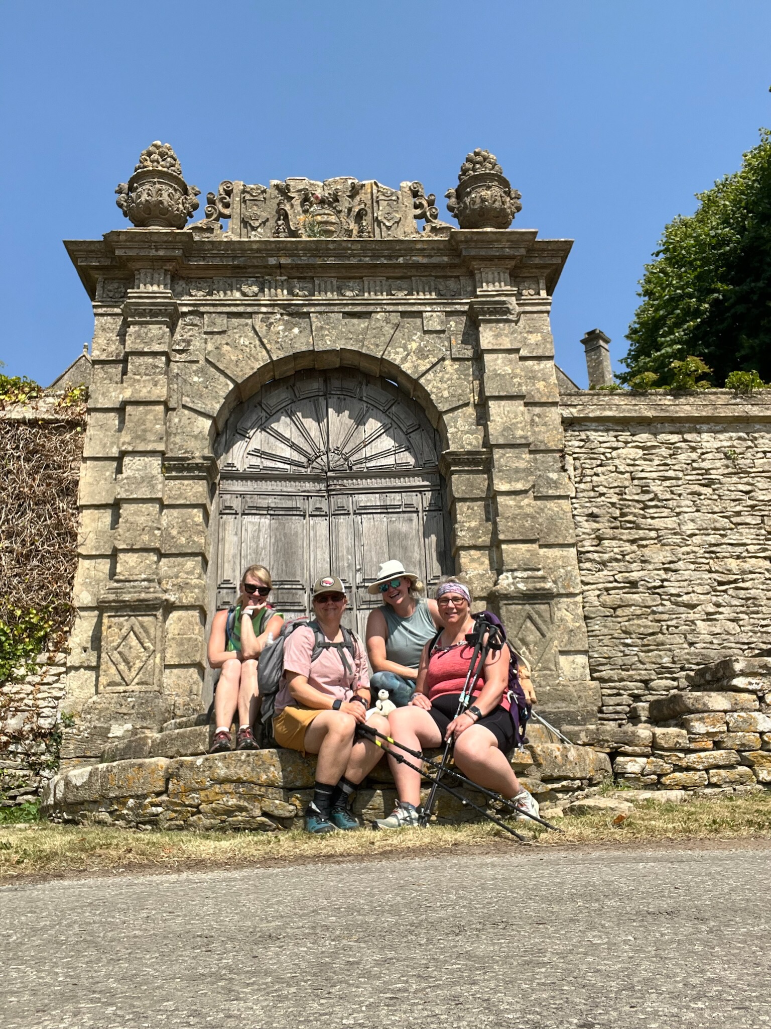
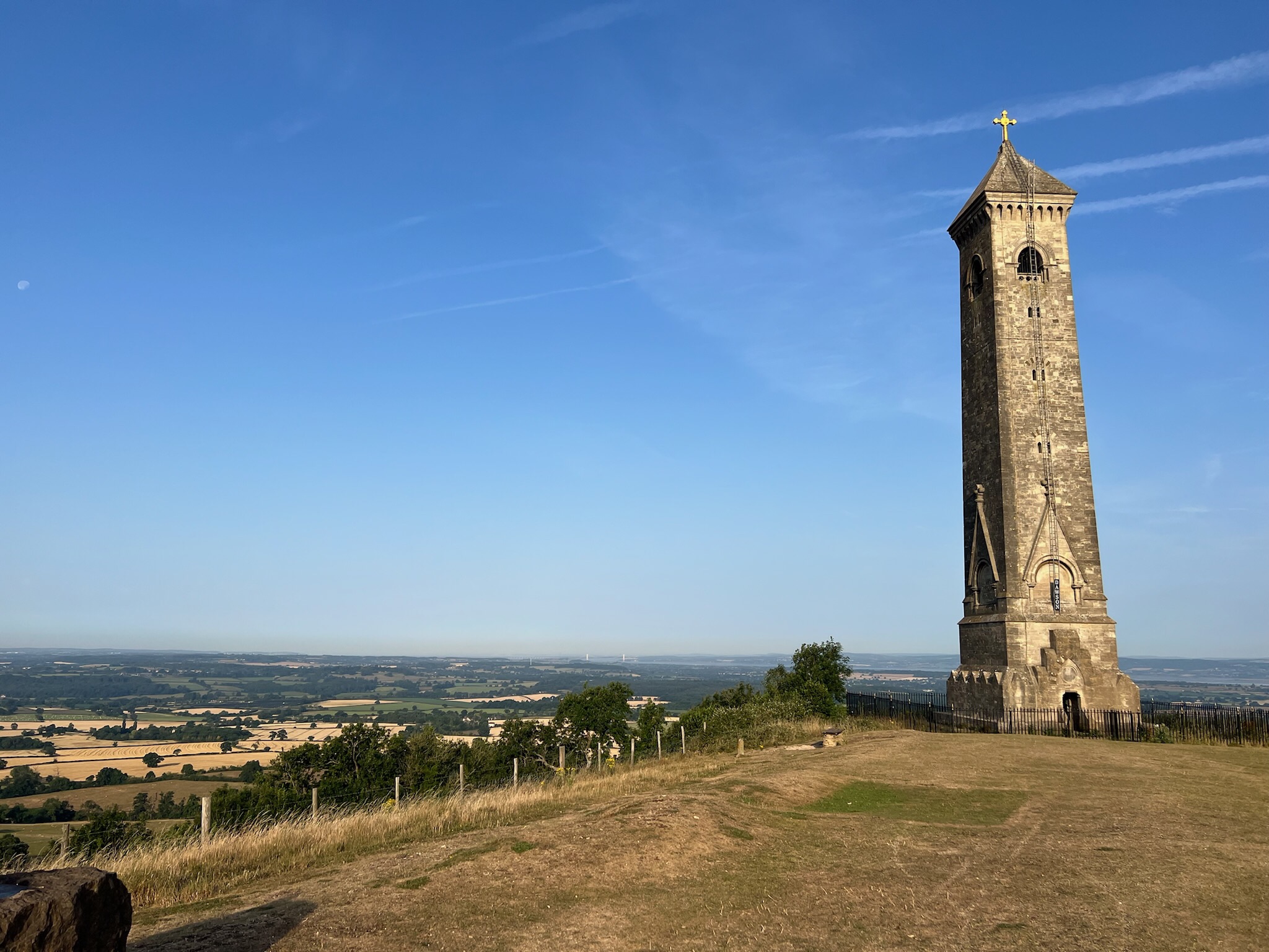
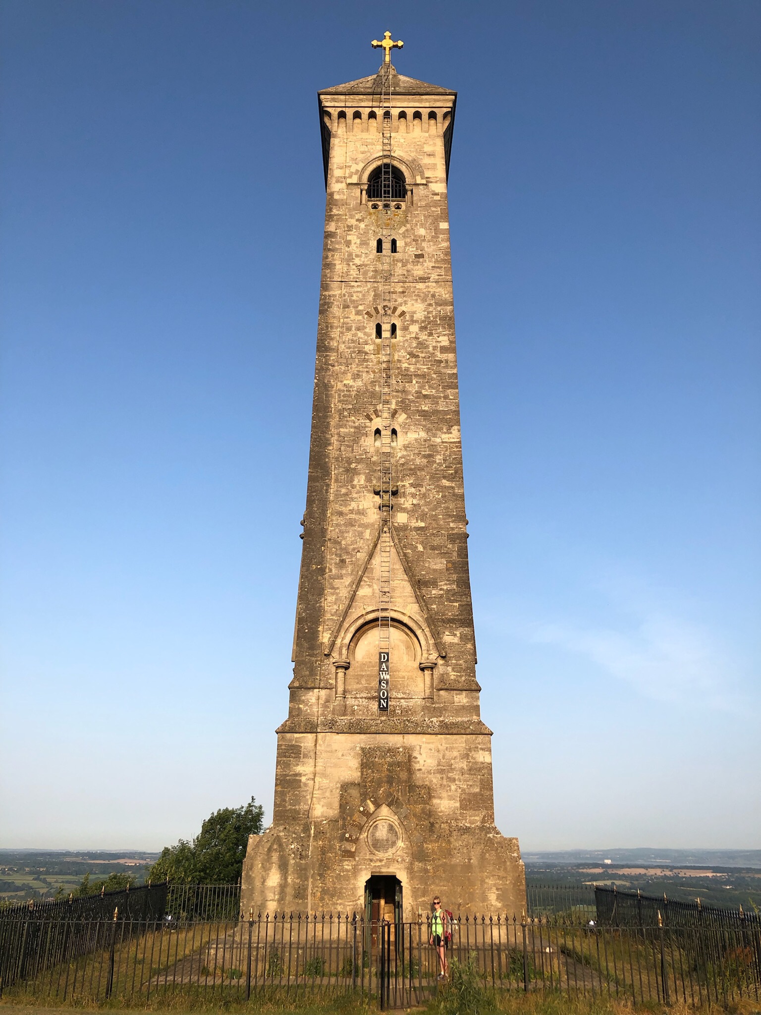
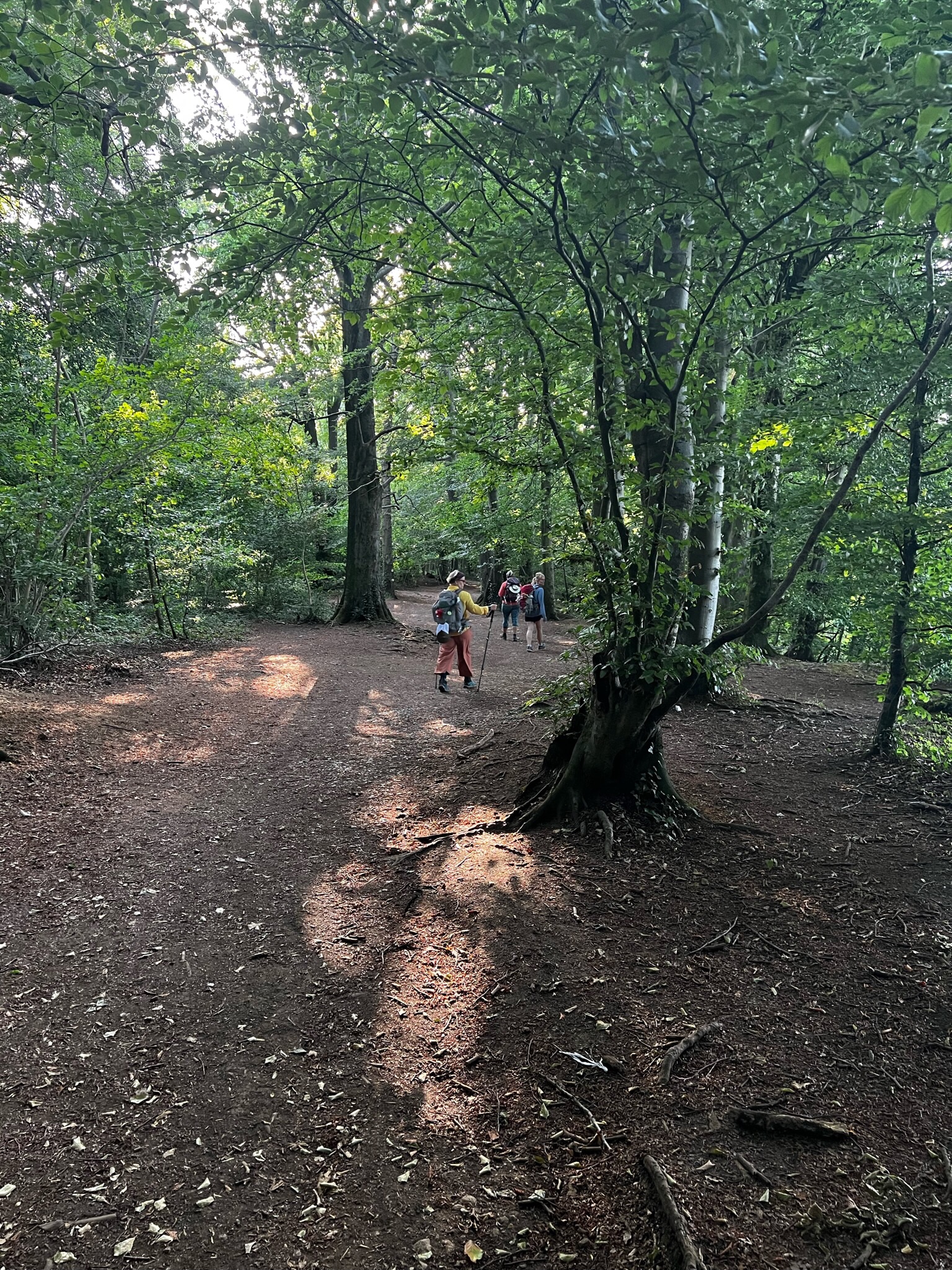
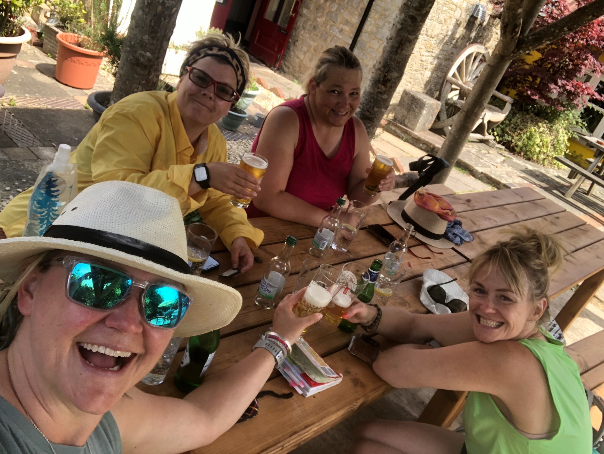
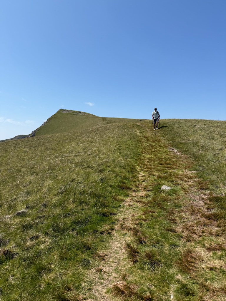
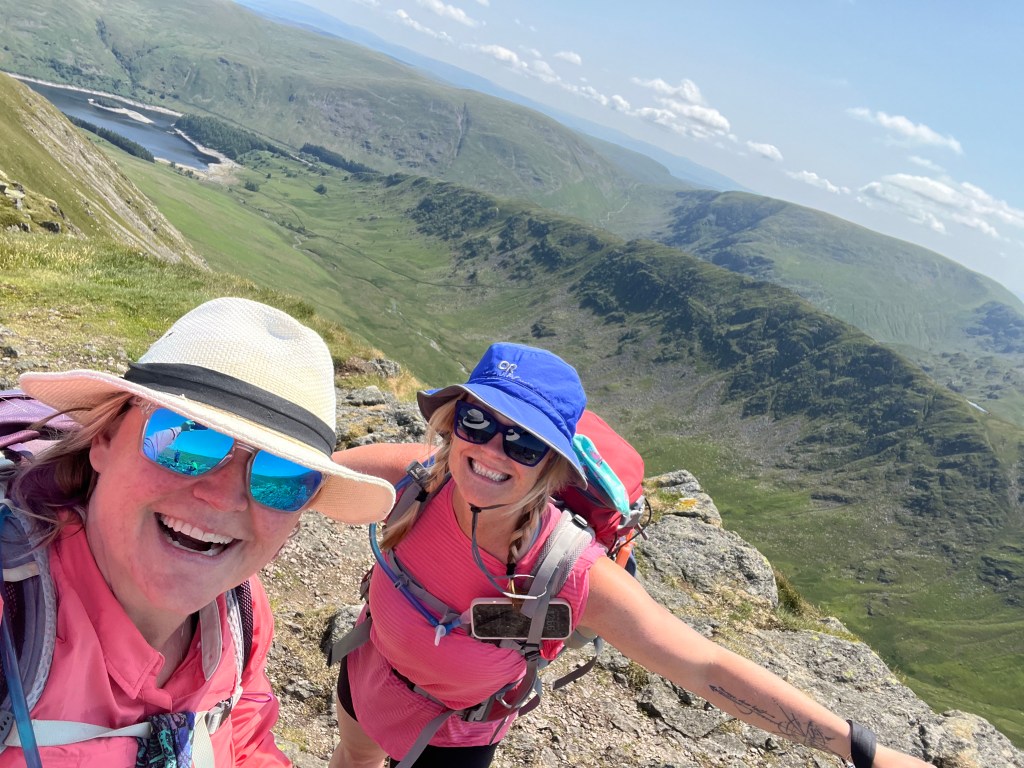
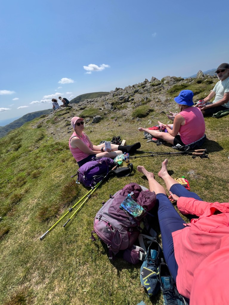
The real reward was up next, Kidsty Pike at 2,559 feet / 780 m – the highest point on the Coast to Coast and it deserves all the praise it gets. The first photo in this post is all of us up there and in awe of the view and our accomplishments so far!

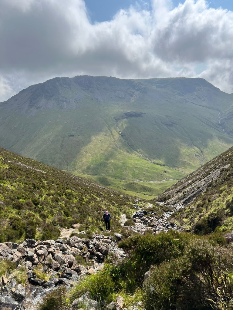
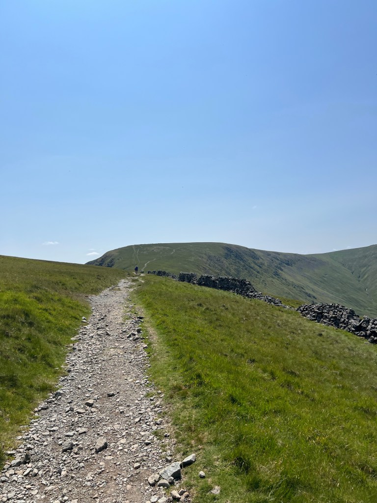
The walk up from The Knott has some good steep sections but nothing compared to what we have seen on other days, and all on pretty wide ridges and tracks making it my favourite climb so far.

After the last trudge up, we took our lunch break at the top of Kidsty Pike in amazing spirits, sunshine, comfy grass to sit on, and yummy snacks. This right here is why I do this – my happy place.

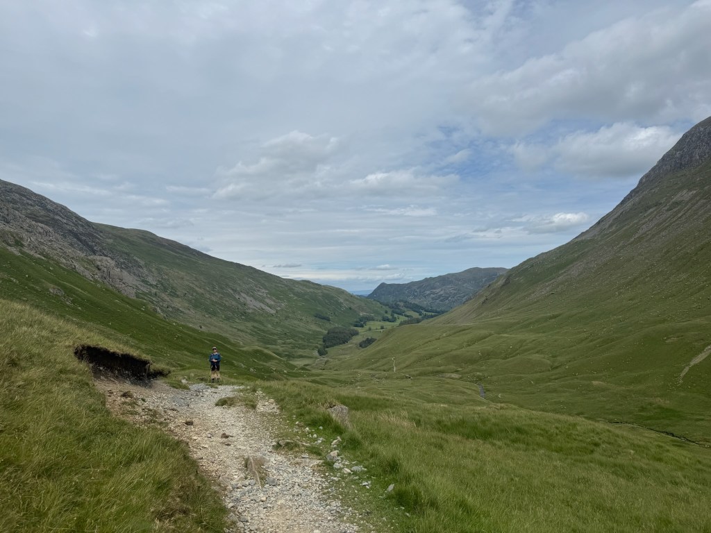
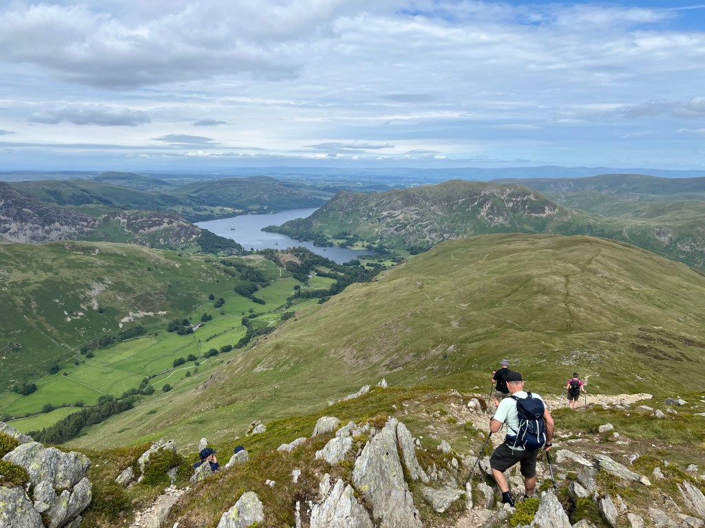
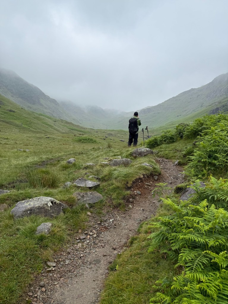
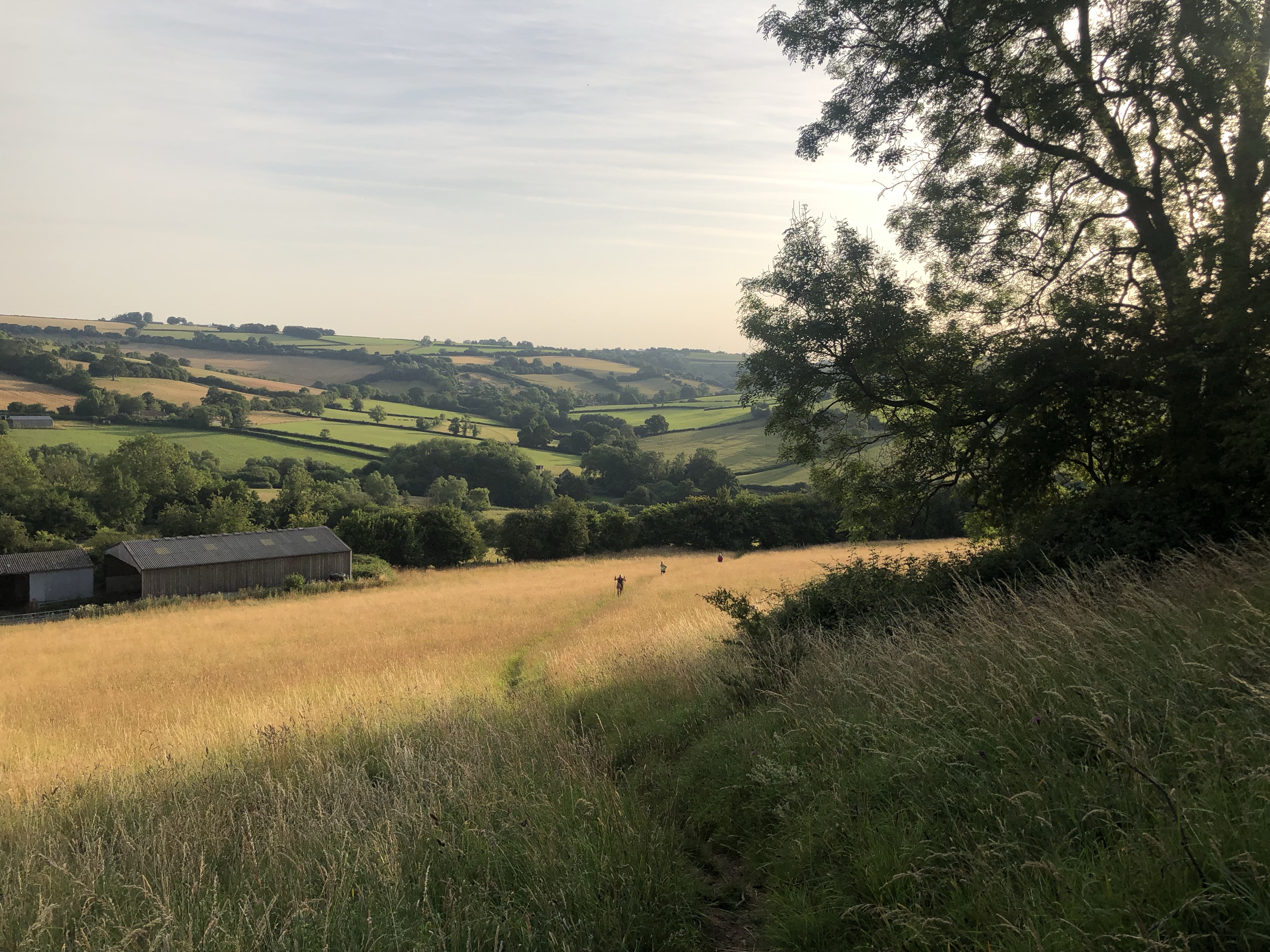
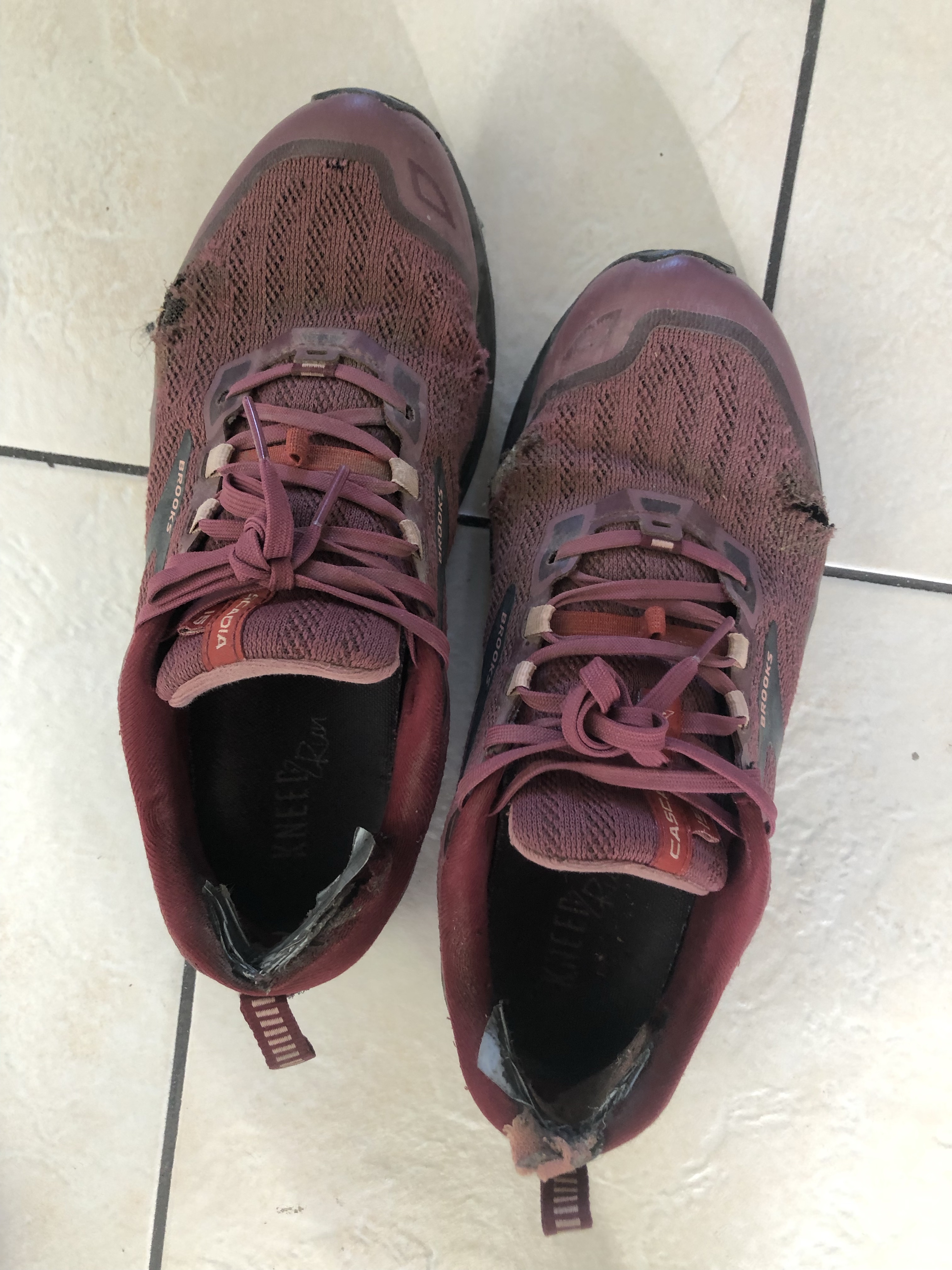
Ok sunscreen on and lunch on board, we started the long, long descent down to the next milestone Haweswater Reservoir. What started off as a nice stroll down on the grass, soon became a toe crushing descent. Just when the feeling of your feet sliding forward in your boots was too much, it became a rocky near-scramble which felt better … at first until it didn’t. Oh and then back to grassy toe crushing. Good times!

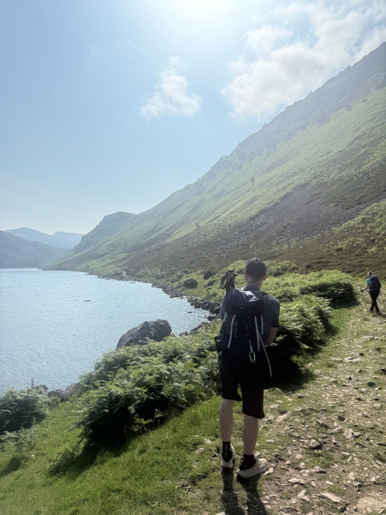
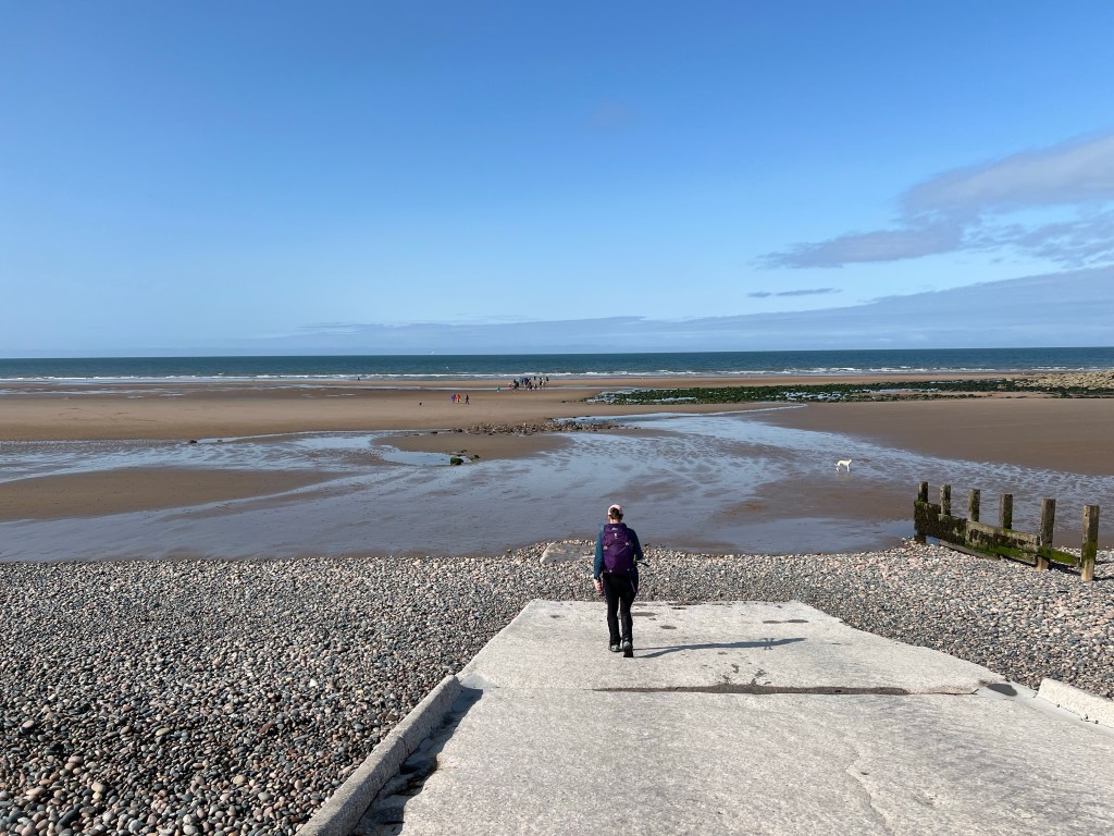
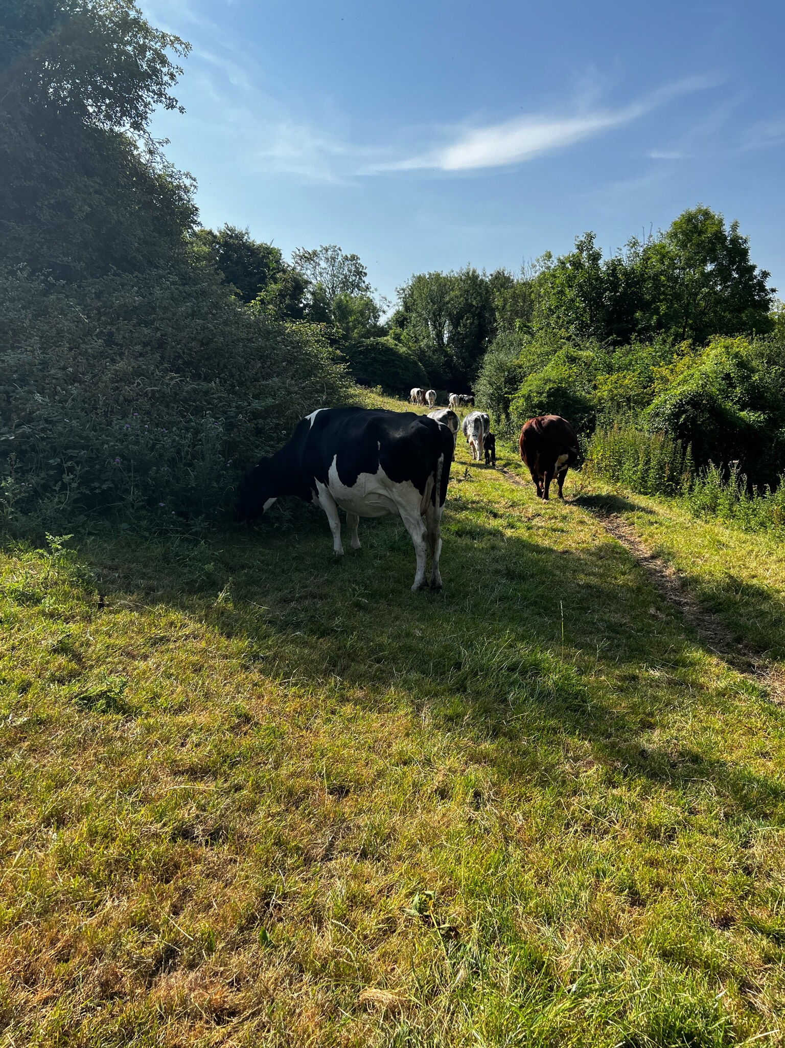
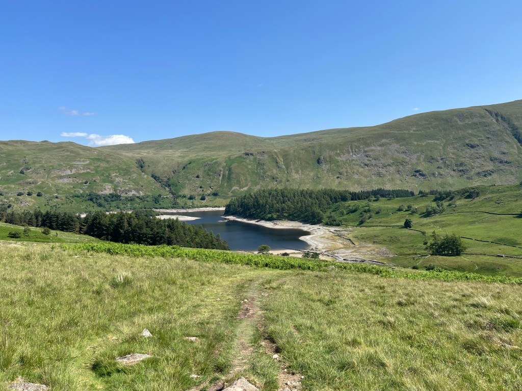
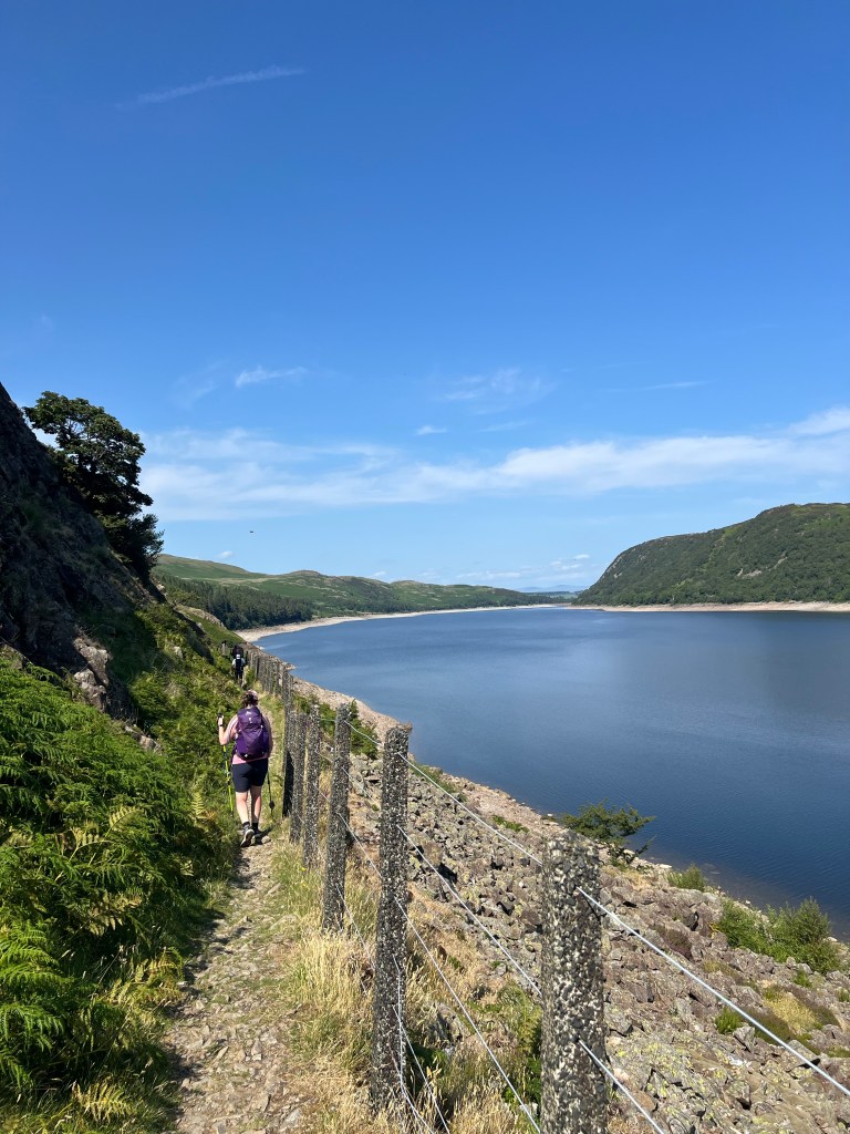
We made quick time of it – no lallygagging on descents for his crew – we had views of our Haweswater Reservoir. The actually loved a town, cemetery and use this spot as a Reservoir. When the water is low you can see some of the buildings from the old town!

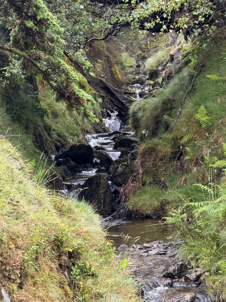
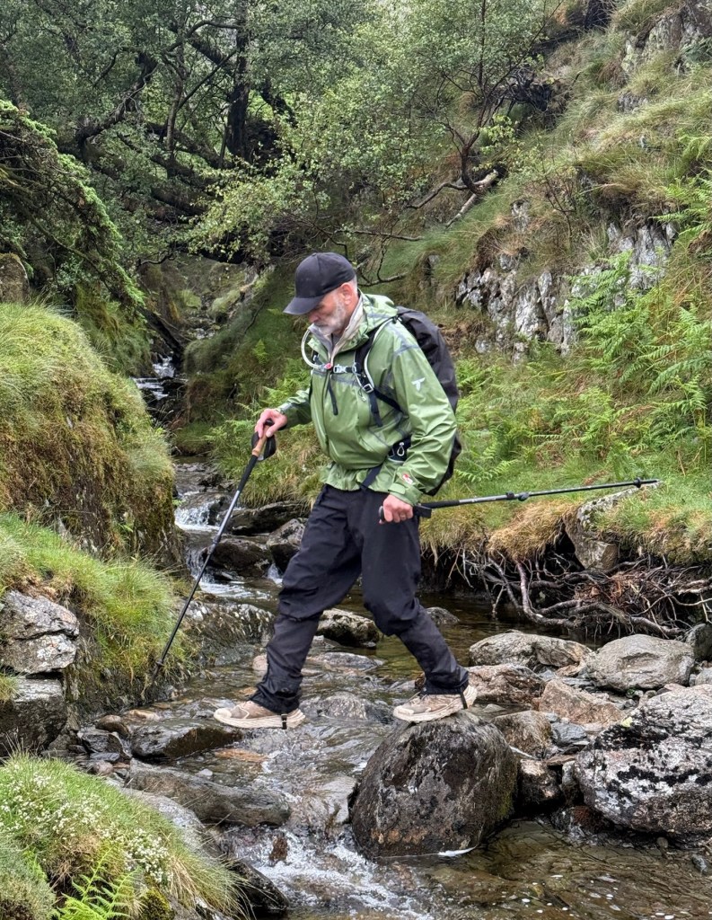
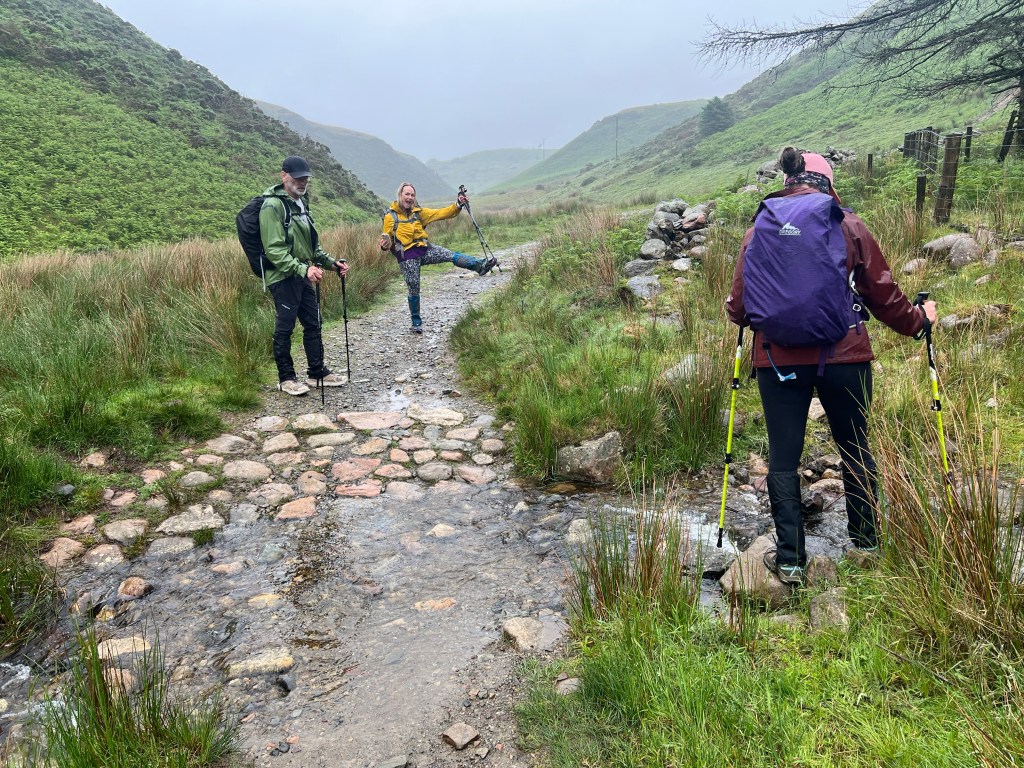
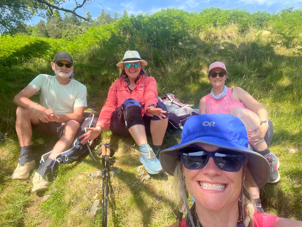
We had another micro little break just at the bottom of the descent in the most amazing little spot beside the river. Shar dunked our buffs in the cool water for us to wear on our necks to cool down.

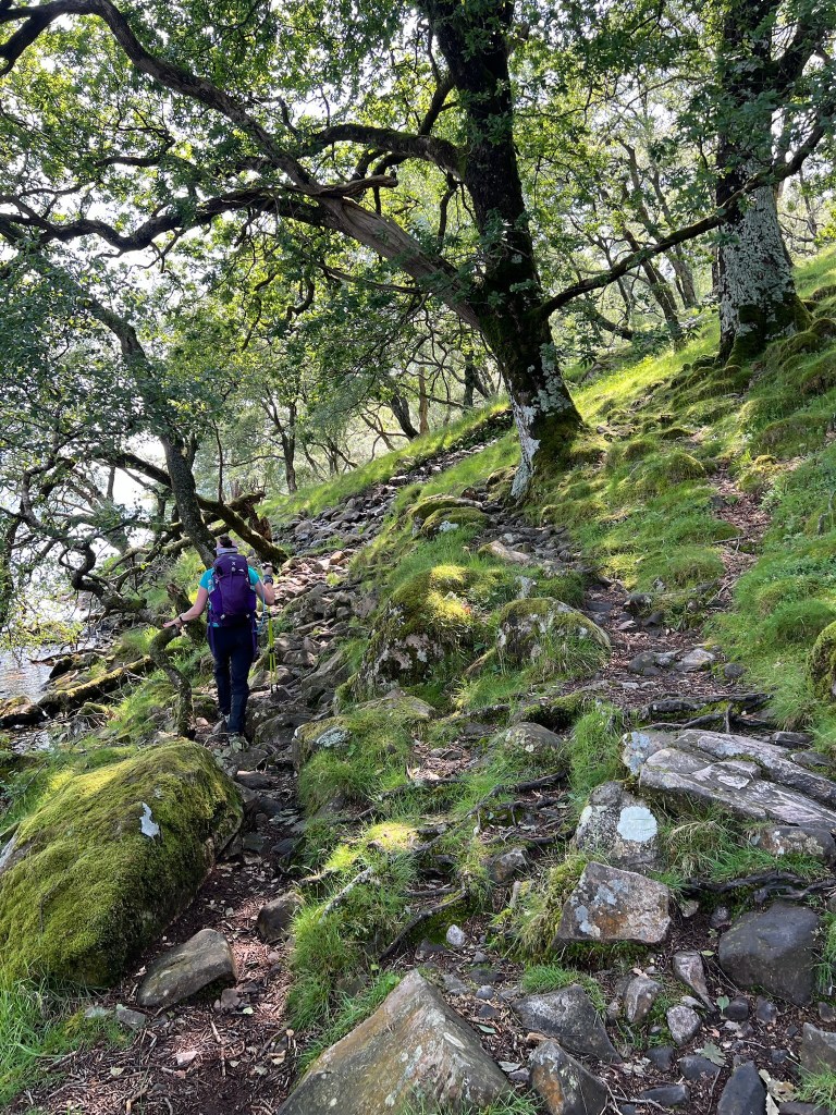
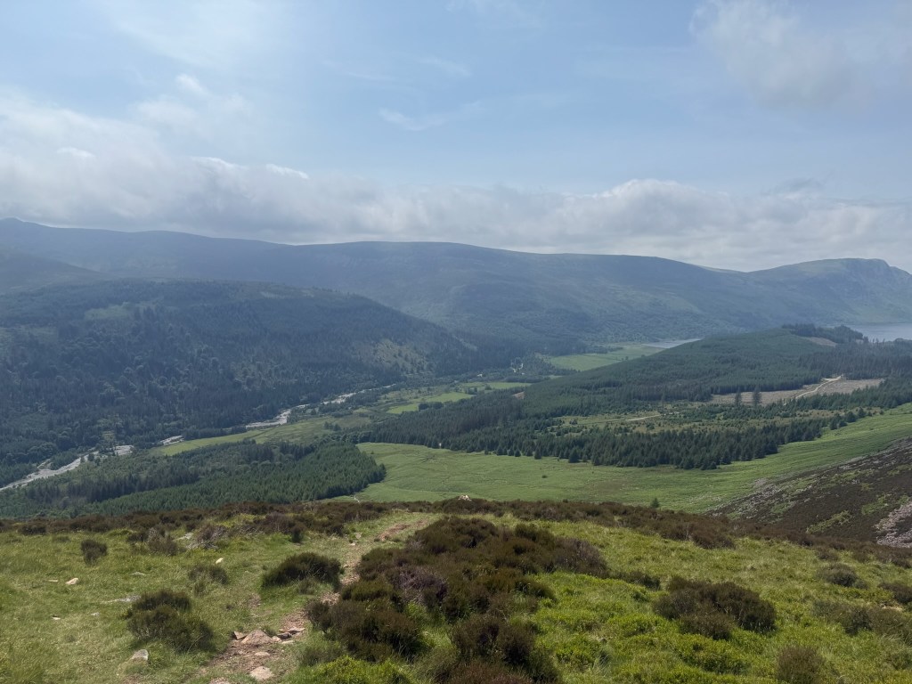
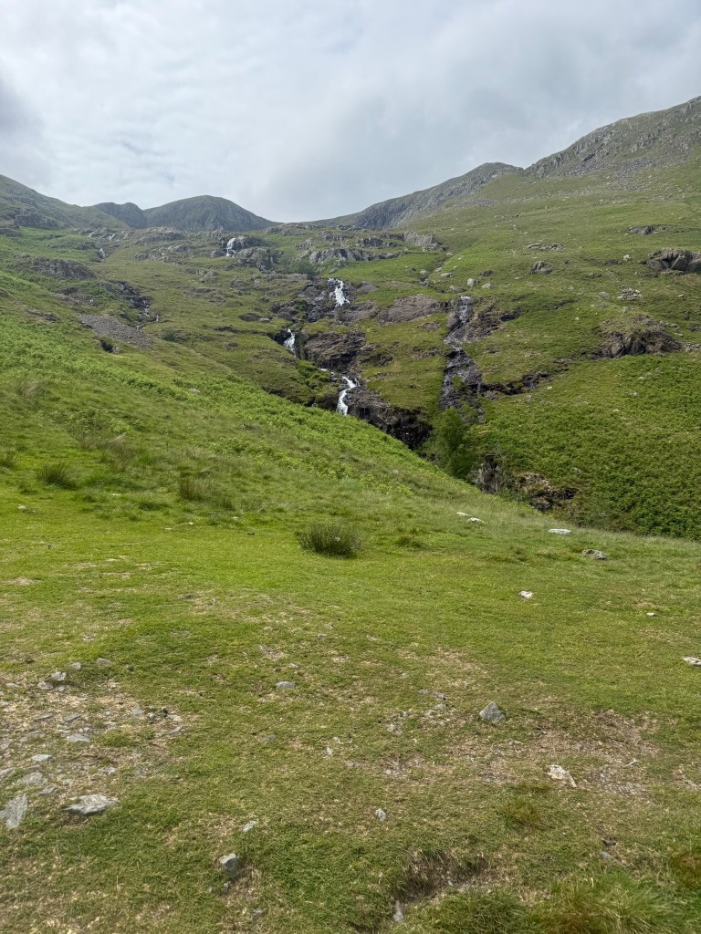
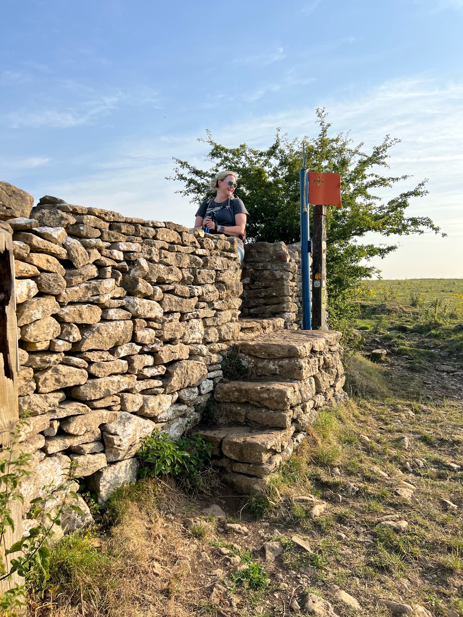
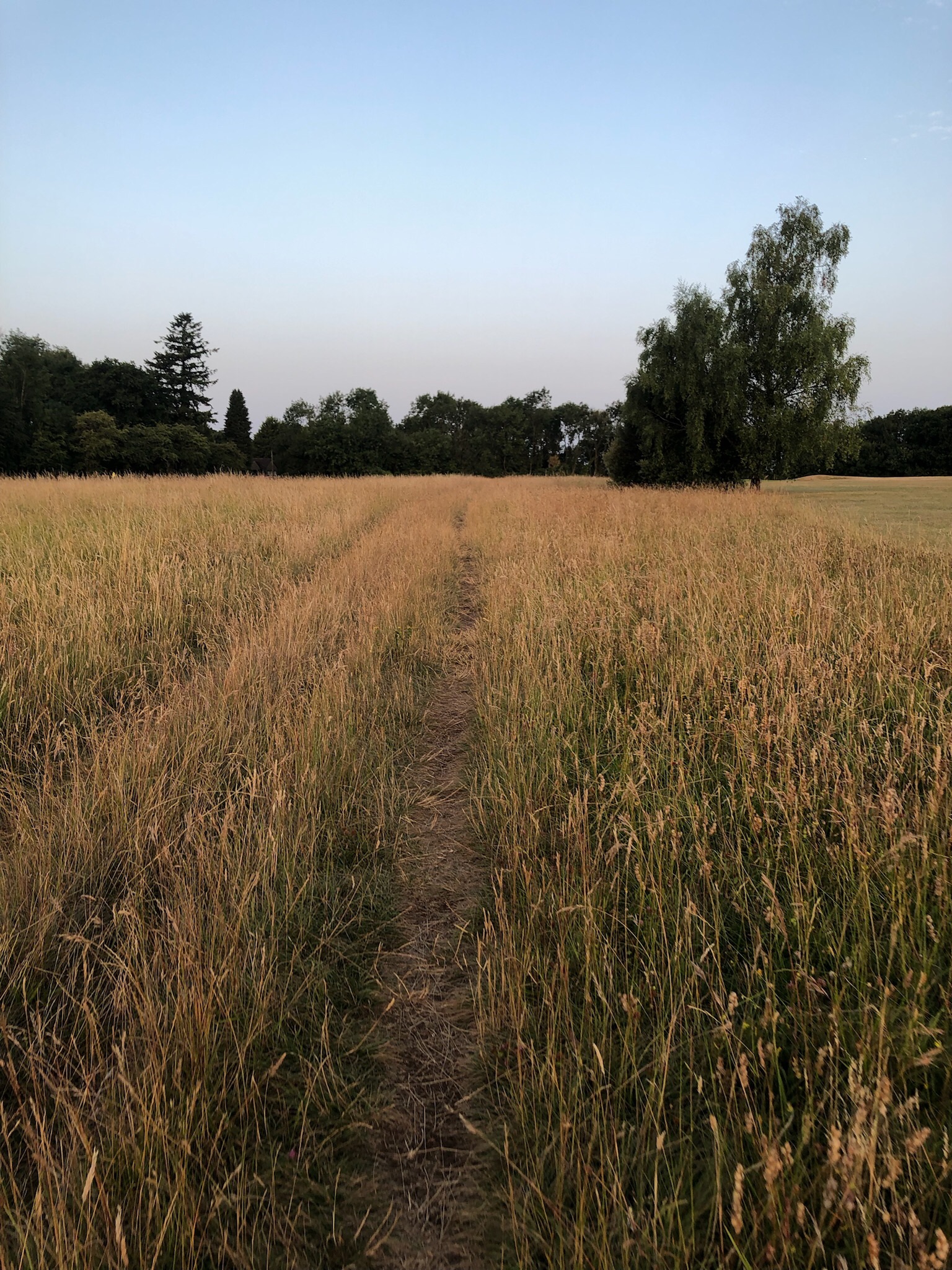
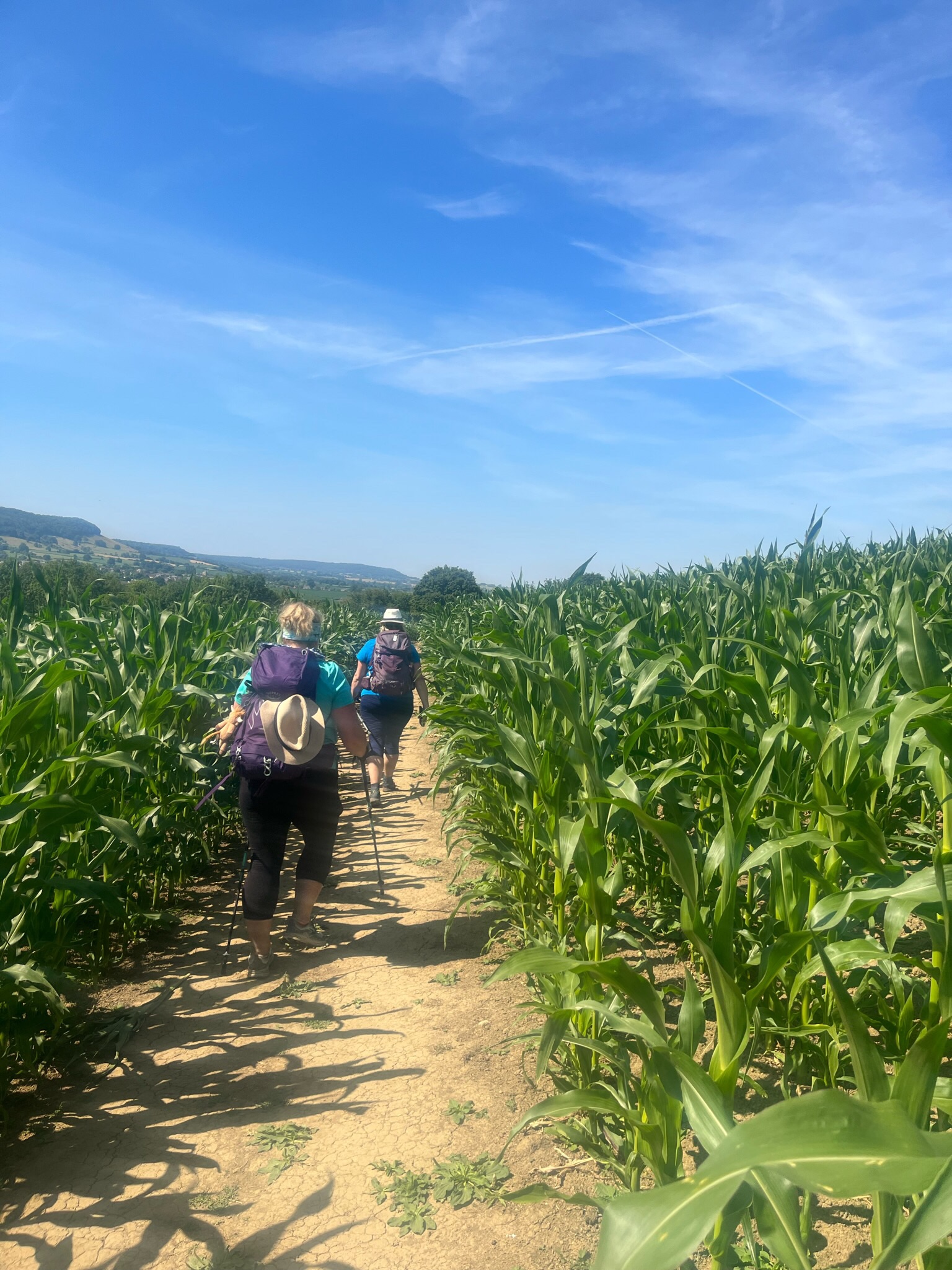
From there it was about a 6km hike along the Reservoir- a bit of up and down along the path, sometimes a little too close to the edge for my liking, but a great trail. The feet and heat were being felt by now so we made quick work of it as there was little to no shade.

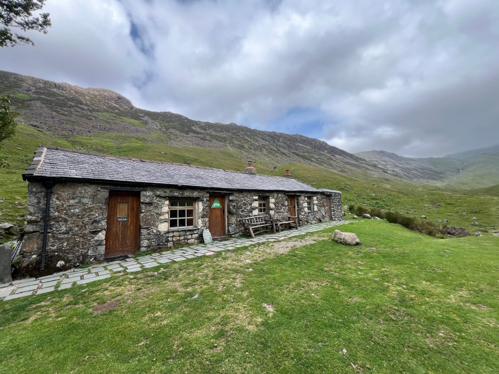
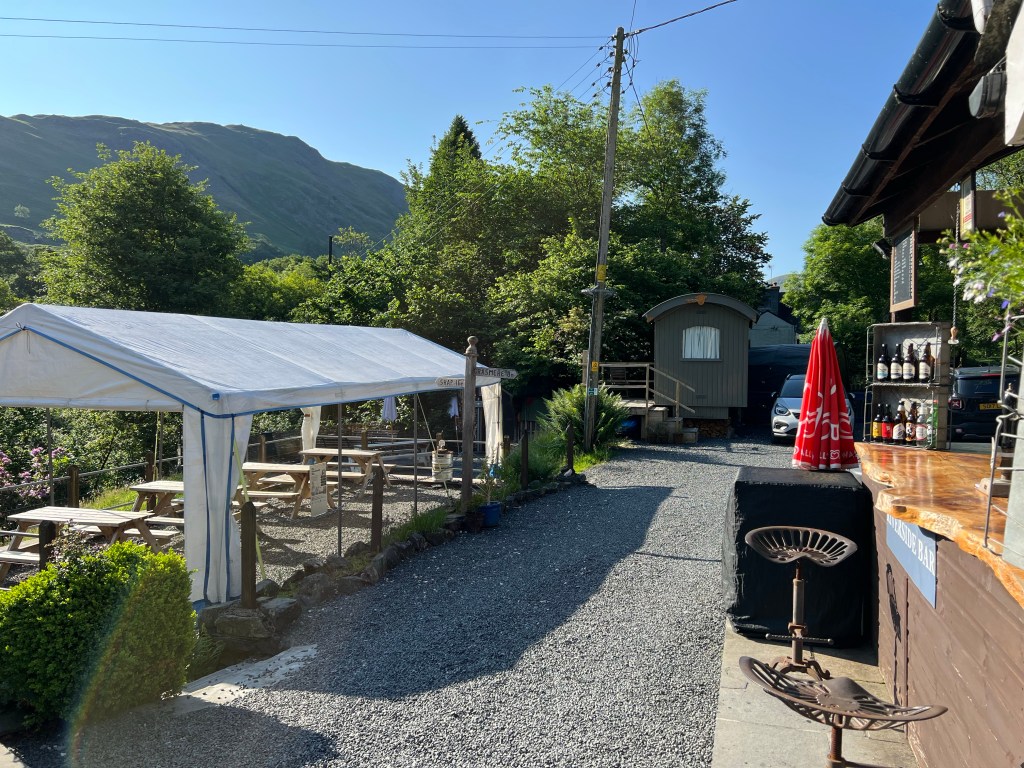
On the other side of the water, we had a 2.4km stretch of quiet road to reach our much deserved home for the night, Mardale Inn. Which had manpower on arrival but made us yummy burgers on the generator power, and then were back up and running by 9pm for the WiFi and hot showers before bed!

For those reading on the run …

  • Date: Thursday June 19 2025
  • Trail: Coast to Coast Path, England
  • Day: 5 of 17
  • To/From: Patterdale / Burnbanks (onto Bampton)
  • Start/Finish time: 900am / 615pm
  • Distance: 20.48km (All Trails)
  • Steps: 35,093
  • Terrain: rocks up and rocks down and rocks rocks rocks
  • Weather: perhaps a little too hot at 25C
  • Breaky: scrambled eggs and yogurt
  • Lunch n Snacks: 11siesorange juice, banana, 2sies strawberries, cookies and sandwiches, 2sies strawberries, juice
  • Dinner: steak burger, chips (fries) and salad
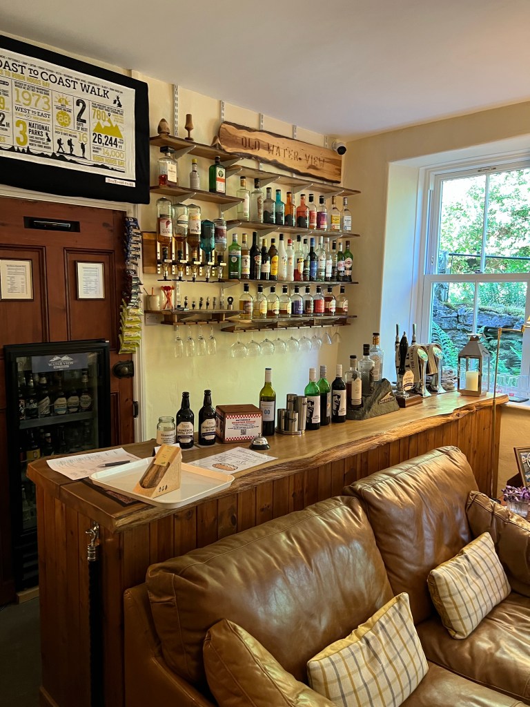
  • Tonight’s home away from home: Mardale Inn (fantastic place to stay!)
  • Mood: good, fleeting blessed
  • Body: dogs are barking, hips tight but my tummy issues are gone
  • Highlight: the highest point of the Path and the trail was tough up up up but not Scaredy Bear tough – enjoyable!
  • Lowlight: the descent from the highest point was toe crushing
  • Deep thoughts: there us such thing as too much of a good thing

And we are off on Day 6, see ya on the flip side! (PS had to write this while walking – sorry about the grammar and spelling mistakes!)

Brande

Coast to Coast Day 2 Ennerdale Bridge to Roswaithe

Day 2 on the Coast to Coast Path is in the books. Today we walked Ennerdale Bridge to Roswaithe which is said to be the toughest stage of the Path and we agree!

We started our day off with a fantastic full English breakfast (bacon, sausage, beans, tomato, toast, eggs) and a couple of extras depending on what you ordered (black pudding, porridge, yogurt, etc.) Ready to burn off those calories, we headed out the door for 9am and made our way to our first obstacle of the day’s walk, Ennerdale Water.

Ennerdale Water is over 4km long and has two ways around it. The Northern Shore which is a forest, gravel track. This is a multi use track, think bikes to hikes, and is recommended when the weather is offensive. The Southern Shore is the classic Coast to Coast Path route and recommended in fine weather but is a lot more work. It’s a path just on the water’s edge, made up of mostly large uneven rocks, steams to cross, some scrambling (think hands and feet), and takes much longer but is absolutely gorgeous. Sun was out, so Southern Shore it is!

That last one there of me (thanks Shar for the snap!) make me look like a boss. But … I am terrified of heights, and what you can’t see in the photo is how steep that trail is (to me), how close it is to a 30-40 foot drop into the lake (for real) and the lake is full of lava, flesh eating alligators, spiders and zombies that are hungry for Brande bits! Well at least that’s how scary in my brain it is and the scenario that was playing out in my mind as I precariously balanced on a ‘knife’s edge’. The mind is an interesting creature!

In just over a couple of hours we put the zombies behind us and were on the other side of Ennerdale Water. After such a long time stepping so carefully, we were ready for a break and had ourselves a little 11sies picnic trailside before kicking off our next obstacle.

With some cookies and fruit onboard, we headed for the forest road (gravel logging road) which would take us to the place where we leave the trail and start heading up and up over the mountain range to our home on the other side, Roswaithe.

There are two options here, the classic is via the Black Sail Youth Hostel (most remote in England which is odd to me as you can technically drive to it) OR the alternative up to Red Pike and across the wide mountain range ridge via Hay Stacks where the routes meet up for the decent into Honister. On a fine day, which we were definitely having, the high route via Red Pike is not to be missed.

So we split the uprights to experience it all! The decision point is at a fence / gate and Dad and Shar headed up to Red Pike and Hai and me carried onto the Black Sail Youth Hostel approach. The plan was to meet in Honister (there is a little cafe at the Slate Mine tourist shop) unless we happened to see each other at the path junction on the ridge – pretty slim chance there but would have been exciting

So off Hailey and I went for few more kms along the forest road ..

We made great time to the Black Sail Youth Hostel. The gravel track was mostly a gentle incline but with little shade for this 6.5km section. Our 15C day while mild was feeling a little less so pretty quick. Think mini donuts on one of those little deep fryer conveyor belts. A little breeze kicked up about half way and we were loving that until that little breeze changed the day pretty quick!

Not too long after our refreshing breeze started, Hailey and I both noticed a change in the temp and speed of that wind all of a sudden. Colder and stronger, and it was bringing in some cloud and fog cover. Wonder how Dad and Shar around doing up top? By the time we made it to Black Sail Youth Hostel, the breeze was gusts and they were strong – slow you down or push you forward while walking strong.

The Hostel was open so we tucked inside for 30mins for a fantastic break – we left a 5er in the honest box collection and had a tea and shared a chocolate. After a quick stop at their toilets, we added a layer of clothing and headed back out into the gust storm!

I have met Wind but never Gust and he is a spicy, blowy chap! We had to laugh and pause a few times when it kicked up particularly well then carry on quickly in the quiet breaks. The path took us onward from the Black Sail Youth Hostel now on a thin grassy or rocky path towards my nemesis of the day – Loft Beck!

Once we had traversed these skinny little trails, we arrived at Loft Beck and Scaredy Bear Brande was in full force. This is a 1000 foot / 300m stone staircase beside a rushing river up a steep ravine from bottom of the valley to top of the mountain. And obviously more zombies in the water waiting for Brande bits to chomp on!

I was in awe of how beautiful it was, how thankful I was for whoever built said stone staircase, and completely terrified. The upside? It was not going to rain, and the wind gusts were pushing us into the mountain like a little temperamental safety harness (yes that’s what I told myself!) The pictures first looking up at the bottom, then down about 75% of the way up do not do it justice. Except maybe that last one, the nice flat green grass waaaay down at the bottom is where we started!

I gave Hailey the warning that if I stop I will never start again, and I took off up and up. Speaking out loud to myself that the wind is my friend and helping me stay on the mountain, that these are just stairs and I do those all the time, I can do anything for 100 steps and again and again, and to not crawl. For the Lord of the Rings fans in the crowd, I have resorted to Gollum like hiking in the past! Not a good look!

When I got to a little safe spot I could look back and check on baby sis.. she was just happily stepping up and up the steps not a concern in the world. Damn gazelle was made for this! Love that!

At the top we hit the junction where Dad and Shar might have been spotted – no dice – so we had a sip of water, almost fell over about a dozen times as the wind was WAY worse up here and then made our way across the top of the wide ridge.

This was gorgeous walking up here, mostly on grass or small stone trail and cairns (piles of rock) all along the route to guide the way. Stunning! I took some videos and popped those up on Running for the Gate Instagram.

The trail book says from the top to the Honister Cafe it was about 60mins walking – we needed double that. You had to stop walking sometimes to let the gust go by and then get some steps in before the next one for quite a bit of our time up there. We definitely kept wondering how Dad and Shar were fairing coming across the whole thing!

We arrived down in Honister after the Cafe closed but I was able to pop in to use the wifi and let our BnB place now we would be later than planned thanks to Gusty McGusterton. We found a nice bench sheltered from the wind and a view of the final descent down into Honister so we could see when Shar and Dad were coming down. They should be about 2 hours behind us according to the guidebook.

Meanwhile Dad and Shar were not traversing the ridge top. They made it up to Red Pike at 755ft in good time but the gusts of wind were treacherous up there – so they snapped a couple pics and then backtracked to take the route Hailey and I did but a couple hours behind us.

By the time we reunited down in Honister – it was pretty cool to see them come up and over the edge there on top and watch their descent – the day was hitting 7pm so we sent a quick note to our BnB lady (I had to jog up the street until I found a signal) and she came and grabbed us.

We arrived to our new home for the night, Yew Craggs in Roswaithe a few mins later, and not 15mins after that we were sitting down for a cold pint, hot homemade pasta and an amazing dessert we had pre arranged with Ann Marie at the BnB.

We were all wind burnt, dog tired, full up from a delish supper when we made our way to bed around 930. Got to give the body a little lay flat sleepy time so we are spry for another tough day though the Lake District tomorrow (in pouring rain I might add!)

For the speedy ..

  • Date: Monday June 16 2025
  • Trail: Coast to Coast Path, England
  • Day: 2 of 17
  • To/From: Ennerdale Bridge / Roswaithe
  • Start/Finish time: 9am / 7pm
  • Distance: 23 (25.4km Hiiker)
  • Steps: 31,180
  • Terrain: Rocky scramble, gravel forest road, grassy trail, steep stone steps of hell, gusty rocky trails, stoney decline
  • Breaky: full English / cooked breakfast
  • Lunch n Snacks: cookies, apple, sandwich packed from last nights accommodations, gummy snacks, tea, chocolate
  • Dinner: local sourced pasta, berries and cream and a local pint Tractor Shed Brewing called Kessin (blonde ale)
  • Tonight’s home away from home: Yew Craggs of amazingness
  • Mood: happy with terrified and proud moments
  • Body: feeling great!
  • Highlight: tea at the Black Sail Youth Hostel with my sister
  • Lowlight: gusty, grumpy winds
  • Deep thoughts: trail magic is really and truly a thing, the people and the path can be the most amazing example of how blessed we really are!

Well Day 3 won’t start itself – off we go!

Brande

Coast to Coast Day 4 Grasmere to Patterdale

Day 4 done like dinner! What a beautiful day – from trail to views to weather, wow.

We kicked the day off with another great breakfast at The Swan Hotel – scrambled eggs, porridge, tea, coffee, the works. Then grabbed our kit and made our way the short way back through Grasmere to the Co-Op. A convenience store meets grocery store for small towns and one of my favourite shops for trail side provisions. I found my Prawn Cocktail crisps (potato chips) and was already excited to crack into them on our lunch break. Yummy!

About a kilometer of quiet road walking to kick off the day and then we were back on rocky paths.

Before heading up, we did a quick chat with Ankles. A very nice chap also doing the Coast to Coast that we had seen for the last couple days. Nicknamed (by us) for his two reconstructed ankles and our amazement that he is doing, albeit it looks painful, the Coast to Coast Path. I will officially complain less about my annoying knee brace!

Up and up and up along a rocky path between the trees and bracken, led us to a gorgeous river crossing and our first route decision on our way up to Grisdale Tarn (538m or 1,765 feet), our lunch spot for the day.

To get to Grisdale Tarn you had to go around Little Tongue – a baby ‘mountain’ – and there was the left side that has steeper sections and more exposed path or the right side Little Tongue that is a sustained climb but a way from the edge. Both at about 1.8km before the paths rejoined and all leading to Grisdale Tarn our lunch spot.

Surprise! I went right and my trusty partner in crime, Hailey, came with me. Also, surprise! Dad and Shar went left for a bit more adrenaline. With a wave and smile we set off.

The Little Tongue route Hailey and I took was absolutely breathtaking! We continued to walk on the very obvious rocky path, with a beautiful stone fence to our left most of the way (in my mind some farmer from way long ago out built it as a safety fence for me, thanks Ned!). We walked up and up and up on a gentle but thoroughly thigh burning incline – the little river or stream crossing every 100 or so feet helped break up the plod.

We left all trees behind pretty quick after the split (and would not see any again along the trail until almost into Patterdale our destination) and wow was it heating up. While still only 15C, we were feeling the sunshine!

A little micro break before the path turned up the incline for the final push over the pass to the Tarn was perfect for some more sunscreen. (You can tell the incline of the path by how we are seating in this photo.) Ankles joined us for this break and we got a bit of the back story on his injuries – soccer – me too!

Nothing to be done but up and over – we were now into Scaredy Bear climb territory – Hailey and I started the hot climb up to the Tarn. Which included lots of those stone steps into the side of the hill for our path and way too many sections that had my heart racing but we made great, steady progress. We were soon in a pretty spot without risk of falling and picking our way through an old rock slide with a smile. (For those from Alberta reading this, it reminded me of climbing through Frank Slide area)

One more final, hot push and we came over the pass at the side of Grisdale Tarn – our meeting spot with Dad and Shar and this side of the hill offered a nice breeze too! We hunkered down for our lunch break. Shoes and socks and knee brace off – felt amazing!

Reunited with Dad and Shar, we had another decision point on the trail today. There are 3 routes to get from here to Patterdale.

  • Striding Edge which is basically a long, exposed path up to a knife’s edge ridge walk then down to town – no thank you from all of us!
  • St Sunday Crag which is a little shorter but still long, exposed path up to a safe, wide ridge for the views then down into town – that was a yes for Shar and Dad.
  • The Valley which is the official route which is a long, decline down through the valley into Patterdale – that was a yes for the Valley Girls, aka Hailey and Brande.

A little photo montage from the Valley! (Highlight was that we could see Shar and Dad make their way up, up and up the climb to St Sunday Crag until there just a little mint and red specs on the hillside!)

A little photo montage from St Sunday Crag!

After a few hours all of us had had our Valley or Ridge thrills, then started to make our way down the long decent (no matter what route you took the toes were feeling it) into Patterdale. We celebrated the end of an amazing day with a cold pint on the patio of The White Lion before making our way to our accommodation.

For this with only a min to spare …

  • Date: Saturday June 18 2025
  • Trail: Coast to Coast Path, England
  • Day: 4 of 17
  • To/From: Grasmere / Patterdale
  • Start/Finish time: 940am / 500pm
  • Distance: 13.8km (Hiiker)
  • Steps: 27,934
  • Terrain: rocks, rocks and more rocks (from boulders to pebbles, we had rocks!)
  • Weather: gorgeous 17c with a few wispy clouds mid afternoon for a short time
  • Breaky: full English / cooked breakfast
  • Lunch n Snacks: 11sies cookie, 2sies half sandwich, Harry Potter candies, 5sies a pint
  • Dinner: baked potato
  • Tonight’s home away from home: Old Water View (wow what an absolute gem!)
  • Mood: feeling good, tired!
  • Body: feet are good, the calves are tight thanks to all this incline
  • Highlight: feet are good, the calves are tight thanks to all this incline
  • Lowlight: terribly sore tummy this afternoon and evening
  • Deep thoughts: it’s really is the little things

Our accommodation is the Old Water View Inn and wow wow wow. This place is an ode to Wainwright himself and stunning. They have a fantastic back garden with picnic tables over looking the river, full bar, baked potato inspired dinner menu, and a resident Red Squirrel (which is quite the treat to spot!)

That’s off on Day 5 up and over the highest point in the trail today in 25C heat! Yahoo?

Brande

Coast to Coast Day 3 Roswaithe to Grasmere

Day 3 done like dinner. It will be a simple 14.5km jaunt up and over the Lining Crag pass and through the valley to Grasmere, they said! Not so much my bloggy blog friends!

The day kicked off with an amazing breakfast at Yew Craggs BnB and then we donned the full waterproofs – from shoes to pants to jackets in anticipation of the 95% rain all day we were expecting … and nature delivered.

We started with just a short road walk and then were on a beautiful rocky path following a river, with a rock wall and some sheep (of course) beside us through the trees. It was raining but not too hard – so far the path was still a path and not a small river.

In about a couple kilometers the path turned into a mix of grass and rock and we were treated with views of the beautiful Lining Cragg pass we were heading up to find our way to Grasmere valley on the other side.

Lining Cragg was our challenge of the day. Sitting at 1,778 feet (542) metres we knew it would be a bit of an uphill slog to the top but with the temp sitting at a nice 7C, the rain still quite light and little wind we were up for it (pun intended!).

As we walked out of Borrowdale Valley (we’re Roswaithe and a number of other hamlets sit) the path started to introduce our incline. A fantastic gradual incline that was just enough to burn the thighs but not so much that you needed to stop for breaks.

The further into and up the valley we got, the path started to get serious – much more incline, stone steps built in. The slog had arrived but wow what scenery… what you could see anyway. We were pretty socked into the cloud and mists by now making it so quiet except our boots, poles and river below. Ok and a touch of Darth Vader breathing. The down side of your rain coat hood up is how amplified your own breath is – so I really sound like that!?

A couple of false summits later, we were ready to say goodbye to this pass. Nothing like coming around a bend on a high climb thinking you are done just to see another, harder section above. Again and again! Keep on swimming, keep on swimming as Dori would say.

By this time a few of the sections were a little sketchy for Scaredy Bear Brande with some thin paths on the mountain shoulder with drops to the side but I was powering through. That was about to change.

As we came up and around the last false summit, we saw the real one and could not believe it. We watched tiny little people ahead of us climb and scramble up what looked like a stone and grass wall. We checked the guidebook and my digital maps to make sure we were even on the right path. We were.

The lot of us were all a little intimidated. So we took a minute to focus our good thoughts and will power (aka the Strachan family stubbornness and competitiveness) to conquer this thing and watch where climbers before were finding the path. It was not clear at all from our vantage point if there was a path at all. There was … ish. Path-curious at best.

Nothing to do but carry on, so we did!

In a boost of path magic, a spry couple of gents went up just before us and confirmed that after a no path section, then a short section of scrambling (hands required) there were in fact a few stone steps to the left of the river we were following. Yahoo! That was confirmation we were going in the ‘right’ direction (debatable in my opinion) and there would be a few less sketchy spots to look forward too.

Dad out front, we headed up and up. Dad was wholly unimpressed by how dangerous this was for his daughters but I think secretly loved the challenge and tackled it like a boss! I was second last and did have to do a good amount with my poles strapped to my wrists and my hands on the rocks ahead it was well outside this gal’s comfort zone! The trail magic continue in our favour – the wind died down, the rain turned to very light mist and we made it. No mishaps or mistakes. Phew!

Looking back we all agreed it was a tough sketchy but not as sketchy as it first looked if they had just marked the actual path with some blazes so folks weren’t struggling to find the next spot to step.

Up and over it was my newest most favourite valley walk for 9 kilometers! Thanks to the recent heavy rains the river and streams were out in full glory showing off waterfalls!

We were even treated to the most amazing stone slab sidewalk where the water soggy grass / peat would have been an absolute nightmare to cross. The sun was trying to peek out and it looked like shiny sidewalk into the unknown! Loved it.

A little, short break for lunch on a few boulders when the rain let up and we carried on. We were making great time, everyone feeling good (despite Hailey’s absolutely water logged shoes poor thing). I loved loved loved this section. The high mountains to each side, green everywhere, amazing path underfoot that gave you just enough rock and rubble to keep you entertained.

At about a km from our destination we had slowly declined to farm level and started to weave on a stone path between farms and fields.

Once we hit the sweet little town of Grasmere at about km 15, it was about 330 and we were ready for a little look about. This town is like a small Banff or Whistler with lots of outdoor shops, tea rooms and little Inns.

I beelined to the Grasmere Gingerbread shop (gingerbread recipe that has not changed in over 150s of years originating right from Grasmere!) to queue for a few pieces for our crew to try. Glad I tried it, but it was too spicy for me with large chewy chunks of ginger.

I am more into a nice afternoon team with a scone, jam and clotted cream! When in England surely a cream tea is a requirement!

We headed to our home for the night, The Swan Hotel, after visiting a few outdoor shops (we needed new rubber bottoms for our hiking poles that have taken a beating on the rocks) and the most amazing puzzle store ever! Thank goodness I only have a backpack or I would have been bringing home at least a dozen puzzles. For real.

For those who love Cole’s Notes:

  • Date: Tuesday June 17 2025
  • Trail: Coast to Coast Path, England
  • Day: 4 of 17
  • To/From: Roswaithe to Grasmere
  • Start/Finish time: 9am / 336pm
  • Distance: 14.5km (15.5km Strava)
  • Steps: 27,386
  • Terrain: rocky (and wet) flat track, stone and rock paths up and up, stones on the steep climb, and a little road walking into Grasmere
  • Weather: cloud and rain to mist all day about 13 degrees at valley level
  • Breaky: full English / cooked breakfast
  • Lunch n Snacks: 11sies cookie, baby food tube. 2sies half a sandwich, gummy Harry Potter candies
  • Dinner: ham and fried eggs with chips
  • Tonight’s home away from home: The Swan Hotel, cute little hotel chain with an amazing beer garden out back
  • Mood: feeling proud our crew conquered the pass, wasn’t sure I could do it – scary!
  • Body: good, feet need some love
  • Highlight: the valley between the pass and Grasmere, absolutely amazing!
  • Lowlight: the terrifying scramble section to get up through the pass
  • Deep thoughts: you can do anything for 10 steps, and 10 steps more, and 10 steps more, and …

A nice dinner, a good sleep and we are just heading off for Day 4 now. I will check in again from Patterdale!

Brande

Coast to Coast Day 1 St Bees to Ennerdale Bridge

Day 1 of the Coast to Coast Path is in the books! The 24 kilometers (which ended up being 25km if you count the steps from our BnB) was a mix of sun and mist, ohhh and ahs, hills and flats, paths and roads. Perfect kick off!

At about 9am (after a delicious full English breakfast) we left the Stonehouse Cottage B&B in St Bees – lovely place. A quick detour to the Post Office Store for our lunch goodies (buns, ham and cheese) and we were on our way.

We took our starting line photo in front of the Coast to Coast sign, christened our boots in the Irish Sea (well actually a small tide pool, the tide was quite a ways out by 9am) and grabbed our pebble to carry on the journey and drop in sea at Robin’s Hood Bay to celebrate our finish!

Then it was up up up a beautiful path to the coast cliffs for the first 7km. Between the sunshine (which we knew was only a treat for us this morning) and the amazing views, we were feeling blessed! Until Dad kicked our butts up the climb and then we had to get serious – Strachan’s can be rather competitive!

(That’s Dad way ahead! Get em!)

The views from the top of the cliff were amazing. The waves were showing off small white caps and the nesting sea birds were everyone tucked into the cliffs. They had a few fenced areas where you could stand from the shelter of the winds and bird watch. Shar and Hai struck up a conversation with a couple and got to borrow binoculars to see Puffins!

At about kilometer 7 (after the St Bees Lighthouse), we took a hard right and started the Eastward 300 kilometer journey to England’s other coast. In a small hamlet called Sandwith (which we of course pronounced sandwich) we took our little 11sies break on some picnic tables outside a closed cafe.

The clouds were now above us and we could feel the change in the weather approaching but didn’t expect anything torrential. To be prepared though, before departing from our break spot we put the waterproof pack covers on, pulled the waterproofs (pants and jackets) out of their compression sacks and put them on top in our backpacks for quick access.

After a bit of quiet road walking, we were onto paths with a mix of fields and track, between farms and sometimes right through people’s farm buildings. The public access rights always amaze me in the UK – wonder how that would work in Canada for us. I would love it!

During our mid day stroll, we passed the ‘Wainright Passage’ sign. He is the guy who created the Coast to Coast Path so of course a quick pic was required. I sent that one off via What’s App as mid-day proof of joy to the family following along back home.

At about 130pm we were ready for a proper lunch stop and were so excited that the timing was perfect to visit St Leonard’s Church in Cleator.

The church often has a Honesty Box of tea, coffee, and chocolate inside. A simple make a donation and enjoy system! Sadly it was not one of those days at the Church but they had a welcome Coast to Coast walkers sign so we took that as a signal that we could respectfully use their covered benches for our lunch break out of the misty rain that had stayed about an hour before.

Gaiters, boots and socks off (so important to give your feet some breathing room after hours in gortex!) and we enjoyed a great lunch. Nothing like ripping open a fresh bun, and tearing off a chuck of cheese when you are hungry, followed by some sweet snacks.

After lunch, we headed for what should have been the big challenge of the day – the 350m climb through the forest up and over Dent Hill. However, it looks like the last couple weeks of thunderstorms wreaked havoc on the forest though and the path was covered in dozens of felled trees. The diversion said there were ‘dangerous trees’ – we had visions of the scary trees that chase Mickey and Donald out of the forest in the Halloween Disney Special but I am sure that is not what they meant.

The Coast to Coast Path team (not actually sure who that is) had a very well marked diversion in place for us – thank you!

Following fluorescent yellow dipped sticks we instead made that climb on a very quiet country lane. It was a climb to a bend in the road, to discover another climb to a bend in the road, and another and another. The long, sustained incline is always extra fun in waterproofs but we made good, sweaty progress. After a couple kilometers, the diversion took us onto a rocky path in the valley between the hills – I LOVED this part! The mist made it feel so quiet and isolated, the sheep dotting the hills and path were adorable and the walking very easy under foot.

Speaking of mist .. don’t actually think we were being rained on all afternoon but rather walking in the clouds or at least thick fog. It was a gentle falling / swirling mist really. Light enough to not want a rain coat but misty enough to need one. We were Care Bears making our way through the clouds – obviously the Care Bears theme song came up often and out loud!

The volume of rain though over the last few days was still very obvious. The path was pretty muddy and many little baby stream crossing were more like impromptu small river crossings. A mix of large leaps across, quick steps on water logged stones or a full on step right in the water (that was me by accident, oops) got us across all of them.

About half way through this valley path, we were reunited with the actual Coast to Coast Path at a place called Nannycatch (which is basically a gate as far as I could make out).

A group of 2 English couples who we had been just behind all day could be seen doing the same river hopping dance as us about 100 yards ahead on the path. I suspect we will be seeing this group a lot the next days on path, we seem to have the same schedule and even accommodations. We had a good chat with them at supper and they are sweet and very seasoned long distance walkers.

After a few more official and less than official Coast to Coast Path markers we found our way to the final stretch of quiet road into Ennerdale Bridge. I cannot believe how many homemade C2C signs we found – from spray paint on rocks, to sharpie markers on red lids nailed to posts, to laminated home printed signs. I love that. Nothing better than knowing you are going the right way!

We made it to Shepherds Arm Hotel in Ennerdale Bridge for about 530pm, checked in, got the wet gear and boots off to the drying room and then feet up with a tea for a bit!

We enjoyed a fantastic meal right at the hotel – roast beef and roast turkey was on special served piping hot. The perfect contrast to my ice cold Lager. Yummy! While at super, we order packed lunches for day 2 and arranged our breakfast time too.

All of us tired and happy we made our way back to the rooms and hit the hay pretty quick around 9/930. Felt good to get flat. What a great day 1 and fantastic start to this epic journey!

A quick Coles Notes for the speed readers:

  • Date: Sunday June 15 2025
  • Trail: Coast to Coast Path, England
  • Day: 1 of 17
  • To/From: St. Bees / Ennerdale Bridge
  • Start/Finish time:
  • Distance: 24km (25.01km Hiiker)
  • Steps: 37,074
  • Terrain: mix of cliff side path, quiet road and rocky (wet) track
  • Breaky: full English cooked breakfast
  • Lunch n Snacks: 11sies cookies, lunch ham and cheese sandwich and cookies, 2sies gummy worms
  • Dinner: crispy pork belly stack with black pudding and bacon and mashed potatoes, a couple of Lakeland Lagers
  • Tonight’s home away from home: Shepherds Arm Hotel (good vibe, great food, amazing shower, soft towels, hard squeaky beds)
  • Mood: feeling blessed with sunshine for any part of today, good company and a healthy family that can do this together
  • Body: feeling good, no blisters yet!
  • Highlight: the path in the valley and confirmation that I am, in fact, a Care Bear
  • Lowlight: the big ole step I took right into the ‘stream’ filling my boot with water
  • Deep thoughts: keep you eyes ahead of your but not so far that you don’t see and enjoy today! Aka don’t worry that tomorrow is a pretty sketchy and remote section of the trail, that’s tomorrow!

That’s a wrap on Day 1, wow! Now off to make my morning tea and pick off Day 2. Roswaithe we are coming for ya.

Brande

Coast to Coast – Let’s Pack

We are in the final stretch folks – departure for the Coast to Coast Path in England is a month away (literally!).

The Dad and Daughters crew have been hard at our training in and around each of our respective cities and provinces. At this point, we also need to add a focus on packing to our pre-departure regime. So let’s talk packing list!

A have posted a few blogs on packing that I recommend a read through – some ‘rules’, some ‘tips’ and some specific lists from my last trips. I just did a reread and they are all still super relevant so that makes me happy.

Specifically though for this Coast to Coast Path adventure, I am recommending the below specific list that takes into account the time of year, distances each day, activities other than the hike, and the mixed long distance path experience of the crew.

Let’s get to it…

Upper Half – Hiking

  • 2-3 Tech T-shirts and/or tank tops
  • 1 Tech Long Sleeve
  • 1 Micro fleece or warm layer Long Sleeve or Zip Up (you will wear this on the plane, chilly evenings when not hiking and while on mid-day hiking breaks too)
  • optional Sun Shirt – I love an Eddie Bauer long sleeve button-up UV shirt. I love it as a thin layer in the evening and I love it on the plane. When hiking in the heat, I want very little sun exposure so wear it all day hiking on hot days. This blonde burns fast!

Lower Half – Hiking

  • 2-3 hiking bottoms (I do a short, a capri tight and full length hiking tights. If you have a zip off pant you can count that as a 2 in 1)

Under Bits

  • 3-4 undies (one for the day, a new pair for the night and spare)
  • 2 sports bras (ladies you will wear one of these when not hiking too and need more than one so you can wash them and they often don’t dry overnight. Wee ticks love tucking into sports bras so changing them out for a good wash gets rid of these jerks! And yes there will be ticks. Sorry)
  • Pajamas

Pack all the above in 1-2 compression or stuff sacks! Think of them like drawers that squish.

Outer Hiking Bits

  • Hiking Poles
  • Rain jacket
  • Rain pants
  • Toque – all have an amazing bamboo toque from Wild & Raven we will be showing off this trip. The best!
  • Hat (for sun but also works for rain, especially for the crew wearing prescription glasses)
  • optional 2 Buffs – good for your head, on your arm for sweat and runny nose, a sling, thigh chafe cover, a carry sack, etc!

Pack your rain gear in a compression sack. This will be in your pack everyday – if the weather spirits love us, you will never use it.

Foot Bits

  • Hiking boots or trail shoes – the ones you will wear every day, every km on trail
  • optional runners – if you have room, changing to a light weight runner on long stretches of road walking (or when being a tourist) feels dreamy! Like clouds!
  • Gaiters – soft short pair for every day to avoid bits in your boots, a optional second tall waterproof pair for the Moors and rainy days
  • Sandals – for the evening, your toes will thank you for the fresh air
  • 4 hiking socks (or combo if you use liners) – you will need 2 socks a day so you can switch-out midday.
  • optional Knee length compression socks – but hugely recommended. I wear them on the plane, in the evening and even overnight if my dogs are barking, and in a heat wave while I hike. My feet love to get their ‘swell on’ once in a while, these socks keep em contained and they help with cramps and recovery

In Your Hiking Pack

  • Hiking Pack (20L to max 35L)
  • Rain cover for Pack (might be built in)
  • Water bladder 3L
  • First Aid Kit (see list below)
  • Carabiner
  • Phone (and camera), optional power pack and cords, optional headphones – all in a waterproof ziplock or case
  • Small bug spray with deer (horseflies!)
  • Sun screen for face and body
  • Lip chap with SPF
  • Trail guide and map – not all of us need to carry these but we should have a couple between us for when we split on low and high route options.
  • Kleenex / Toilet paper (and ziplock to pack out)
  • Small hand sanitizer
  • Your lunch and snacks as applicable
  • Candy (mmm Coke Bottles and Sour Soothers are my recommendation!)
  • Wallet and some small cash (for honesty boxes or wee stops that don’t take card)

I like to put ‘like’ items in a little case – sunscreen, lip chap, Kleenex, sanitizer etc so it’s easier to find. I also bring a cute little zippy case for snacks. Over the days you will cumulate a little variety of half eaten cookie and candy packages from the shops – these keeps them and their crumbs contained. This is called the Happy Zippy!

You will find what works for you between the pockets in your backpack. My best recommendation is to put things back where you found them! If your pocket on left hip is for lip chap, sour soothers and hand sanitizer then don’t go putting your lip chap in the right pocket.

Plane, Train, Evening & Tourist

Basically all the activities you will do when not hiking. This is wear a little cotton next to the skin when you have been head to toe in tech gear can feel like a dream!

  • Plane / Train / Tourist light pack that can be squished really small to go into or hooked to your larger backpack when we travel about – I have a Osprey Ultralight Stuff Sack Backpack that can be stuffed into its own pocket that I swear by. No I do not work for Osprey – yes I am available if they want me too 😉
  • Plane / Train / Tourist outfit that you will also wear each night at the pub post hike and shower. Think simple, think small to pack but also comfy and photo worthy. I do a cotton pants tight black and cotton tank. Then use my hiking fleece or sun shirt or tech long sleeve to layer up.

Random Must Have Bits

A brain dump of the extra things I bring along that I feel are essential and are relevant to all the activities you will do.

  • UK plug or adapter
  • Tech charger leads/cords that work with the UK plug or adapter
  • Headphones
  • Light weigh water bottle – think the weight and size of a Smart Water Bottle. You need to stay hydrated so this is your plane, train, evening, tourists ‘always with you’ bottle AND suggest you also take it on the hike each day with some electrolytes. Your bladder is water only.

Toiletries

These are super personal but happy to share my list if it’s helpful. I will say you use less than you think and if visiting a country like England you can buy what you run out of or forget. Finally, everyone is prettier on vacation – relaxed and happy is beautiful – so take less or even more makeup. Don’t stress!

  • Brush or comb
  • Small shampoo (and conditioner)
  • Brush or comb
  • 1/2 bar soap (in a waterproof bag / case)
  • Deodorant*
  • Body cream
  • Face Cream
  • Razor
  • Tweezer (remember ticks!)
  • Prescriptions*
  • Toothbrush, toothpaste and floss*
  • Q-tips
  • Nail clippers
  • Tiny stinky bathroom smell spray
  • Meds Rescue – a little sample of the meds you might need if feeling unwell. I bring a single little blister pack (and take a photo of the instructions) of the following: Pepto, Imodium, Gravol, day Sinus or Allergy, night Sinus or Allergy, a few throat drops, Advil and Tylenol.
  • optional hair spray
  • optional dry shampoo
  • optional hair elastics
  • Minimal make up*
  • Perfume sample*

Anything with a * I bring on the plane with me in the above-mentioned stuff sack backpack – with 20hrs of travel ahead of us, these help me feel human. For sure your prescription meds must be carried on with you!

All of this is packed in a little toiletries bag!

Extra’s I Swear By

  • Sunglasses
  • A few laundry sheets or soap
  • Silk sleep sack – they often only have a comforter in the BnBs and I am a sheet gal so bring my own!
  • An extra, empty compression of stuff sack of about 8L or 10L for your dirty laundry. Keep that stink contained 😉
  • Ziplocks – a couple medium sized one and a bunch of sandwich size for snacks when the bag breaks, wet socks, exploded sunscreen, etc.
  • Electrolytes! Nuun is my go to. I like the ones with caffeinee for a wee boost during my hike and without caffeine in the evening to help recovery. I use that lightweight water bottle mentioned above for my Nuuny-juice!
  • Sleep mask (for the plane and each night. The sun is up at 5am and black out curtains are not a thing in English BnBs)
  • Ear plugs
  • Copy of your passport and your itinerary – and leave a copy of each at home with a loved one!

First Aid in Your Hiking Pack

  • Headlamp or small torch with batteries
  • Emergency blanket
  • Blister treatment – I swear by and only use UK sourced Compeeds but do what works for you! Blister bandaid, Leuko tape, wool, etc.
  • Individual wrapped Alcohol swabs – before you do anything first aid-like swab those hands and the treatment site!
  • Safety pins (a few) or needle and thread – the little travel sewing kits are a dream
  • Bug bite relief
  • Polysporin or equivalent
  • Whistle (may be built into your pack strap, I know Osprey has a whistle strap)
  • Tweezers (from your toiletries bag)
  • Emergency electrolytes or sport beans
  • Bandaids
  • Prescription rescue meds – inhaler, epinephrine, etc. If you have these make sure you fellow hikers know where to find them and when you need them. Put them in an obvious outer pocket on your pack too!
  • Medical tape
  • Tensor bandage
  • Lighter
  • Duct tape – wrap a whole bunch around the lighter instead of trying to being a roll
  • optional Saline Tubes
  • optional Iodine Soaked Pads
  • optional Tegaderm Dressings

The optional items may be better suited to treating blisters and skin abrasion off the trail so you don’t need to carry them in your hiking pack. Also work with the crew you are hiking with to share the load on these items where it makes sense.

Well that’s it – wow that feels like a lot but at almost 2000km of long distance path hiking I feel like it’s a solid list for newbies and a good place to play with for the non-amateurs.

One final MOST SUPER IMPORTANT TIP

Packing tends to be one of the most stressful steps for people. I can see that. It’s not the actual packing – it’s about all the many, many, many micro decisions you have to make that can be exhausting. In a world where we are all sitting on the edge of decision fatigue, packing can break the bank. Try this:

  1. Set aside a place where you can put your to-be-packed items as you collect, buy and decide on them. I literally get dressed for my training hikes from this pile and then put them back when washed.
  2. Hang your packing list up beside it – and in detail as you decide. Do not just list 2 tech tshirts. No! List 1 smartwool red tech tee, 1 grey under armour tee. Decision made, moving on.
  3. Check off the list twice. When you add something to the pile highlight it, when you actually put it in your bag to depart cross it off.
  4. Keep a list of things you decided NOT to take and why (an example from my list: purple tech T-shirt do not pack, it rubs my arms weird on my pack straps). This may sound odd but trust me. In the last days and hours before you depart you will doubt yourself, and start to rethinking that purple shirt – the answer is NO because it rubs my arms weird which I figure out 2 months ago. Leave it home! Stick to the list.

Ok longest blog post with the most bulleted lists goes to this gal. I meet with our Dad and Daughters crew tonight about packing – this blog post is the agenda.

Brande (31 sleeps!)

Coast to Coast – A New Adventure

The next adventure begins …

While the last couple of years have been more local adventures (so a little quiet here on Running for the Gate), that is all changing folks! In just 36 sleeps my bloggy blog friends, I am off to England to walk the Coast to Coast Path.

What is the Coast to Coast Path you ask?

Oh, you are in for a treat on this one – and I hope, as the person walking this sucker, I am too. The Coast to Coast Path is just over 300kms of glorious, rugged England landscape. You literally start the walk with your toes in the West coast (St. Bees) and meander a shot jaunt across the country in a straight-ish line to dip them in the East coast (Robin Hood’s Bay). On the journey, we will walk through 3 National Parks: Lake District, Yorkshire Dales and North York Moors. I think we even dabble just a wee bit in the Pennines National Park as well. It is going to be amazing!

If you are rambler, a fellwalker, a hill walker, a long-distance path walker, a hiker, a thru hiker, a weekend warrior of the hills, adventurer of landscapes, you get where I am going here … you have likely heard of the legend Alfred Wainright. This man is a fellwalking superstar. He walked up and down and around all of the Lake District and more England, all the while creating pictorial guides of his routes for others to give this amazing hobby a go. The Coast to Coast Path is his creation. We will be walking in the steps of ole A.W. for this one and cannot thank him enough for forging the way.

When, Who, Where of the Coast to Coast Path?

Well, this is where excitement about walking this Path and giddiness of the company I will be with combines into the most amazing of combos. This is a father and daughters’ adventure! We are celebrating a 70th (Daddio) and a 50th (my sister Shar, a name you have seen on Running for the Gate many times) with this walk. My sister Hailey (another name you would have seen in the Kilimanjaro hiking blogs) and I tagging along to ensure the right level of shenanigans and tom foolery.

The four of us kick off our adventure in just 36 sleeps. On June 12 we will make our way from Canada to London via plane, London to St Bees via train, St Bees to Robin’s Hood Bay via hiking boot, Robin Hood’s Bay to Londa via bus and plan, then back to Canada in the air for July 3. In there somewhere we will visit Kendal (the birthplace of Wainright himself), walk 16 days and visit York. So excited!

As we make our way to departure and while on our adventure, I will be sure to post highlights here. For videos, check out @runningforthegate on Instagram. I do a little morning ‘this is what our day looks like’ and an evening ‘this is actually what the day felt like’ video and sometimes a few in between. 

For now I will leave you with this most amazing quite from our Path founder …

Oh, how can I put into words the joys of a walk over country such as this; the scenes that delight the eyes, the blessed peace of mind, the sheer exuberance which fills your soul as you tread the firm turf? This is something to be lived, not read about. On these breezy heights, a transformation is wondrously wrought within you. Your thoughts are simple, in tune with your surroundings; the complicated problems you brought with you from the town are smoothed away.” A.W.

Yes to ALL of that A.W. – there is just nothing like walking up and away from it all to free the mind and soar the soul.

Brande aka Doctor Boots

Cotswold Way, Day 8 Cold Ashton to Bath

Looking back on Day 8 of 8 on the Cotswold Way – yes that’s right, finish line day!

We clocked this day in at 15 kilometers and just over 5 hours back in July – wrapping up before the sun was sweltering but still warm enough that the cold ‘finish line’ pint in the ONLY pub with air conditioning in all of Bath felt amazing. In fact, it felt epic!

We kicked the day off as early as possible as part of our continued ‘beat the heat wave’ strategy. We were staying in Bath so had to arrange taxi transport from our B&B back to Cold Ashton to start our walk back to Bath (where the finish line is for the Way).

Our walking company had arranged the taxi to pick us up at 930am originally but in light of the 35C temps we expected by noon that was no longer going to work! Chatting direct with the taxi company, they agreed to change it to 6am for us. We had to skip our included breakfast at the B&B but totally worth it! We were on the trail for 630am and the temperature was really comfortable of hours. That 3.5 hour difference would likely mean a 10C difference – that’s a big deal!

Much of the day (morning really) was spent walking though fields of cattle or crops. Most had wide open views of the hills and other fields around us – the sense of being small in such a big space was fantastic!

The path today was ‘easy’ in that it was a lot of rolling up and downhill – not the dramatic, heart pumping climb in and out of every town we had grown used too. The trail and the views were still spectacular mind you! Recognizing that we would soon be playing in Bath and London and the views would be all city scape and not these beautiful green hills – we had to snap one more selfie ‘up top’. So lush!

A little bovine excitement …

One of the fields we crossed had a ‘Bull in Field’ sign. While we appreciate the heads up, the warning can make you a little more nervous than is maybe warranted. I could have probably crossed this field blissfully unaware that Mr Bull was present but the sign had me on high alert. (Refer back to terrifying Bull vs Brande of 2008 on Hadrian’s Wall incident here for background lol)

We stayed together walking with a pep in the ole step to the rock stile (steps up and over the field’s rock wall perimeter) where we would leave the field behind – no reason to dilly dally even if Mr Bull was being entertained by his ladies in the far corner.

As luck has it though, when we stared our trek across the very long field, the cattle also made their move and started to make their way to the same end of the field we were headed towards. But no worries folks – our graceful, stealth like hiking skills had us at the rock fence well before the beef arrived. In fact, we were so non-pulsed by the walking steaks and hamburgers heading our way that we hung out at the rock wall a while for a little photo shoot. We knew we could just pop over the fence quickly if the beef headed our way.

Little did we know, the fence was not complete. The beef walked right through the gap to the very next, again long and large, field we were also heading into. Another field where we had to walk to the far side of AND then walk the length to the farthest corner (where the cattle were heading too) to reach the next stile to leave said beef filled field behind. Yikes! We double timed it a little more seriously this time … just in case Mr Bull heard us laughing at him and took exception to our tom foolery!

We made it and little did we know that would be some of the last livestock we would see as we wrapped up Cotswold Way. Soon we were in more urban settings, passing though a golf course (where we took a nice snack break), then city parks and finally the city itself.

By the time we did get into Bath late morning, we were smoking hot – the temp was already in the low 30s and the approach into Bath was full of steep hills and little shade. An emergency iced latte was required from the cutest coffee shop called Hungry Bear before we even approached the finish line.

Rested a bit and refreshed a little, we made our way to the Bath Abbey where the Cotswold Start/Finish is located – a circular plaque on the ground with an acorn in the center, matching the one we started at in Chipping on Campden.

Unfortunately the Abbey was in full swing all week for local university graduations so we couldn’t visit the actual Abbey (as many do when they finish or start) and we had to act like bouncers to get some time with the acorn plaque without a grad in the frame. So while not quite what we expected – it felt pretty amazing all the same.

Right, well there is the Cotswold Way wrapped up with a spectacularly hot finish but what a long distance adventure! While not listed as difficult or even moderately strenuous in guide books, the Way should not be underestimated. There is a good amount of work on the trail to be done – you cannot achieve great views without great climbs. Most definitely easier that the Offa’s Dyke Path but still a heck of a work out and but felt great to finish.

Ok now let’s go find a celebratory pint …

Brande

Cotswold Way, Day 7 Old Sodbury to Cold Ashton

Looking back at Day 7 on the Cotswold Way and our 16km hike from Old Sodbury to Cold Ashton.

This was another hot one – smack dab in the middle of the unexpected and inconvenient UK heat wave. Temps were forecasted to hit 36C but we lucked out and it topped out at a ‘comfy’ 33C while we were on the trail. Ugh! No matter, we were getting ahead of the heat by starting early again. We left the Dog Inn in Old Sodbury at 5am. It was even a touch chilly as we started out and I got to wear the thin long sleeve I had dragged from Canada for a good minute or two.

Our ramble the first hours of the day had all the things that make early morning walking my favorite! Great temp, amazing landscape, good friends and all is quiet. I find peace when walking and with these conditions, I was in complete Zen!

We walked across wheat field after wheat field, which were easy underfoot and had very little incline, as the sun came up – making the landscape (and our photos) looks pretty magical! Even the dew glistening off the spider webs in our path or across the wheat tops looked pretty and I don’t think I have ever put pretty and spider in the same sentence. Ick.

The icing on the early morning cake? We were blessed with a view of hot air balloons off in the distance. Beautiful! When planning this trip to the Cotswold many people asked ‘where is that’ and my answer was always ‘do you know those images of rolling green hills, clear blue skies and air balloons on calendars, puzzles and screen savers? That’s the Cotswolds’. I could not even believe we got to actually experience this in person. Wow, pinch me I was in a puzzle!

Following a lengthy and thoroughly enjoyable hot air balloon photo shoot – we are all scrapbookers and photograph junkies so you cannot even imagine how many photos we took collectively – we were on our way again.

Not too long later we came upon some signage that diverted the Way around a police incident on Beacon Lane or Road or some such place. The diversion didn’t change the distance we walked, just took us off then back to the route a little.

As we walked the diversion, which I think was about an hour, we discussed what the possible police incident could be. In my always very logical and pragmatic approach to life, I assumed the obvious – a multi person murder / suicide event. Oh wait maybe a horrible alien cult problem. Hmm no. Most definitely and had to be a serial killer. For sure. In stark contrast to my drama, Cheryl suggested it was likely just a grow-op. Which I interpret as a scary, international gang growing whatever makes heroine and amassing stock piles of weapons of mass destruction and serial killing. Obviously. Definitely. Whatever the reason, nothing came up in the media – we looked – so one of my assumptions is surely true if it was so very secret squirrel.

Back to the walk …

We stopped in Tormarton for our morning break – some snacks and a chance to get the feet out of our shoes and up for a bit. I personally had to break every 2-3 hours due to my pesky foot injuries and I needed to do some surgery on my hiking shoes. They were falling apart and I had been using duct tape, sports tape and a sewing kit for the last 100+ km already. They just needed to work with me for a few more days – so a bit more duct tape and sweet talking was required! ‘I love you shoes-sies, we got this! Please do not fall apart on me now’ may have been heard as I coaxed them back to hike-able condition.

Rosa was feeling the need to keep waltzing so spent a just bit of time with us at the break spot and then carried on the Way. It was fun knowing she was ahead of us and we would be ‘hunting’ her aka excited to see her again once the rest of us got going again. I am competitive person by nature so felt a bit like the greyhound with the rabbit on the track in front.

While ‘hunting’ Rosa, we passed through a fantastic forested area called Dryham Wood and came across a message box!

When Cheryl, Shar and I came across the message book, among messages from MANY walkers, we saw a note from Rosa. A proof of life that she was ahead of us and we were on her tail! The hunt continues.

After spending some time to add our own message – which included a hello to our New York friends who were behind us on the trail and a drawing of all of us by our resident artist Shar (she is mumbling ‘I am an artist’ right now as she reads this I bet) – the ‘hunt Rosa’ adventure picked up again.

Pleased to report, we found her not too far after the forest and it’s funny how good it felt to have the band back together. I think she got lonely and stopped to wait for us cause her long legs and steady pace could have our ran us all day if she wanted to.

After a bunch more kilometers, we were so excited to arrive at little cafe just off route. A dangerous road walk (think playing chicken with a big truck or 2) by Shar to confirm it was open, followed by a much safer jaunt across a field by the rest of us to join her, and we had a fantastic place for our Elevensies break. This may have included bacon rolls, hot tea, black pudding and more. Such a fantastic spot and we were out of the sun!

Today’s final walking destination was Cold Ashton, a very-tiny-wee town (read that as a grouping of houses and a parish hall) where we would be getting a pre-arranged taxi to Bath where we had our next B&B. The taxi was meant to come for us at 4pm but we were due to arrive in Cold Ashton by noon and we wanted to get the Bath asap to get out of the heat. A morning of calling and texting via WhatsApp with the taxi transport company while I walked (good thing it was easy walking today or I would have fallen in a death gully) – and we had a taxi pick up for noon!

Following our break, we made our way to Cold Ashton to make sure we were ready for the taxi. The time between arrival and pick up afforded time for a little photo session!

Our taxi was on time and made quick work of the 20min ride to the Walton’s Guest House in Bath. We would be staying at this B&B for the next 3 nights and we were excited about not packing everything each morning.

We had showers and naps and then headed out about Bath (in the sweltering heat) for the evening – this included an amazing Italian meal on the riverside for Cheryl’s birthday. The best Carbonara I ever had that day and the worst sleep ever for all of us that night – historic buildings are not built for heat waves. Sweat, toss, sweat, hit pillow in frustration, sweat, toss, and morning alarm. The belly full of pasta and pints did not help but totally worth it!

More on our Bath excursions in a future post and our final day on the Cotswolds Way too!

Brande

Cotswold Way, Day 6 Dursley to Old Sodbury

Day 6 of 8 on the Cotswold Way was the first day we saw the temperatures rise to well above the 30C mark. The heatwave that we are experiencing here in England has definitely changed our approach to the walk and I am secretly loving it .. we have decided to start these last days of the Way as the sunrises at 5am. My favourite time to be hiking! Brings back fond memories of my Camino adventure.

All of us were up at 430am (if not earlier) to get ready and quietly sneak out the doors of the Woodlands House B&B in Dursley. The B&B does not do breakfast for 430am so instead they left us a nice note and had some fruit, crisps (potato chips) and granola bars for us to grab and go. I have to admit I did missed my full English Breakfast and pot of tea.

As we started our walk with the moon heading to bed and the sun coming up all in the first hour of the day. The temperature was perfect and, crazy enough, still warm enough to be in just tank tops and shorts (a signal of the heat to come!)

The Way kicked off with a climb out of the town (of course), a nice jaunt across a golf course, some more uphill and then we were rewarded with our first break of the day at the Broadway Tower.

An amazing tower on the top of a lengthy hill surrounded by forest and fantastic footpaths all over the place. No wonder we saw so many early morning dog walkers here – they too were beating the heat of the day at a great place!

While the rest of us settled into our first break to enjoy our trial breakfast, Shar popped up the 187 steps of the tower to see the 360 views of the landscape. Adding more steps to an already 26km day on a skinny old, stone, skinny spiral staircase was not my idea of a good time. She was our tribute to head up and see what she could see – while we snacked lol.

While sitting enjoying our breakfast we heard scary, freaky animal screaming from the forest we would be entering next – like blood curdling kind of screaming. We had no idea what made the sound. A bird of prey, tortured souls, maybe a werewolf! The dogs in the area were barking heaps when it happened too. When we asked the locals who passed us what is was they also had no idea. What the heck?! I asked one chap walking his dog if there are werewolves in the areas, jokingly of course, oh wow he laughed. We chatted about our hike with him a bit more and as we said goodbye, he said ‘good luck with the beasties’. Hilarious!

Happy to report we made it through the woods safely. We may never know if it was a werewolf or white walker or a death eater.

From there we crossed field after field of crops and livestock. One crop we had not seen yet was a field of, we think, Canola plants. They were head height and the field was so long it took us quite some time to get through – poor Cheryl was in the front of our pack on spider web clearing duty and her shoulders and arms were on fire by the time we came through. Thanks Cheryl!

I took my turn on spider web clearing in the next Vegetation Corridor of Humid Hell (what we came to call skinny paths between chest height brambles and grasses). One of the down sides of getting out first on the trail is that no other hikers cleared the arachnids for us already.

One ‘exciting’ moment on the trial was when we tried to get through a pasture of cattle. Other walkers came through before us and cause the cattle to move to one end of the pasture which was quite skinny with bramble (thistle, stinging nettle, blackberry bushes, etc) and either side and our gate dead centre where the beef were currently standing. Doh!

We tried to find a high path to get past and down to the gate but nope, trued a low route and nope, tried to encourage them as a group to move along to one side or the other but nope, and tried to walk through them also nope.

After way too many minutes in the hot sun hoping they might move away from the gate on their own, we made our way through the devil brambles and used the arms wide and saying ‘Bubba Bubba Bubba’ over and over again (not sure why I used that word in the first place but we all got in on it and it worked) moved the massive cows off the path enough to get to the gate. We mostly came out unscathed…Rosa’s legs (she was the lead on the bramble taming portion of our plan) however will never be the same!

In our travels we passed a few other cool sights, another tower, a fantastic church, neat shine stile and some new Cotswold Way sign style we hadn’t seen before.

Our most favorite moment, was this sweet sign from a local child offering us weary hikers some fresh water on way too hot of a day.

Just a few kilometers from Old Sodbury, our destination for the day, we stumbled into the Beaufort Arms pub to refresh with some iced sparkling water and a look at the trail ahead. The temp was already in the 30s and we had just finished a long section of the trail where there was little or no shade to take breaks in.

As it got hot on the trail our technique was to hike from shade to shade. Cross a long pasture in the sun, take a micro standing break in the shade to cool down and slow the heart rate – repeat! During the afternoon, these shaded breaks were getting far and few between with no trees or clouds to provide refuge. We were sorta, kinda, totally melting.

Looking at the trail ahead, we had just a few km left but it was all through wide open farmland – that meant waist high crops and zero trees / shade. We would have been like mini donuts on the deep fryer conveyor belt at a carnival. I like to eat donuts not be a donut. So what to do? When in doubt let the path decide…

The bartender (we refer to her as Beaufort Bonnie now) was going into Old Sodbury at the end of her shift in an hour and offered us a ride AND the kitchen had cooked too many roasted potatoes for Sunday dinner and brought us out a warm bowl for free to enjoy. A sign to order cold pints to wash the potatoes of joy down and hitch the ride!

We arrived at the Old Sodbury, thanks Beaufort Bonnie, at about 4pm to enjoy a shower, maybe a nap, and then a great supper in the Dogs Inn pub (also our accommodation) and some pints in the beer garden with some other hikers we met along the way. Fun!

A fantastic way to end the day before we start again tomorrow at 5am again!

Brandé