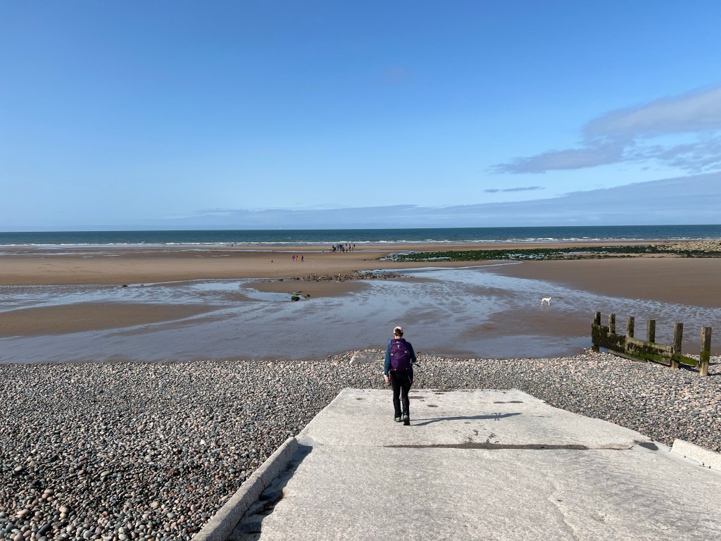
Day 2 on the Coast to Coast Path is in the books. Today we walked Ennerdale Bridge to Roswaithe which is said to be the toughest stage of the Path and we agree!
We started our day off with a fantastic full English breakfast (bacon, sausage, beans, tomato, toast, eggs) and a couple of extras depending on what you ordered (black pudding, porridge, yogurt, etc.) Ready to burn off those calories, we headed out the door for 9am and made our way to our first obstacle of the day’s walk, Ennerdale Water.
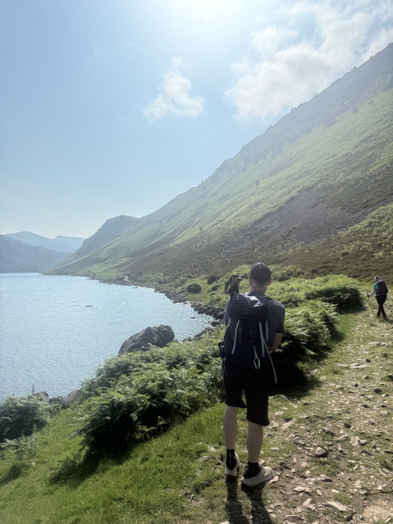
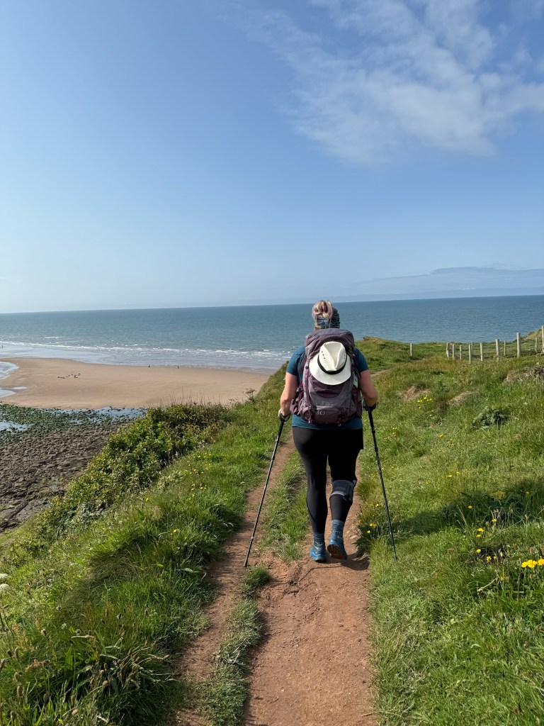
Ennerdale Water is over 4km long and has two ways around it. The Northern Shore which is a forest, gravel track. This is a multi use track, think bikes to hikes, and is recommended when the weather is offensive. The Southern Shore is the classic Coast to Coast Path route and recommended in fine weather but is a lot more work. It’s a path just on the water’s edge, made up of mostly large uneven rocks, steams to cross, some scrambling (think hands and feet), and takes much longer but is absolutely gorgeous. Sun was out, so Southern Shore it is!

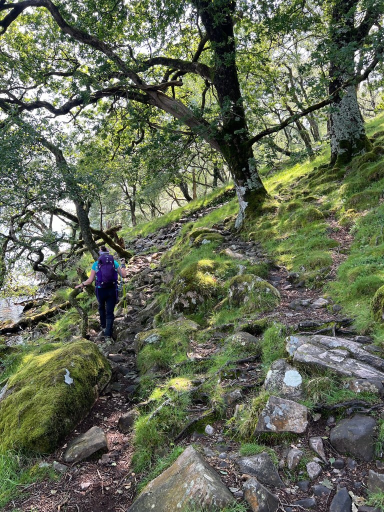
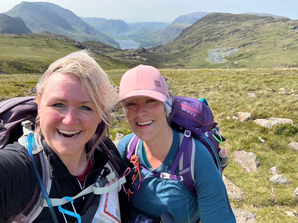
That last one there of me (thanks Shar for the snap!) make me look like a boss. But … I am terrified of heights, and what you can’t see in the photo is how steep that trail is (to me), how close it is to a 30-40 foot drop into the lake (for real) and the lake is full of lava, flesh eating alligators, spiders and zombies that are hungry for Brande bits! Well at least that’s how scary in my brain it is and the scenario that was playing out in my mind as I precariously balanced on a ‘knife’s edge’. The mind is an interesting creature!
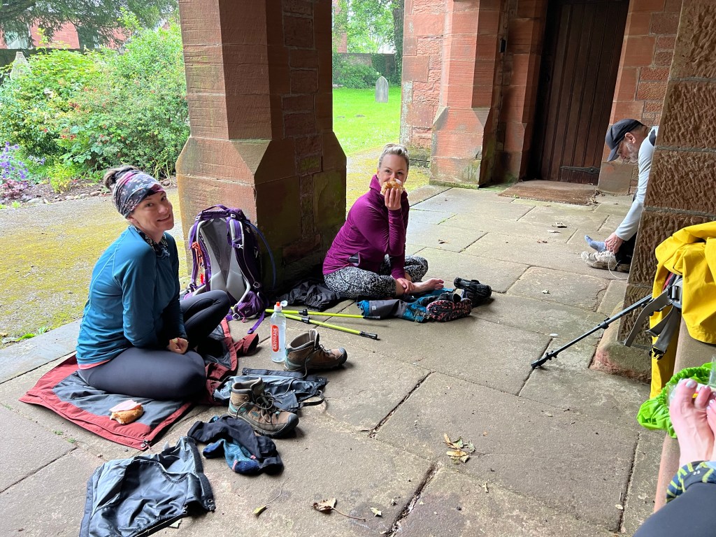
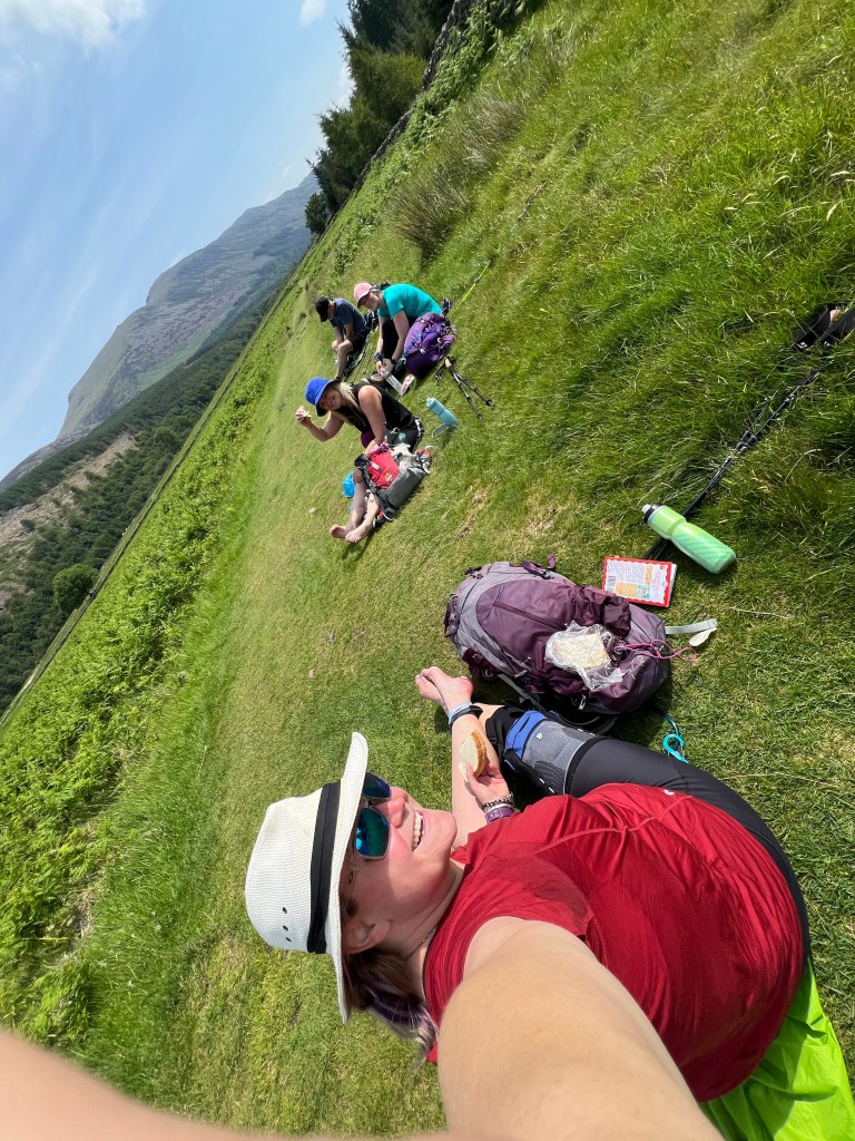
In just over a couple of hours we put the zombies behind us and were on the other side of Ennerdale Water. After such a long time stepping so carefully, we were ready for a break and had ourselves a little 11sies picnic trailside before kicking off our next obstacle.
With some cookies and fruit onboard, we headed for the forest road (gravel logging road) which would take us to the place where we leave the trail and start heading up and up over the mountain range to our home on the other side, Roswaithe.
There are two options here, the classic is via the Black Sail Youth Hostel (most remote in England which is odd to me as you can technically drive to it) OR the alternative up to Red Pike and across the wide mountain range ridge via Hay Stacks where the routes meet up for the decent into Honister. On a fine day, which we were definitely having, the high route via Red Pike is not to be missed.
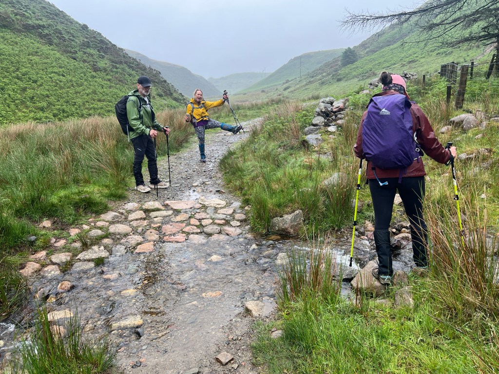
So we split the uprights to experience it all! The decision point is at a fence / gate and Dad and Shar headed up to Red Pike and Hai and me carried onto the Black Sail Youth Hostel approach. The plan was to meet in Honister (there is a little cafe at the Slate Mine tourist shop) unless we happened to see each other at the path junction on the ridge – pretty slim chance there but would have been exciting
So off Hailey and I went for few more kms along the forest road ..
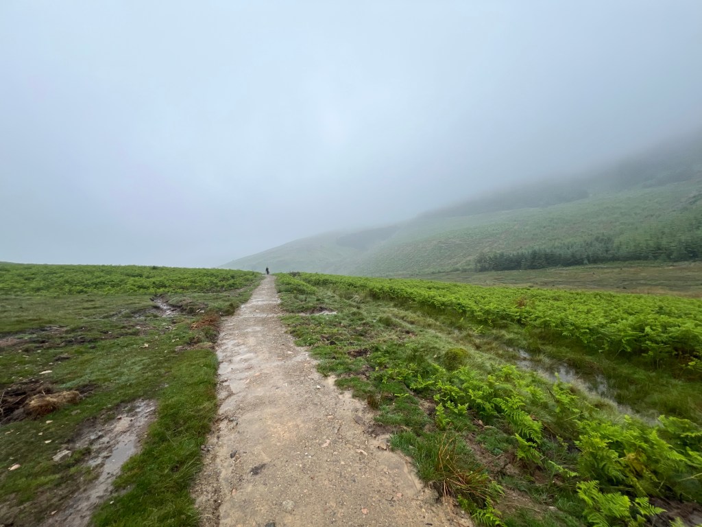
We made great time to the Black Sail Youth Hostel. The gravel track was mostly a gentle incline but with little shade for this 6.5km section. Our 15C day while mild was feeling a little less so pretty quick. Think mini donuts on one of those little deep fryer conveyor belts. A little breeze kicked up about half way and we were loving that until that little breeze changed the day pretty quick!
Not too long after our refreshing breeze started, Hailey and I both noticed a change in the temp and speed of that wind all of a sudden. Colder and stronger, and it was bringing in some cloud and fog cover. Wonder how Dad and Shar around doing up top? By the time we made it to Black Sail Youth Hostel, the breeze was gusts and they were strong – slow you down or push you forward while walking strong.
The Hostel was open so we tucked inside for 30mins for a fantastic break – we left a 5er in the honest box collection and had a tea and shared a chocolate. After a quick stop at their toilets, we added a layer of clothing and headed back out into the gust storm!
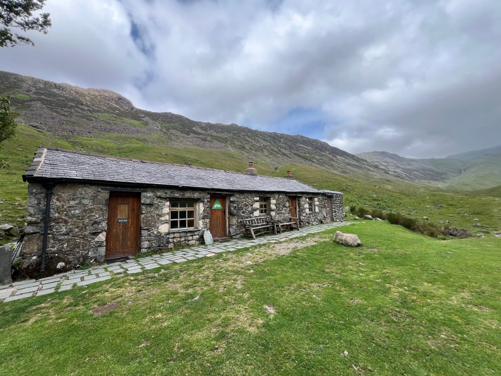
I have met Wind but never Gust and he is a spicy, blowy chap! We had to laugh and pause a few times when it kicked up particularly well then carry on quickly in the quiet breaks. The path took us onward from the Black Sail Youth Hostel now on a thin grassy or rocky path towards my nemesis of the day – Loft Beck!
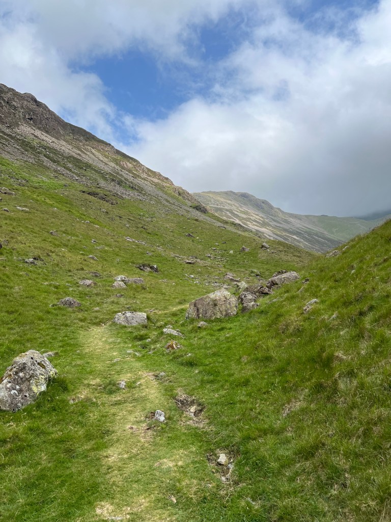

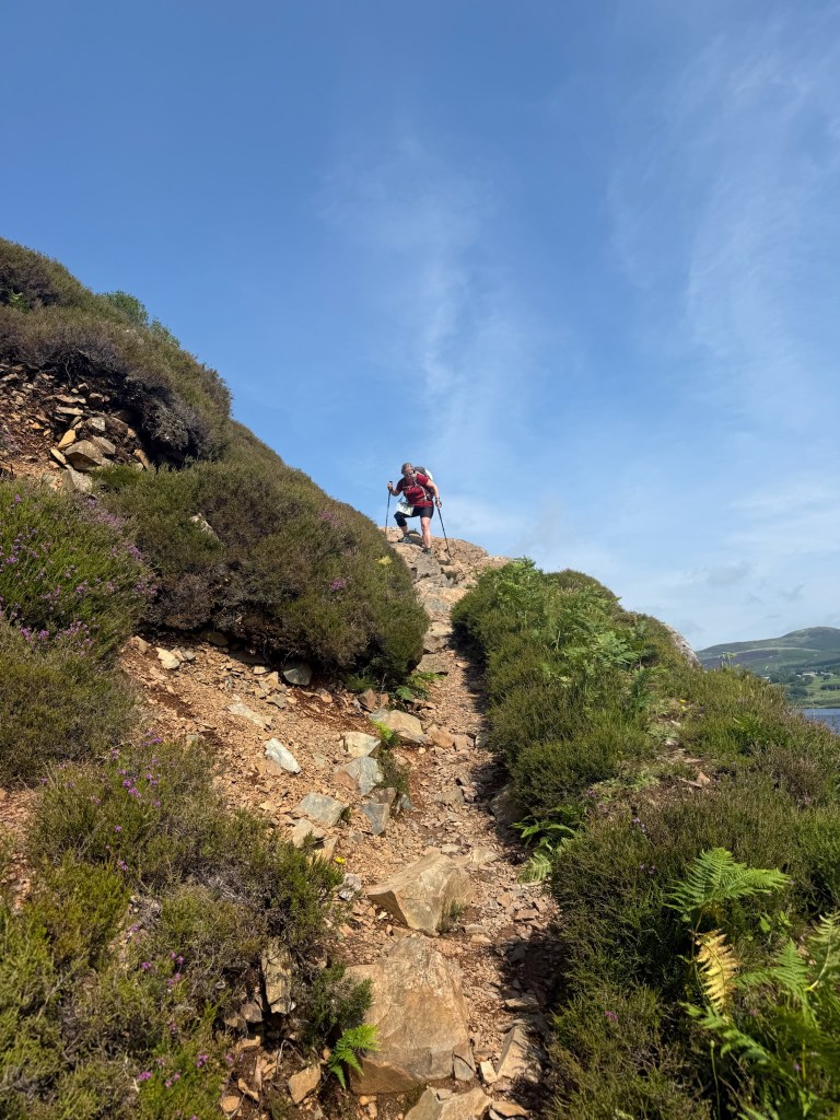
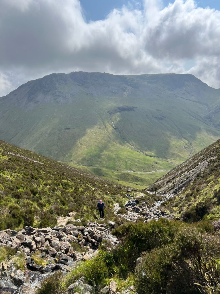
Once we had traversed these skinny little trails, we arrived at Loft Beck and Scaredy Bear Brande was in full force. This is a 1000 foot / 300m stone staircase beside a rushing river up a steep ravine from bottom of the valley to top of the mountain. And obviously more zombies in the water waiting for Brande bits to chomp on!
I was in awe of how beautiful it was, how thankful I was for whoever built said stone staircase, and completely terrified. The upside? It was not going to rain, and the wind gusts were pushing us into the mountain like a little temperamental safety harness (yes that’s what I told myself!) The pictures first looking up at the bottom, then down about 75% of the way up do not do it justice. Except maybe that last one, the nice flat green grass waaaay down at the bottom is where we started!

I gave Hailey the warning that if I stop I will never start again, and I took off up and up. Speaking out loud to myself that the wind is my friend and helping me stay on the mountain, that these are just stairs and I do those all the time, I can do anything for 100 steps and again and again, and to not crawl. For the Lord of the Rings fans in the crowd, I have resorted to Gollum like hiking in the past! Not a good look!
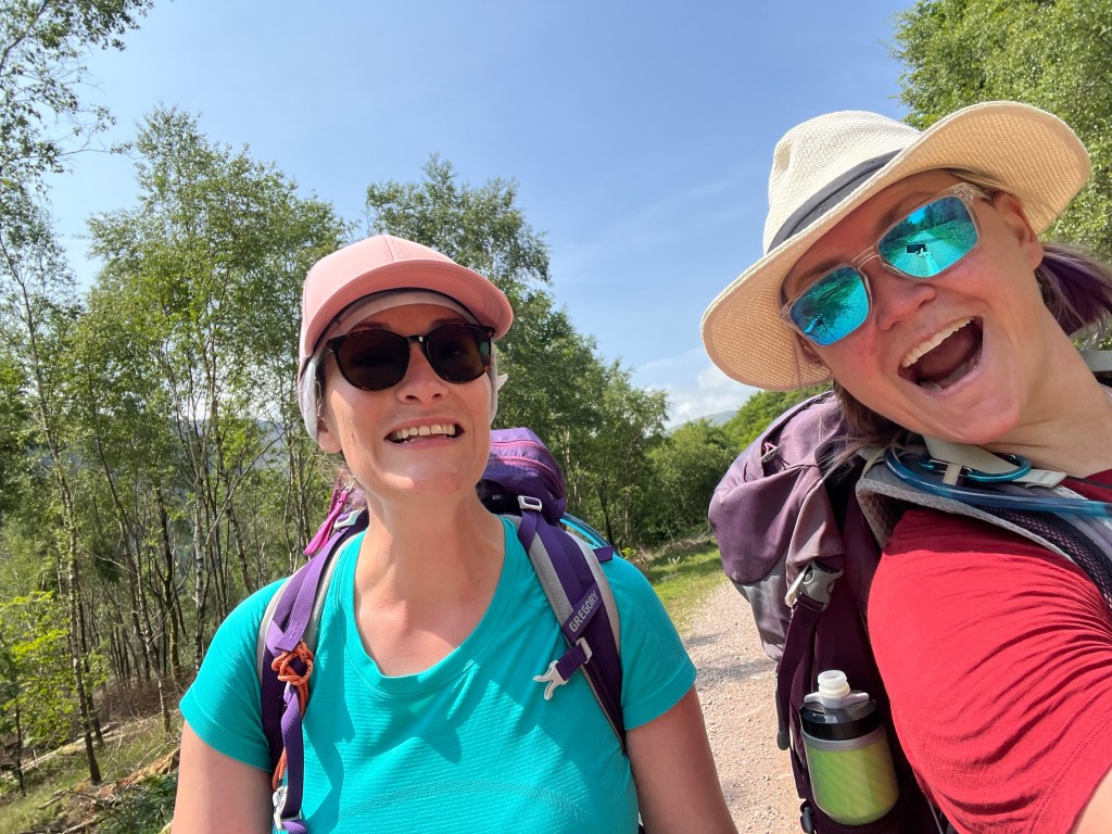
When I got to a little safe spot I could look back and check on baby sis.. she was just happily stepping up and up the steps not a concern in the world. Damn gazelle was made for this! Love that!
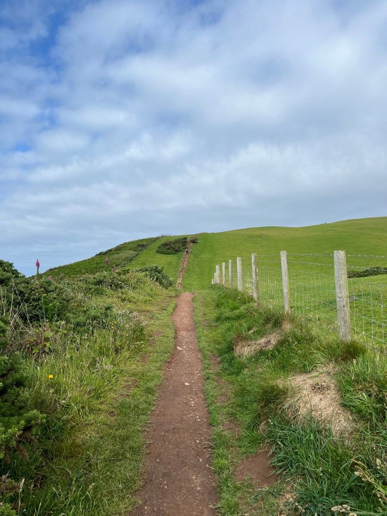
At the top we hit the junction where Dad and Shar might have been spotted – no dice – so we had a sip of water, almost fell over about a dozen times as the wind was WAY worse up here and then made our way across the top of the wide ridge.
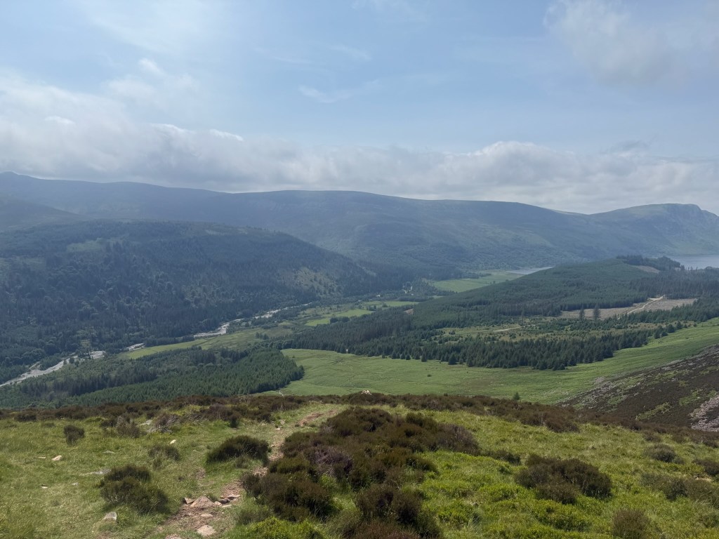
This was gorgeous walking up here, mostly on grass or small stone trail and cairns (piles of rock) all along the route to guide the way. Stunning! I took some videos and popped those up on Running for the Gate Instagram.
The trail book says from the top to the Honister Cafe it was about 60mins walking – we needed double that. You had to stop walking sometimes to let the gust go by and then get some steps in before the next one for quite a bit of our time up there. We definitely kept wondering how Dad and Shar were fairing coming across the whole thing!
We arrived down in Honister after the Cafe closed but I was able to pop in to use the wifi and let our BnB place now we would be later than planned thanks to Gusty McGusterton. We found a nice bench sheltered from the wind and a view of the final descent down into Honister so we could see when Shar and Dad were coming down. They should be about 2 hours behind us according to the guidebook.
Meanwhile Dad and Shar were not traversing the ridge top. They made it up to Red Pike at 755ft in good time but the gusts of wind were treacherous up there – so they snapped a couple pics and then backtracked to take the route Hailey and I did but a couple hours behind us.

By the time we reunited down in Honister – it was pretty cool to see them come up and over the edge there on top and watch their descent – the day was hitting 7pm so we sent a quick note to our BnB lady (I had to jog up the street until I found a signal) and she came and grabbed us.
We arrived to our new home for the night, Yew Craggs in Roswaithe a few mins later, and not 15mins after that we were sitting down for a cold pint, hot homemade pasta and an amazing dessert we had pre arranged with Ann Marie at the BnB.
We were all wind burnt, dog tired, full up from a delish supper when we made our way to bed around 930. Got to give the body a little lay flat sleepy time so we are spry for another tough day though the Lake District tomorrow (in pouring rain I might add!)
For the speedy ..
- Date: Monday June 16 2025
- Trail: Coast to Coast Path, England
- Day: 2 of 17
- To/From: Ennerdale Bridge / Roswaithe
- Start/Finish time: 9am / 7pm
- Distance: 23 (25.4km Hiiker)
- Steps: 31,180
- Terrain: Rocky scramble, gravel forest road, grassy trail, steep stone steps of hell, gusty rocky trails, stoney decline
- Breaky: full English / cooked breakfast
- Lunch n Snacks: cookies, apple, sandwich packed from last nights accommodations, gummy snacks, tea, chocolate
- Dinner: local sourced pasta, berries and cream and a local pint Tractor Shed Brewing called Kessin (blonde ale)
- Tonight’s home away from home: Yew Craggs of amazingness
- Mood: happy with terrified and proud moments
- Body: feeling great!
- Highlight: tea at the Black Sail Youth Hostel with my sister
- Lowlight: gusty, grumpy winds
- Deep thoughts: trail magic is really and truly a thing, the people and the path can be the most amazing example of how blessed we really are!
Well Day 3 won’t start itself – off we go!
Brande