Coast to Coast Day 14 Clay Top Bank to Blakey Ridge

That’s us, Day 14 on the Coast to Coast Path is a wrap. We walked the 14.5km stretch of gravel track all in the high moors to reach Blakey Ridge. A fantastic day!

We started with an 8am breakfast at the Fox and Hound in Slapewath. A nice little hotel that was quite a ways off the Path so it was odd to not be around Coast to Coasters!

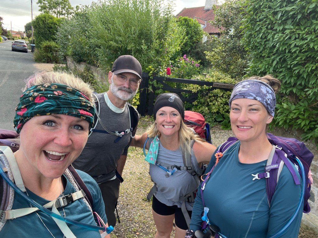
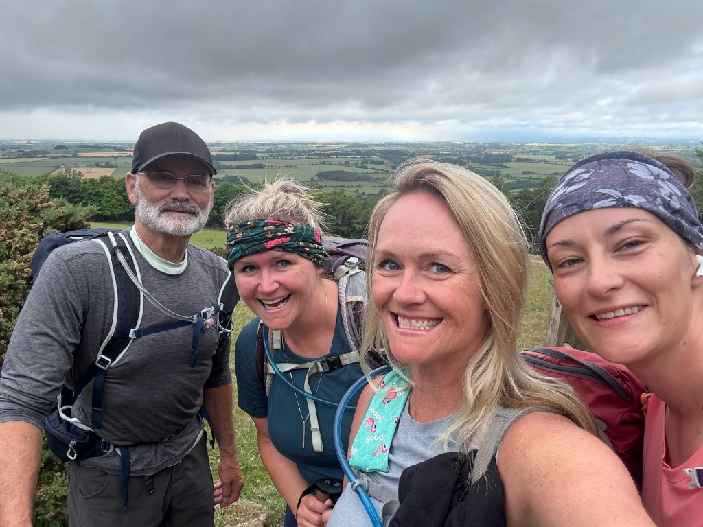
At just after 9am, Ray our private car hire (arranged by Contours Holidays) picked us up and we were zooming back to Clay Bank Top where we left off yesterday. Wow, does a car feel fast when you have only been moving by your own feet for 2 weeks!

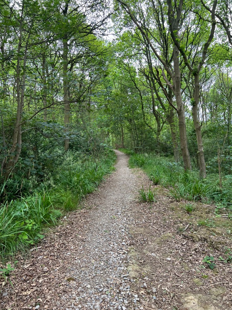
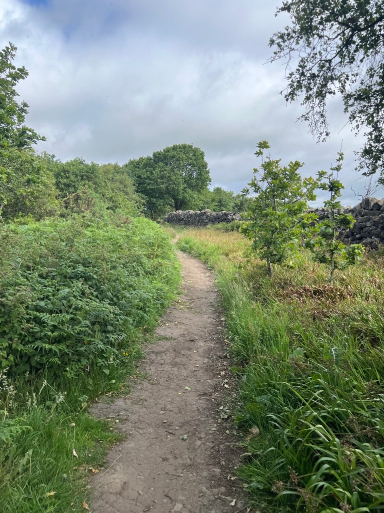
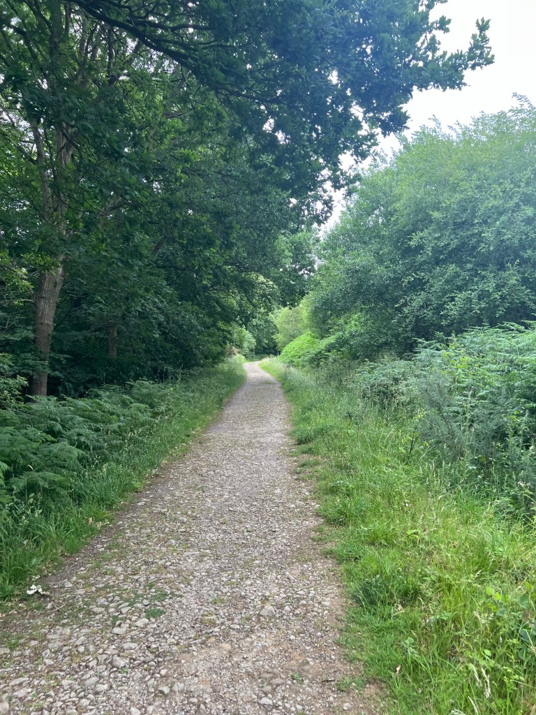
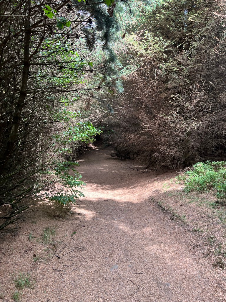
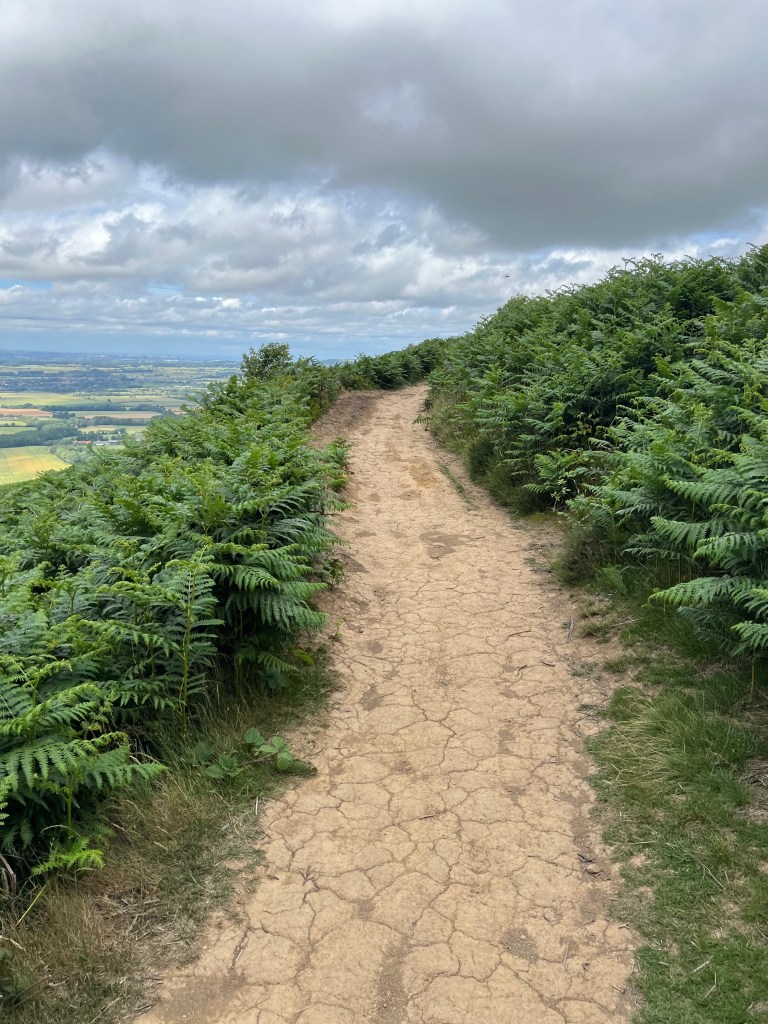
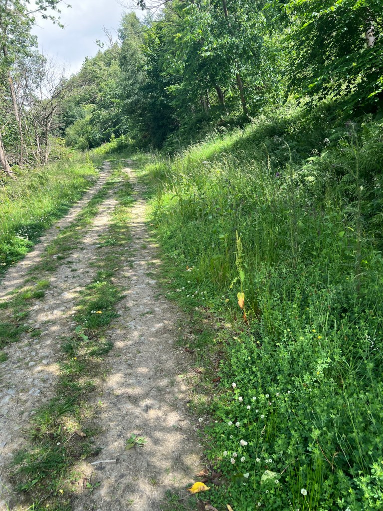
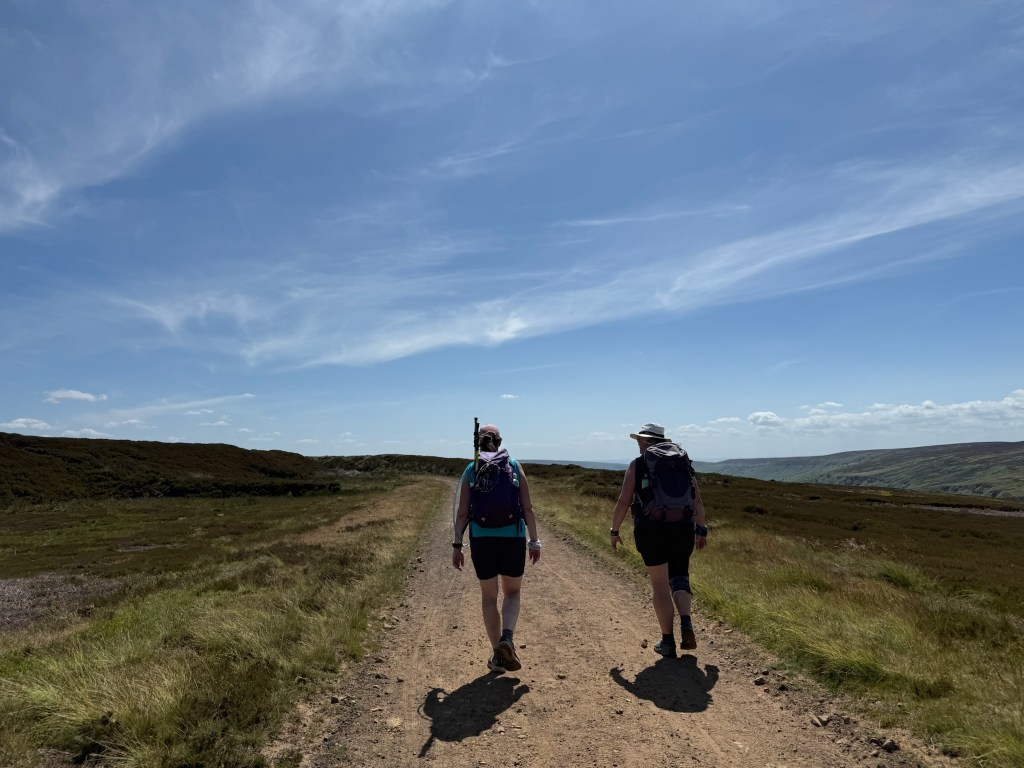
By 945am, we were on the trail head and ready to stroll the 14.5km to Blakey Ridge. A bit of an incline to start though the trees, a quick pop over the fence and we were on the stone slabs that would get us to the top of the ridge.

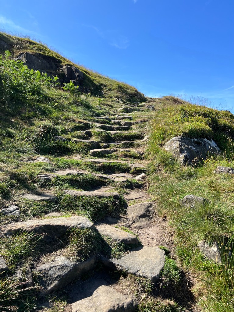
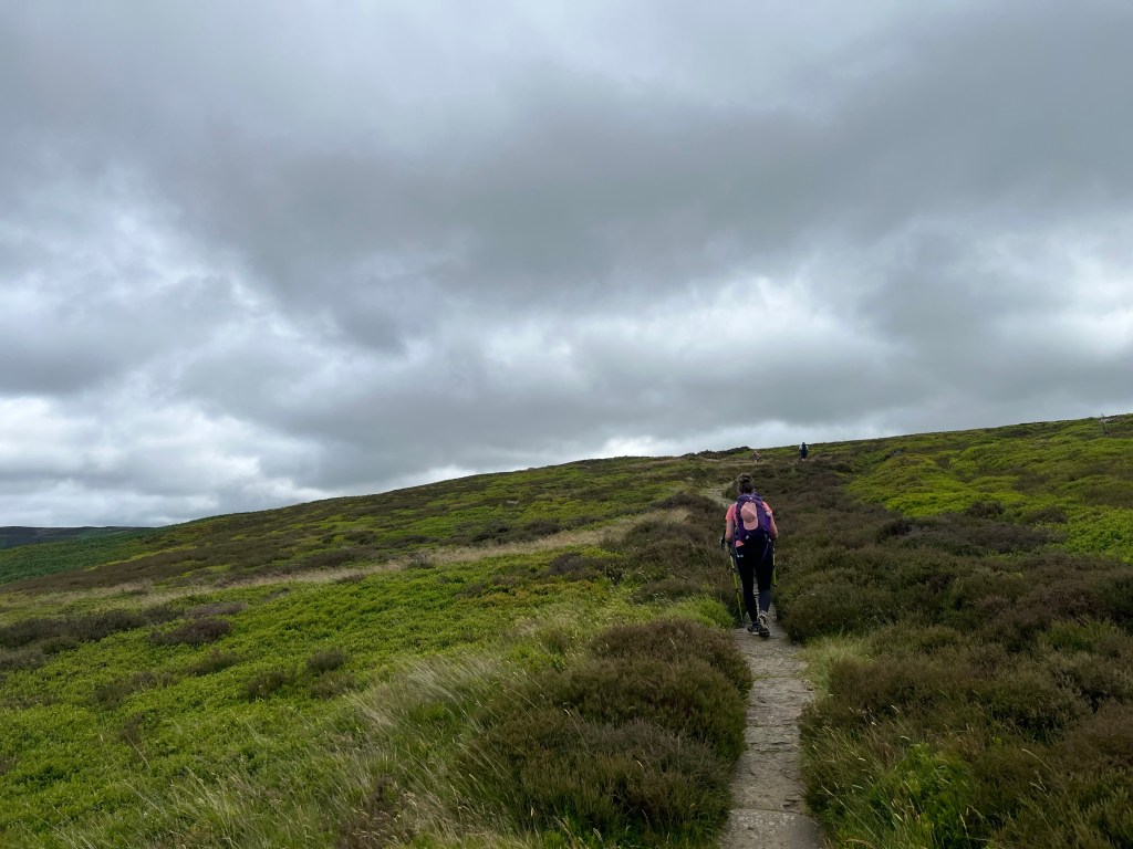
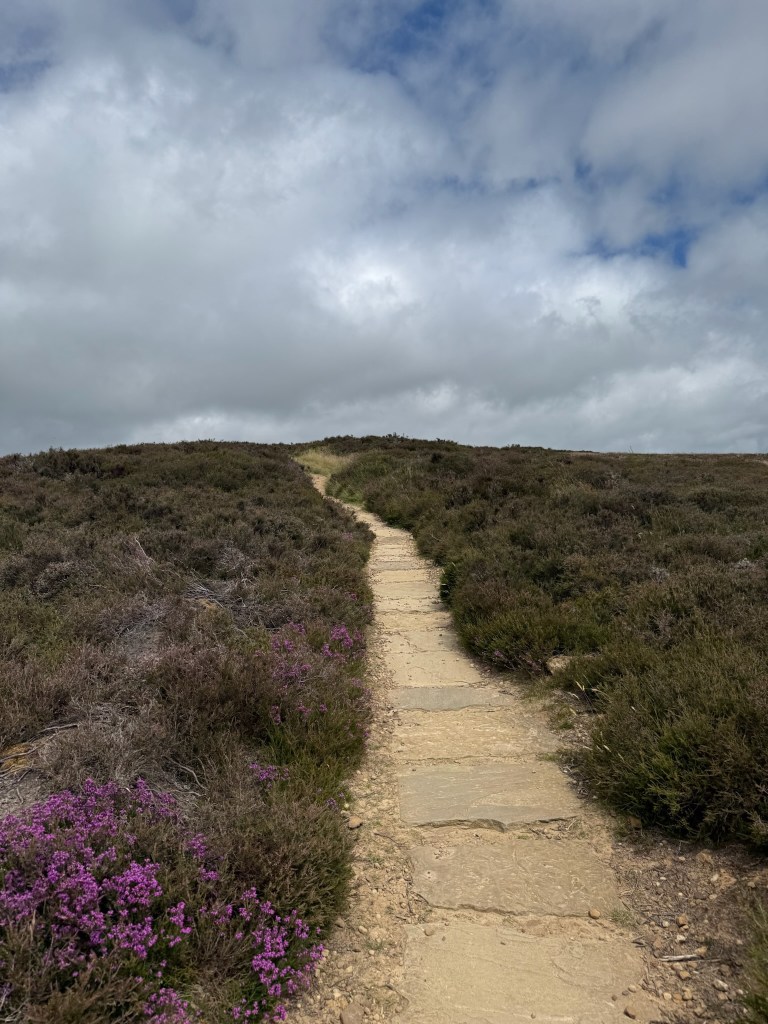
After a short uphill work out and pause to catch our breath, we were at about 370m and that is pretty much where we would stay for the next few hours until we reached Blakey Ridge and The Lion Inn.

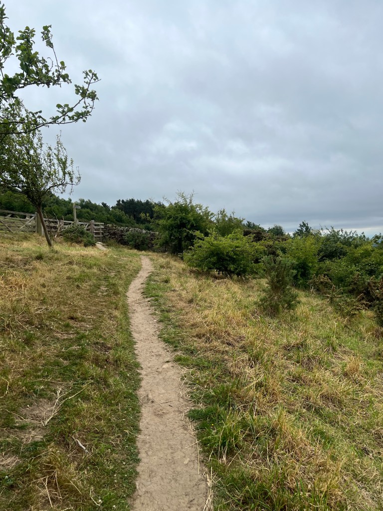
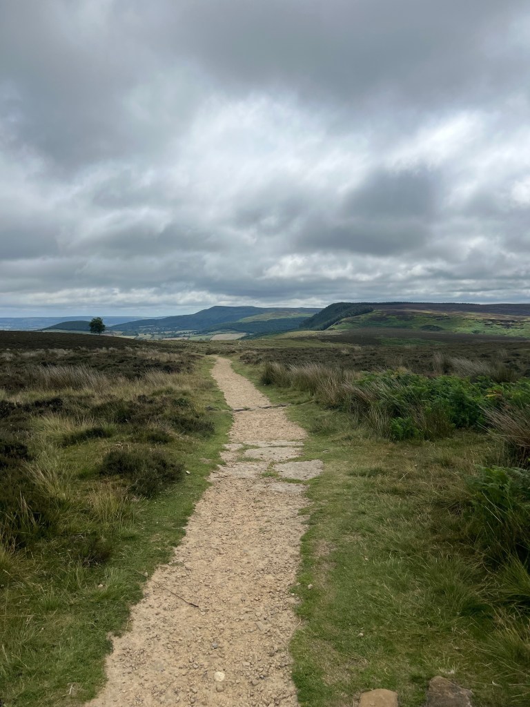
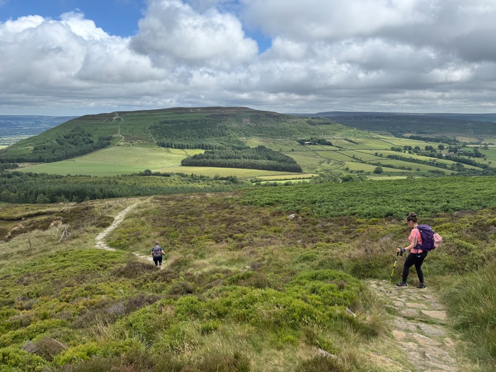
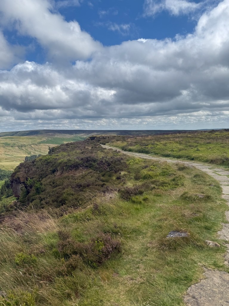
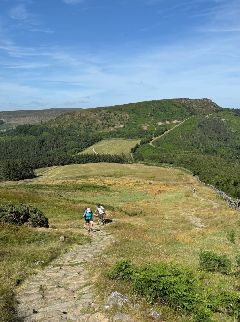
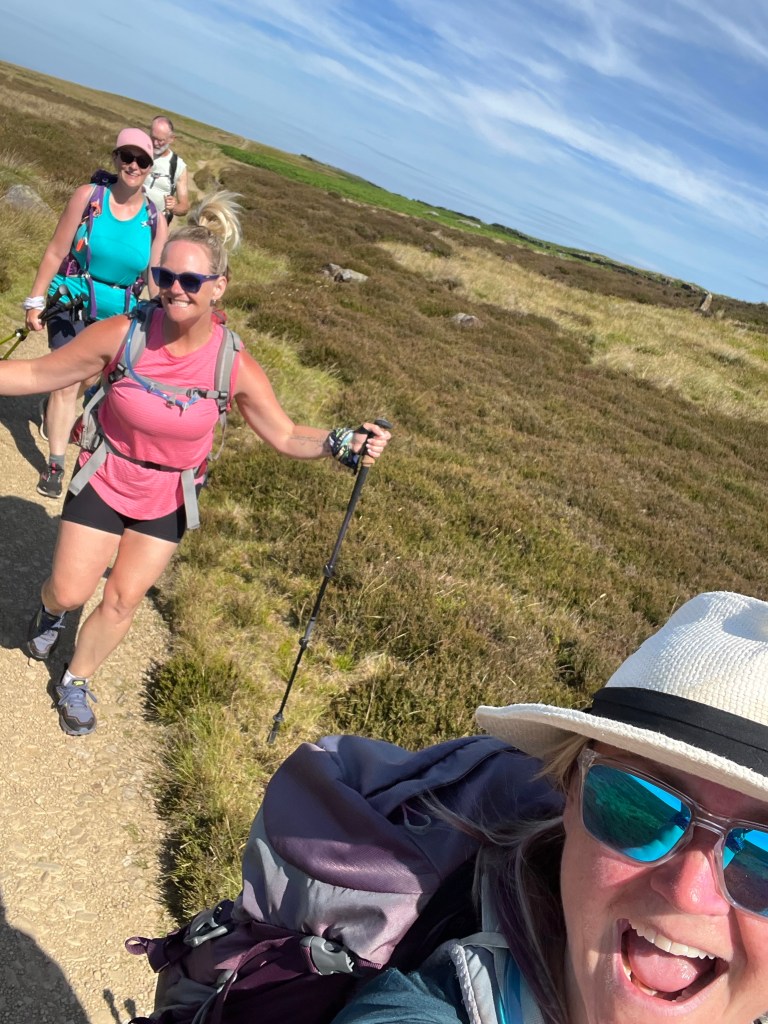
The path opened up to a gravel / sand track, that slowly meandered across the moors. We followed this path the whole way – so not tough a job for my navigation skills today!

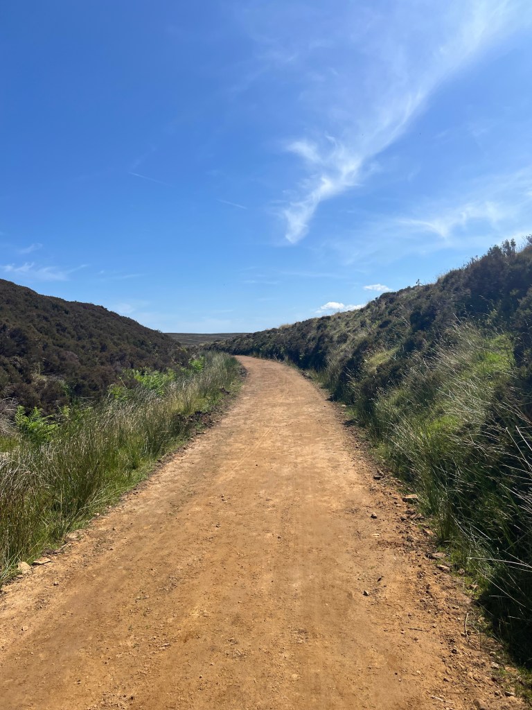
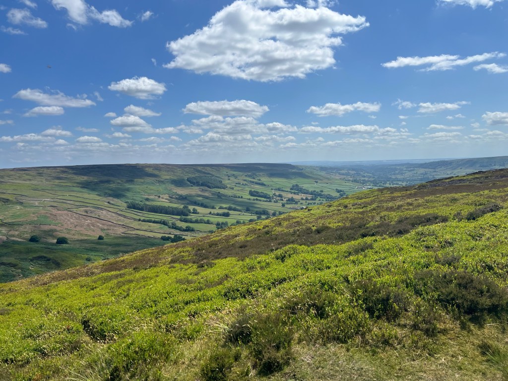
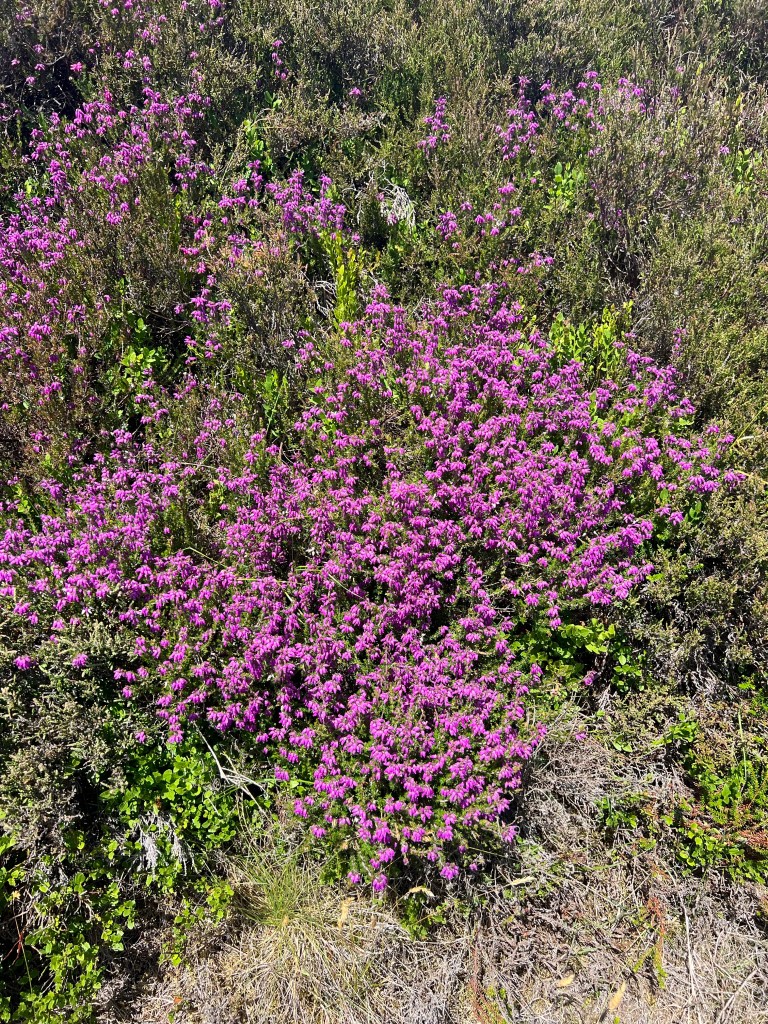
Spending that much time in the moors with a flat path underfoot meant you could really take a look around at all the different flora and fauna, the colors, just how much the landscape actually changed around us, etc.

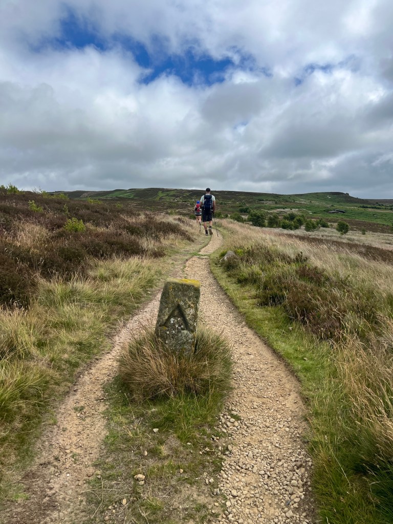
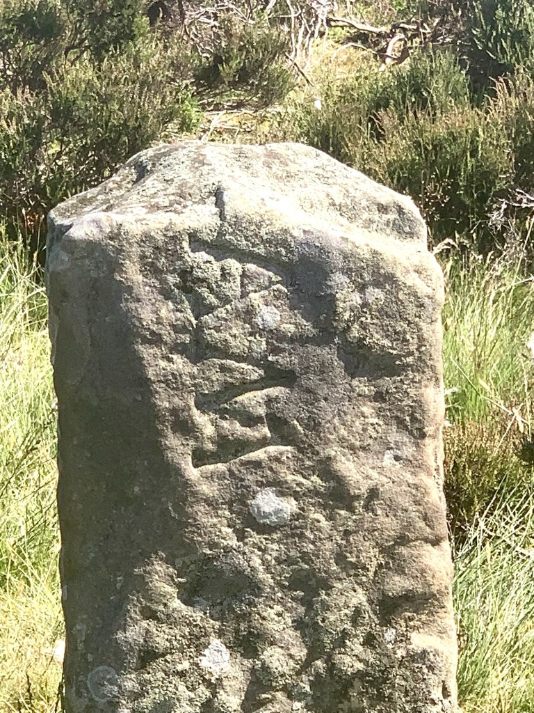
So neat to see the rock boundary markers dotting the landscape, and experience a bit more of the Cleveland Way (which continued to overlap much of the Coast to Coast today). We even glimpsed and overlapped the Esk Valley Walk trails, and this area is the Lyke Wake Walk too which follows engraved boundary markers. I am always in awe (and jealous) of the public footpath systems here in the UK. Brilliant!

We understand that much of today’s path is on what was the iron workers railway – used by iron workers and their families exclusively before the motor car and change in industry removed the railway in early 1900. I do not recall seeing any proof of the actual railway history other than how flat and gentle the curves of the path are which would be railroad friendly I am guessing.

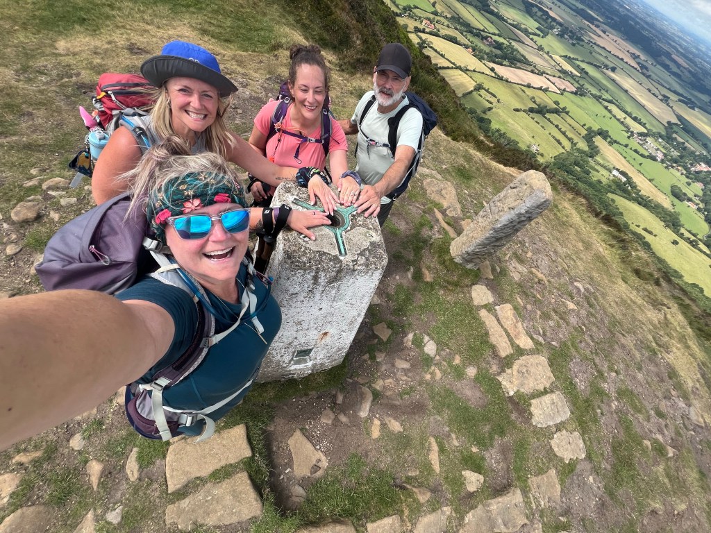
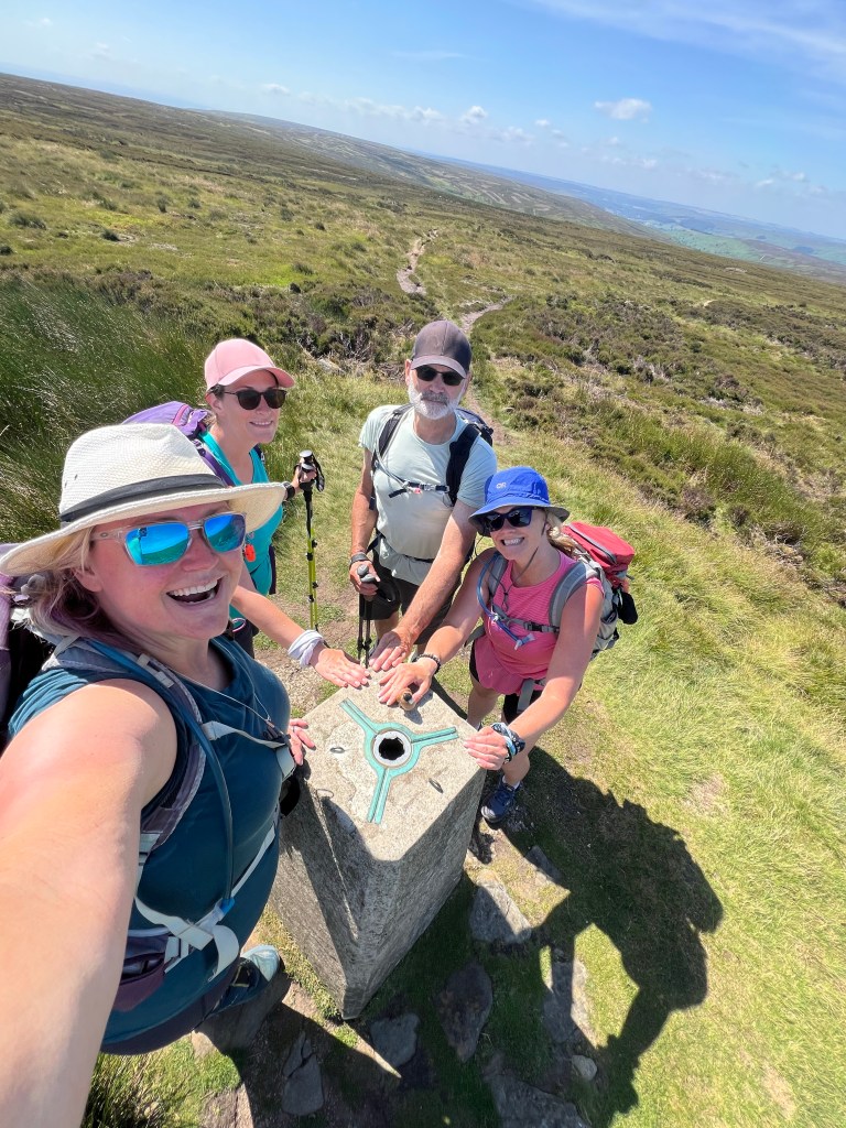
A couple of highlights included reaching a trig point (or triangulation station) – a cement triangle at the top of a peak used for navigation and surveying. Hikers love a milestone, so these are always a photo opportunity!

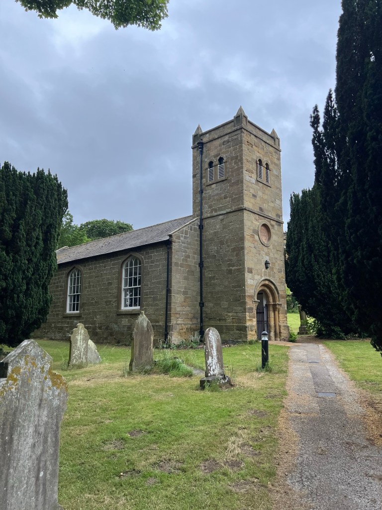
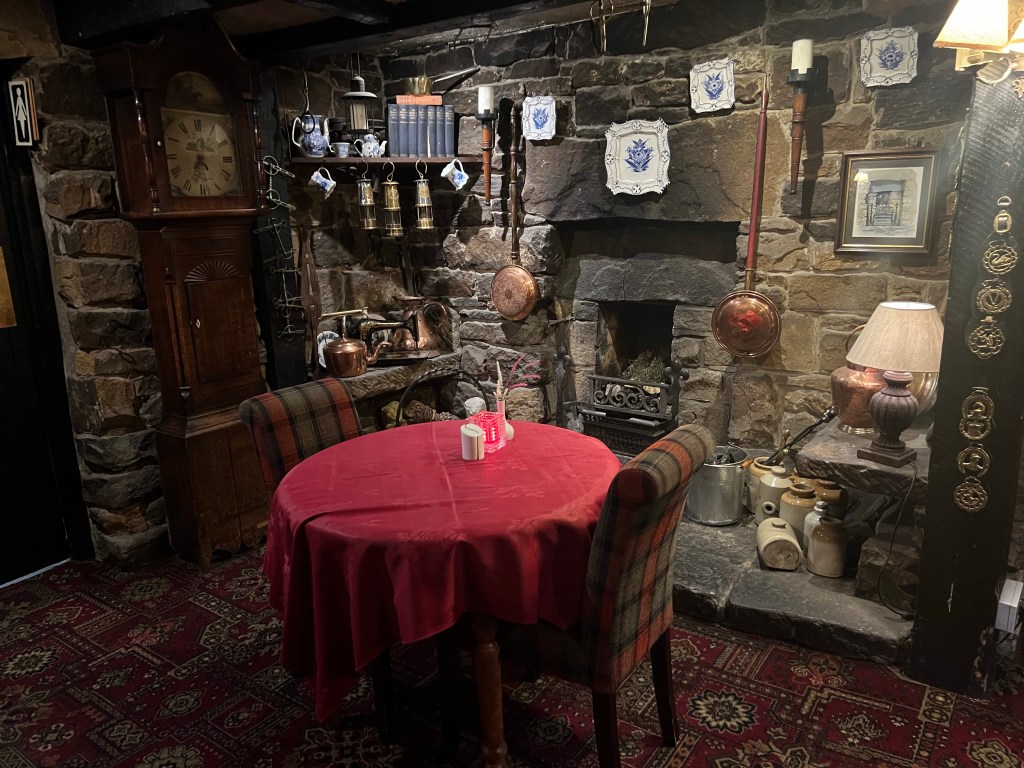
Another big highlight was coming around the last bend in the path, and glimpsing our home away from home for the night – the Lion Inn!

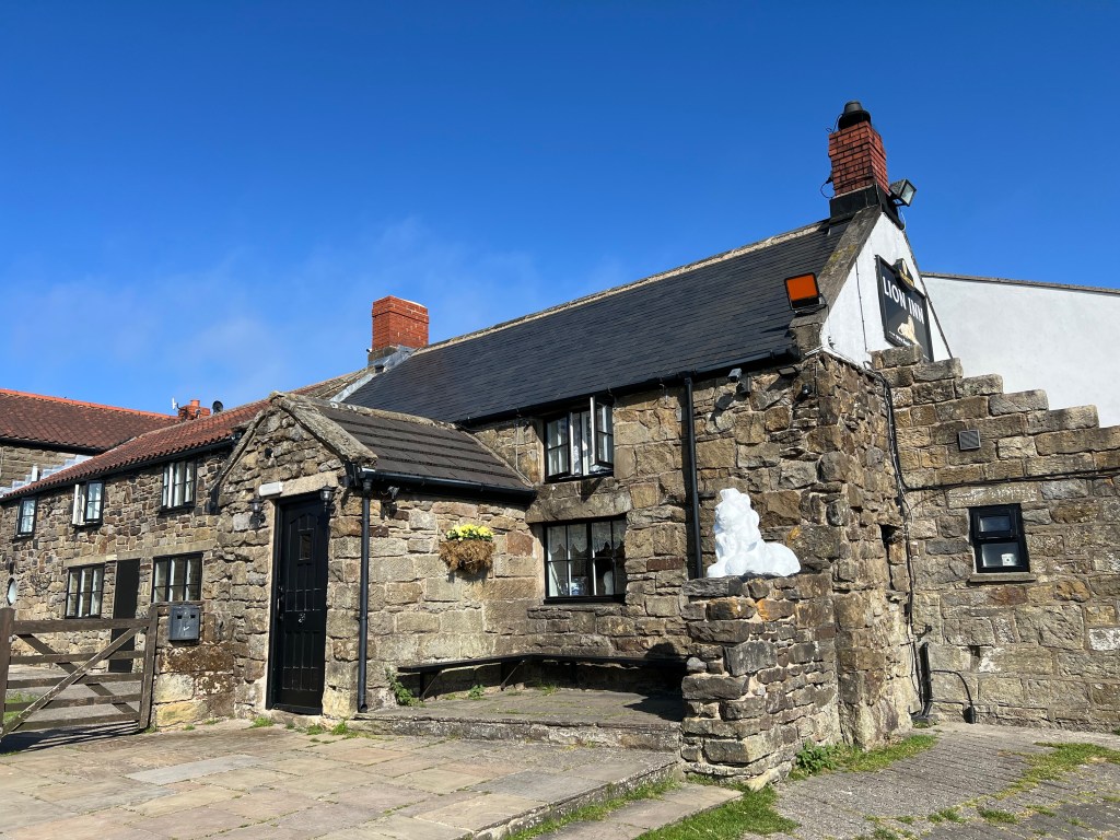
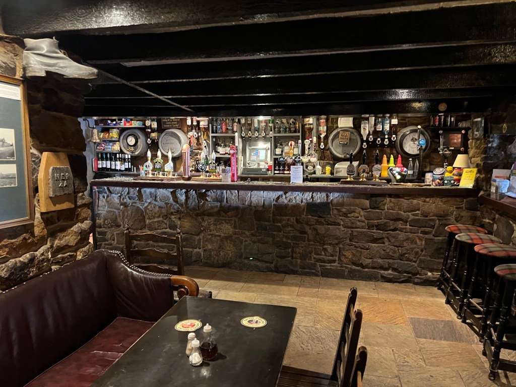
The Lion Inn is ‘a 16th Century free-house located at the highest point of the North York Moors National Park, it stands at an elevation of 1,325 feet and offers breathtaking views over the valleys of Rosedale & Farndale.’ The history of the Inn is very interesting and definitely worth a read if staying here!

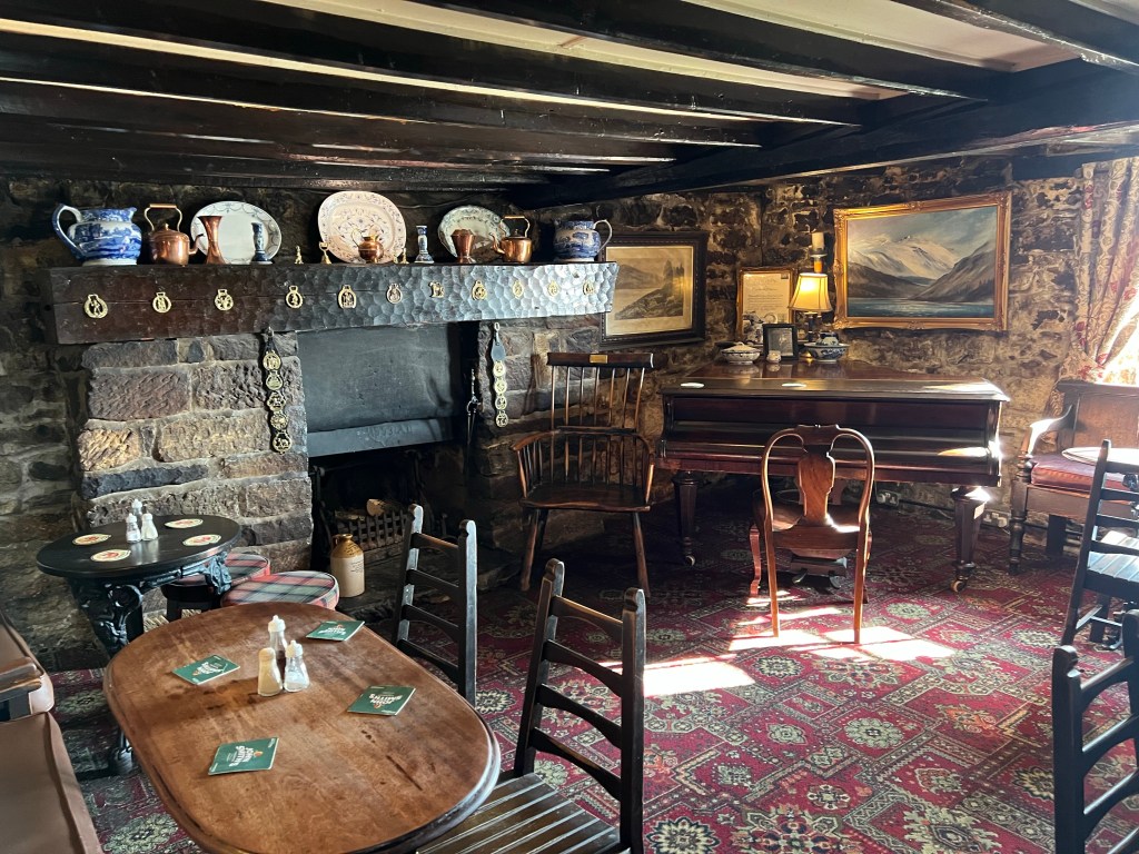
I have read a lot about each place we are booked to stay. Helpful things like where it’s located, amenities, directions, etc and also less ‘helpful’ things but so much more interesting … like if they have ghosts!

The Lion Inn has a host of ghosts stories and wasn’t I beyond excited to be handed the keys to Room 5 – the very room that is believed to be most haunted here! Mrs Potts?

Well, maybe it was the long walk in the heat, the couple of pints, a big supper, more likely the fact that my Dad is right across the hall in Room 4 making the little girl in me feel super safe – but no ghostie for me. Boo!

I slept like a comfy little hiker baby. And when I did wake up in the night, I didn’t pick up on a single ghostie vibe. At one point Shar (my roomie tonight) did ask if was ok?! Odd. Now, the ghost in Room 5 is believed to be friendly. Maybe they were just being a good host and letting us get our hiker sleep? Or maybe the thing was standing over me all night …

Only have a sec? I got you …

  • Date: Sunday June 29 2025
  • Trail: Coast to Coast Path, England
  • Day: 14 of 17
  • To/From: Clay Bank Top / Blakey Ridge
  • Start/Finish time: 945am / 2pm
  • Distance: 14.3km (Hiiker)
  • Steps: 21,753
  • Terrain: small section of forest track and stone slabs/steps then all gravel track in the moors
  • Weather: 22C with a slight breeze and a few pretty, whispy clouds
  • Breaky: full English / cooked breakfast
  • Lunch n Snacks: banana, tuc crackers on trail and then a burger with chips (shared with Shar) at the Lion Inn
  • Dinner: beef sandwich and chips(shared with Dad) at The Lion Inn
  • Tonight’s home away from home: the one I was MOST excited about, The Lion Inn on Blakey Ridge in believe to be haunted room 5!
  • Mood: excited!
  • Body: feeling good, all my blister buddies seem to be on a little vacation!
  • Highlight: a full day on the moors
  • Lowlight: not a tree in sight for just a minute of deep shade
  • Deep thoughts: doing the same thing over and over and over again is a comfortable routine but even that can chafe

Well that’s us off on Day 15 – catch you when we reach Egton Bridge in 18.5km.

Brande

Coast to Coast Day 13 Ingleby Cross to Clay Top Bank

Day 13 complete! A 22km stroll up and out of Ingleby Cross and then some more up and overs x4 till we hit Clay Bank Top!

The morning started with a lovely breakfast at the Ingleby House Farm BnB. The fruit salad was epic, the company included a couple from New York doing the Coast to Coast and the coffee and tea were piping hot. Perfect.

After thanking our host (and Shar saying good bye to their dog, Socks) we were on our way. First through the small village of Ingleby Cross on some quiet hamlet roads and a quick stop at the local church to see if we could find more of those wooden church mice carvings.

Too bad, the church was locked up so we took a peek in the windows (spotting the purple pew boxes we had read about in the guidebook – bold colour choice) and got back to the task for the day – walk, walk, walk.

Pretty quickly we were in the trees, and the incline was starting to lean up. A mix of packed path, gravel track and some stone steps and slabs had us up and over the valley in no time at all.

At the top, we were rewarded with views of the path ahead and our first glimpse of our ultimate destination the North Sea in the distance. Crazy to think we are so close now! Hard to see in the photo but there looked to bit a bit of a rainbow across the horizon above the sea ahead – a good sign.

Right near the top of this first climb, the Coast to Coast meets up with the Cleveland Way (another walk on our list to do one day) and we would actually remain with the Cleveland all day. At this point the path gets a little confusing though with so many signs, and we made a wrong turn to get to the right detour!

In my defense, I may have been distracted by the googley eyes someone put on the National Path acorn symbol. I am a sucker for googlies!

A local lady walking her dog told us about the Our Lady’s Chapel just off the path. The origins of this Chapel are interesting but best I can make out it was stood up in the 1300s, is still a working Chapel and still welcomes pilgrims to stay. It was very secluded, the smallest we have see yet but no less beautiful. The stone work!

I had a chance to check the map to guidebook and found out where I went wrong, and a quick way to get us back on tracking using one of the many public footpaths all over the hills.

We made quick work of it and even had another walker (doing the Cleveland Way and the guy we now call Sticks) follow us back to the path as we had all done a little happy detour. We would see Sticks a few more times today as we traded places on the path.

Soon we were on our way to the next big climb of the day across the Scarth Wood Moor. This was a fantastic section of the path – wide open, with huge views of the surrounding rolling country side. The path was a mix of packed sand stone or mill stone slabs. Easy waking!

Leaving Scarth Moor we then hit Clain Wood and made our way back up and up into the forest (and a micro break) before dipping back down for a short time on the road and then again back up and up into the trees again for our next climb of the day over Knolls End via what I think is the Carlton Moor. There are a lot of Moors!

We read that this are has the highest density of Heather growing and one look confirms that. Only some of the Heather was in bloom (an amazing purple) and I can only imagine how beautiful it is when it’s all in bloom. Wow!

We stayed on top of this ridge for a little while enjoying the amazing views as we walked, but soon enough the steep, stone descent was upon us and we made our way down, down and down to both get out of the wind and find our lunch break picnic spot. We were at 13km by now and feeling ready for some fuel.

Over lunch we strategized the rest of our day. Confirming our anticipated pace so I could check in with Ray the private car hire giving us a ride from the trail to our hotel (and back again in the morning) and approach to the next climbs. There are a couple of alternative paths for the next climbs – so we decided to split and do all the routes!

Shar would go up and over (she is a Summit Seeker!) and we would do the shoulder approach around the peaks. We set meeting points after them both as the paths came back together each time to check in. Perfect!

Off Shar went. Some highlights..

Off Dad, Hai and B went. Some highlights …

At about 345pm, right around when planned, we met at the Clay Bank Top. This is literally a car park with a picnic table that people use to access all the many trails in the area.

We had pre arranged to meet our driver here at 5pm (but he confirmed he could come early at 430pm) so we had some post hike snacks at the picnic table to pass the time.

Ray our private car hire was very efficient getting us about 30mins to our stay for the night at the Fox and Hound in Slapewath. A bit of a drive (with some tight hair bending turns for these Canadians) but it’s been a great stay.

We arrived just after 5pm to a fantastic welcome, clean rooms and after some showers enjoyed a pint outside and dinner.

For those with only a wee bit of time…

  • Date: Saturday June 28 2025
  • Trail: Coast to Coast Path, England
  • Day: 13 of 17
  • To/From: Ingleby Cross to Clay Bank Top
  • Start/Finish time: 845am / 4pm
  • Distance: 21.4km (Hiiker)
  • Steps: 29,948
  • Terrain: forest track, a few fields, rocky paths, stone steps and slabs
  • Weather: 22C with a mix of cloudy and sunny skies, nice breeze with gust on top of the ridges
  • Breaky: amazing fruit salad, and full English at Ingleby House Farm BnB
  • Lunch n Snacks: pre packed lunch from Ingleby House Farm BnB with crisps, fruits, strawberries, cookies
  • Dinner: vegetable lasagna at the Fox and Hound Pub in Slapewath
  • Tonight’s home away from home: Fox and Hound Hotel in Slapewath (transported to/from by Ray’s Personal Car Service arranged by Contours Walking Compani)
  • Mood: fantastic!
  • Body: feeling good. Bill, Bob, Edna and Irene (my blisters) understand the house rules now and are being a little less rambunctious
  • Highlight: walking in forests again!
  • Lowlight: horseflies!
  • Deep thoughts: you don’t what you are missing, if you miss it

That’s us off on Day 14, catch ya on the flip!

Brande